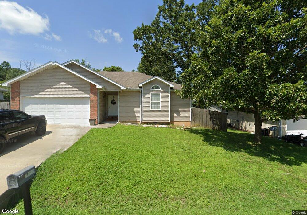
1721 Westway Dr West Plains, MO 65775
Estimated Value: $134,345 - $250,000
3
Beds
2
Baths
--
Sq Ft
7,405
Sq Ft Lot
About This Home
This home is located at 1721 Westway Dr, West Plains, MO 65775 and is currently estimated at $206,336. 1721 Westway Dr is a home located in Howell County with nearby schools including Faith Assembly Christian School.
Ownership History
Date
Name
Owned For
Owner Type
Purchase Details
Closed on
Feb 12, 2016
Sold by
Peterson Robert and Peterson Felicia
Bought by
Cochran Kathleen Marie and Cochran Rose Marie
Current Estimated Value
Purchase Details
Closed on
Feb 20, 2009
Sold by
Grisham Builders Llc
Bought by
Grisham Properties Llc
Purchase Details
Closed on
Aug 31, 2005
Sold by
Grisham Inlow Builders Llc
Bought by
Peterson Robert and Peterson Felicia
Home Financials for this Owner
Home Financials are based on the most recent Mortgage that was taken out on this home.
Original Mortgage
$86,640
Interest Rate
5.81%
Mortgage Type
New Conventional
Create a Home Valuation Report for This Property
The Home Valuation Report is an in-depth analysis detailing your home's value as well as a comparison with similar homes in the area
Home Values in the Area
Average Home Value in this Area
Purchase History
| Date | Buyer | Sale Price | Title Company |
|---|---|---|---|
| Cochran Kathleen Marie | -- | Brill Title Company | |
| Grisham Properties Llc | -- | None Available | |
| Peterson Robert | -- | None Available |
Source: Public Records
Mortgage History
| Date | Status | Borrower | Loan Amount |
|---|---|---|---|
| Previous Owner | Peterson Robert | $86,640 |
Source: Public Records
Tax History Compared to Growth
Tax History
| Year | Tax Paid | Tax Assessment Tax Assessment Total Assessment is a certain percentage of the fair market value that is determined by local assessors to be the total taxable value of land and additions on the property. | Land | Improvement |
|---|---|---|---|---|
| 2025 | $706 | $21,860 | $2,350 | $19,510 |
| 2024 | $705 | $19,520 | -- | -- |
| 2023 | $705 | $19,520 | $0 | $0 |
| 2022 | $667 | $18,470 | $0 | $0 |
| 2021 | $633 | $18,470 | $0 | $0 |
| 2020 | $633 | $17,440 | $0 | $0 |
| 2019 | $662 | $17,280 | $0 | $0 |
| 2018 | $662 | $17,280 | $0 | $0 |
| 2017 | $661 | $17,280 | $0 | $0 |
| 2015 | -- | $16,860 | $0 | $0 |
| 2014 | -- | $16,860 | $0 | $0 |
| 2013 | -- | $16,860 | $0 | $0 |
Source: Public Records
Map
Nearby Homes
- 4811 State Route Cc
- 4949 State Route Cc
- 1916 Meadowbrook Dr
- 1219 County Road 6170
- 000 County Road 4100
- 1165 Susan Dr
- 2416 Gleghorn St
- 000 Millwood Subdivision
- 2321 Alley Springs Dr
- 1945 Debra Dr
- 000 Woodridge Subdivision
- 1402 Stoney Dr
- 1933 Lynn Dr
- 2815 Burke Ave
- 2035 Roberta Ave
- 000 Gleghorn St
- 1938 Debra Dr
- 1931 Kay Dr
- 1908 Timber Ln
- 1157 Chateau Dr
- 1719 Westway Dr
- 1723 Westway Dr
- 2904 Bridges
- 1722 Westway Dr
- 1720 Westway Dr
- 1717 Westway Dr
- 1724 Westway Dr
- 2906 Bridges
- 1718 Westway Dr
- 1802 Westway Dr
- 1715 Westway Dr
- 2908 Bridges Ave
- 2908 Bridges Ave
- 2903 Bridges Ave
- 1803 Westway Dr
- 1335 Cedar Ln
- 2905 Bridges Ave
- 1333 Cedar Ln
- 1804 Westway Dr
- 1713 Westway Dr