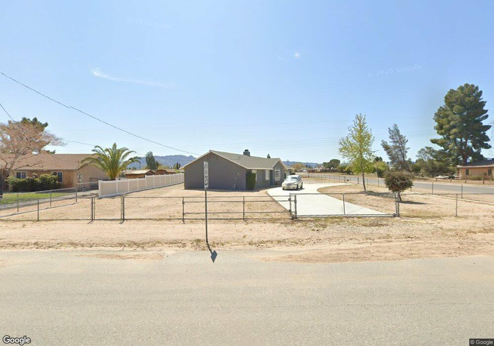
17215 Redding St Hesperia, CA 92345
The Mesa NeighborhoodEstimated Value: $414,000 - $448,000
3
Beds
2
Baths
1,368
Sq Ft
$311/Sq Ft
Est. Value
About This Home
This home is located at 17215 Redding St, Hesperia, CA 92345 and is currently estimated at $424,787, approximately $310 per square foot. 17215 Redding St is a home located in San Bernardino County with nearby schools including Kingston Elementary School, Ranchero Middle School, and Sultana High School.
Ownership History
Date
Name
Owned For
Owner Type
Purchase Details
Closed on
Feb 23, 2009
Sold by
Deutsche Bank National Trust Company
Bought by
Mitche I James and Sheri D Mitchel I
Current Estimated Value
Home Financials for this Owner
Home Financials are based on the most recent Mortgage that was taken out on this home.
Original Mortgage
$121,850
Outstanding Balance
$77,110
Interest Rate
5.04%
Mortgage Type
VA
Estimated Equity
$347,677
Purchase Details
Closed on
Dec 4, 2008
Sold by
Costa Brian A
Bought by
Deutsche Bank National Trust Company
Purchase Details
Closed on
Apr 11, 2006
Sold by
Costa Lori
Bought by
Costa Brian A
Home Financials for this Owner
Home Financials are based on the most recent Mortgage that was taken out on this home.
Original Mortgage
$236,500
Interest Rate
6.35%
Mortgage Type
New Conventional
Purchase Details
Closed on
Aug 29, 2005
Sold by
Costa Lori
Bought by
Costa Brian A and Costa Lori
Home Financials for this Owner
Home Financials are based on the most recent Mortgage that was taken out on this home.
Original Mortgage
$165,000
Interest Rate
5.81%
Mortgage Type
New Conventional
Purchase Details
Closed on
Jan 28, 2004
Sold by
Costa Brian and Costa Lori
Bought by
Costa Lori
Purchase Details
Closed on
Aug 17, 2000
Sold by
Pl & D Investments
Bought by
Costa Brian A and Costa Lori J
Home Financials for this Owner
Home Financials are based on the most recent Mortgage that was taken out on this home.
Original Mortgage
$102,842
Interest Rate
8.15%
Mortgage Type
FHA
Purchase Details
Closed on
Jan 26, 2000
Sold by
Peterson Land & Development Inc
Bought by
Pl & D Investments
Home Financials for this Owner
Home Financials are based on the most recent Mortgage that was taken out on this home.
Original Mortgage
$80,500
Interest Rate
7.87%
Mortgage Type
Construction
Purchase Details
Closed on
Dec 29, 1999
Sold by
Irwin Betty G and Irwin William M
Bought by
Peterson Land & Development Inc
Home Financials for this Owner
Home Financials are based on the most recent Mortgage that was taken out on this home.
Original Mortgage
$80,500
Interest Rate
7.87%
Mortgage Type
Construction
Create a Home Valuation Report for This Property
The Home Valuation Report is an in-depth analysis detailing your home's value as well as a comparison with similar homes in the area
Home Values in the Area
Average Home Value in this Area
Purchase History
| Date | Buyer | Sale Price | Title Company |
|---|---|---|---|
| Mitche I James | $119,000 | Chicago Title Company | |
| Deutsche Bank National Trust Company | $140,383 | Commonwealth Temecula | |
| Costa Brian A | -- | Old Republic Title Company | |
| Costa Brian A | -- | Home Connects | |
| Costa Lori | -- | -- | |
| Costa Brian A | $103,000 | Lawyers Title Company | |
| Pl & D Investments | -- | Lawyers Title | |
| Peterson Land & Development Inc | $20,000 | Lawyers Title |
Source: Public Records
Mortgage History
| Date | Status | Borrower | Loan Amount |
|---|---|---|---|
| Open | Mitche I James | $121,850 | |
| Previous Owner | Costa Brian A | $236,500 | |
| Previous Owner | Costa Brian A | $165,000 | |
| Previous Owner | Costa Brian A | $102,842 | |
| Previous Owner | Peterson Land & Development Inc | $80,500 |
Source: Public Records
Tax History Compared to Growth
Tax History
| Year | Tax Paid | Tax Assessment Tax Assessment Total Assessment is a certain percentage of the fair market value that is determined by local assessors to be the total taxable value of land and additions on the property. | Land | Improvement |
|---|---|---|---|---|
| 2025 | $1,637 | $153,247 | $32,197 | $121,050 |
| 2024 | $1,637 | $150,242 | $31,566 | $118,676 |
| 2023 | $1,618 | $147,296 | $30,947 | $116,349 |
| 2022 | $1,580 | $144,408 | $30,340 | $114,068 |
| 2021 | $1,551 | $141,576 | $29,745 | $111,831 |
| 2020 | $1,532 | $140,124 | $29,440 | $110,684 |
| 2019 | $1,500 | $137,377 | $28,863 | $108,514 |
| 2018 | $1,470 | $134,683 | $28,297 | $106,386 |
| 2017 | $1,443 | $132,042 | $27,742 | $104,300 |
| 2016 | $1,412 | $129,453 | $27,198 | $102,255 |
| 2015 | $1,393 | $127,508 | $26,789 | $100,719 |
| 2014 | $1,374 | $125,010 | $26,264 | $98,746 |
Source: Public Records
Map
Nearby Homes
- 7850 Lyons Ave
- 7610 Glider Ave
- 7885 Montrose Ave
- 7697 Montrose Ave
- 7535 Kenyon Ave
- 7991 Montrose Ave
- 7681 Newhall Ave
- 0 Newhall Ave Unit HD25223892
- 8020 Newhall Ave
- 7486 Earhart Ave
- 7902 Alston Ave
- 39718117 Danbury Ave
- 17041 Fairburn St
- 0 Oxford Ave Unit HD25072687
- 17412 Danbury Ave
- 16938 Fairburn St
- 16739 Mission St
- 0 Kenyon Ave
- 7548 Chase Ave
- 16725 Mission St
- 17229 Redding St
- 17199 Redding St
- 17245 Redding St
- 17222 Redding St
- 17185 Redding St
- 17261 Redding St
- 7794 Kenyon Ave
- 7789 Jenkins Ave
- 17169 Redding St
- 7804 Kenyon Ave
- 7798 Jenkins Ave
- 7801 Jenkins Ave
- 17254 Seaforth St
- 17182 Redding St
- 17274 Seaforth St
- 17168 Redding St
- 7818 Kenyon Ave
- 17232 Seaforth St
- 17286 Seaforth St
- 17299 Redding St