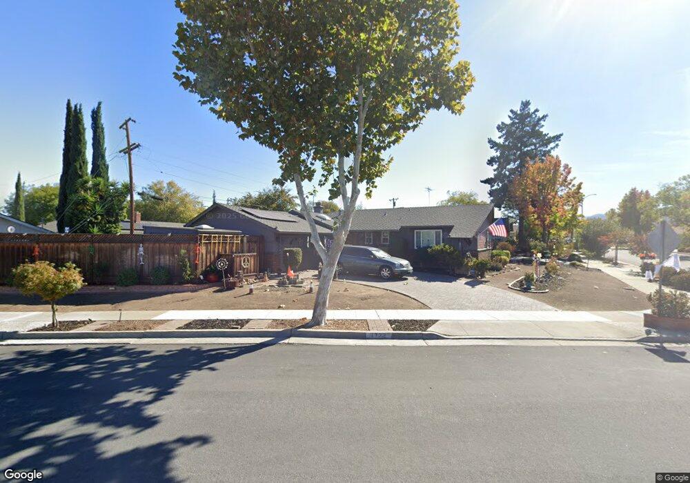
1722 Coralee Dr San Jose, CA 95124
Kooser NeighborhoodEstimated Value: $1,671,000 - $1,791,000
4
Beds
2
Baths
1,374
Sq Ft
$1,262/Sq Ft
Est. Value
About This Home
This home is located at 1722 Coralee Dr, San Jose, CA 95124 and is currently estimated at $1,734,037, approximately $1,262 per square foot. 1722 Coralee Dr is a home located in Santa Clara County with nearby schools including Lietz Elementary School, Noddin Elementary School, and Union Middle School.
Ownership History
Date
Name
Owned For
Owner Type
Purchase Details
Closed on
Feb 10, 2021
Sold by
Thiel Greg Havens and Johnsen Lynn Hollis
Bought by
Thiel Greg Havens and Thiel Personal Ass Greg Havens
Current Estimated Value
Purchase Details
Closed on
Oct 22, 2015
Sold by
Thiel Herbert H
Bought by
Herbert H Thiel Living Trust and Johnsen Lynn Hollis
Purchase Details
Closed on
Jun 26, 2010
Sold by
Thiel Herbert H and Barbara Thiel J
Bought by
Thiel Herbert H and Thiel Greg
Create a Home Valuation Report for This Property
The Home Valuation Report is an in-depth analysis detailing your home's value as well as a comparison with similar homes in the area
Home Values in the Area
Average Home Value in this Area
Purchase History
| Date | Buyer | Sale Price | Title Company |
|---|---|---|---|
| Thiel Greg Havens | -- | None Available | |
| Herbert H Thiel Living Trust | -- | None Available | |
| Thiel Herbert H | -- | None Available | |
| Thiel Herbert H | -- | None Available |
Source: Public Records
Tax History Compared to Growth
Tax History
| Year | Tax Paid | Tax Assessment Tax Assessment Total Assessment is a certain percentage of the fair market value that is determined by local assessors to be the total taxable value of land and additions on the property. | Land | Improvement |
|---|---|---|---|---|
| 2025 | $2,655 | $85,178 | $24,222 | $60,956 |
| 2024 | $2,655 | $83,509 | $23,748 | $59,761 |
| 2023 | $2,561 | $81,873 | $23,283 | $58,590 |
| 2022 | $2,526 | $80,269 | $22,827 | $57,442 |
| 2021 | $2,417 | $78,696 | $22,380 | $56,316 |
| 2020 | $2,317 | $77,890 | $22,151 | $55,739 |
| 2019 | $2,246 | $76,364 | $21,717 | $54,647 |
| 2018 | $2,185 | $74,868 | $21,292 | $53,576 |
| 2017 | $2,146 | $73,401 | $20,875 | $52,526 |
| 2016 | $2,049 | $71,963 | $20,466 | $51,497 |
| 2015 | $2,096 | $70,883 | $20,159 | $50,724 |
| 2014 | $1,587 | $69,496 | $19,765 | $49,731 |
Source: Public Records
Map
Nearby Homes
- 1772 Conrad Ave
- 1721 Ross Cir
- 1719 Ross Cir
- 1742 Del Paso Ave
- 5066 Carter Ave
- 4843 Pepperwood Way
- 4814 Pine Forest Place Unit 7
- 1684 Tupolo Dr
- 1638 Branham Ln Unit D
- 1668 Nora Way
- 0000 Harwood Rd
- 4216 Camden Ave
- 4927 Leigh Ave
- 3942 Paladin Dr
- 4848 Anna Dr
- 1503 Love Ct
- 1543 Rose Anna Dr
- 1796 Chevalier Dr
- 4867 Anna Dr
- 3825 Woodford Dr
- 0 Camden Ave Ave Unit ML81005757
- 4906 Alan Ave
- 4859 Little Branham Ln
- 1720 Coralee Dr
- 4867 Little Branham Ln
- 4910 Alan Ave
- 1725 Coralee Dr
- 1723 Coralee Dr
- 4873 Little Branham Ln
- 1727 Coralee Dr
- 4905 Alan Ave
- 1721 Coralee Dr
- 4916 Alan Ave
- 1729 Coralee Dr
- 4909 Alan Ave
- 4881 Little Branham Ln
- 1719 Coralee Dr
- 1733 Coralee Dr
- 4915 Alan Ave
- 4922 Alan Ave