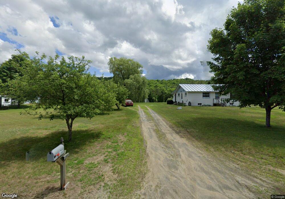
1722 Littleton Rd Monroe, NH 03771
Estimated Value: $229,039 - $276,000
2
Beds
1
Bath
1,152
Sq Ft
$227/Sq Ft
Est. Value
About This Home
This home is located at 1722 Littleton Rd, Monroe, NH 03771 and is currently estimated at $261,260, approximately $226 per square foot. 1722 Littleton Rd is a home located in Grafton County with nearby schools including Monroe Consolidated School.
Ownership History
Date
Name
Owned For
Owner Type
Purchase Details
Closed on
Nov 7, 2019
Sold by
Pierce Peter M and Pierce Manuel Gnia
Bought by
Noonan Taryn and Johnson Tracey
Current Estimated Value
Home Financials for this Owner
Home Financials are based on the most recent Mortgage that was taken out on this home.
Original Mortgage
$116,844
Outstanding Balance
$103,338
Interest Rate
3.87%
Mortgage Type
FHA
Estimated Equity
$157,922
Purchase Details
Closed on
Aug 10, 2009
Sold by
Janes Michael W and Janes Kristin M
Bought by
Pierce Peter M
Home Financials for this Owner
Home Financials are based on the most recent Mortgage that was taken out on this home.
Original Mortgage
$117,346
Interest Rate
5.47%
Mortgage Type
Purchase Money Mortgage
Purchase Details
Closed on
Jul 3, 2008
Sold by
Fenoff Todd A
Bought by
Janes Michael W and Janes Kristin M
Home Financials for this Owner
Home Financials are based on the most recent Mortgage that was taken out on this home.
Original Mortgage
$115,000
Interest Rate
6.01%
Mortgage Type
Purchase Money Mortgage
Create a Home Valuation Report for This Property
The Home Valuation Report is an in-depth analysis detailing your home's value as well as a comparison with similar homes in the area
Home Values in the Area
Average Home Value in this Area
Purchase History
| Date | Buyer | Sale Price | Title Company |
|---|---|---|---|
| Noonan Taryn | $119,000 | -- | |
| Pierce Peter M | $115,000 | -- | |
| Janes Michael W | $122,000 | -- |
Source: Public Records
Mortgage History
| Date | Status | Borrower | Loan Amount |
|---|---|---|---|
| Open | Noonan Taryn | $116,844 | |
| Previous Owner | Janes Michael W | $117,346 | |
| Previous Owner | Janes Michael W | $115,000 |
Source: Public Records
Tax History Compared to Growth
Tax History
| Year | Tax Paid | Tax Assessment Tax Assessment Total Assessment is a certain percentage of the fair market value that is determined by local assessors to be the total taxable value of land and additions on the property. | Land | Improvement |
|---|---|---|---|---|
| 2024 | $1,987 | $186,400 | $42,900 | $143,500 |
| 2023 | $1,814 | $186,400 | $42,900 | $143,500 |
| 2022 | $1,320 | $108,300 | $37,400 | $70,900 |
| 2020 | $1,297 | $108,300 | $37,400 | $70,900 |
| 2019 | $1,228 | $108,300 | $37,400 | $70,900 |
| 2018 | $1,158 | $108,300 | $37,400 | $70,900 |
| 2016 | $1,122 | $98,900 | $31,200 | $67,700 |
| 2015 | $1,040 | $98,900 | $31,200 | $67,700 |
| 2014 | $1,186 | $98,900 | $31,200 | $67,700 |
| 2012 | $1,407 | $124,200 | $31,200 | $93,000 |
Source: Public Records
Map
Nearby Homes
- 396 Nelson Rd
- 1291 Littleton Rd
- 342 Grange Hall Rd
- 1573 Us Route 5 S
- 433 Grange Hall Rd
- 286 Carter St
- 88 Mill Hill
- 00 Coppermine Rd Unit 59
- 391 Bimson Dr
- 0 Denio Rd Unit 5059200
- 0 Denio Rd Unit 5059211
- 0 Denio Rd Unit 5059215
- 0 Denio Rd Unit 24587948
- 0 Denio Rd
- 0 Denio Rd Unit 5059206
- 0 Denio Rd Unit 24587953
- - Denio Rd
- 4615 U S 5
- 4706 Us Route 5 S
- 630 Plains Rd
- 1736 Littleton Rd
- 1760 Littleton Rd
- 16 Tyler Dr
- 1767 Littleton Rd
- 100 Judys Ln
- 1643 Littleton Rd
- 9 Judys Ln
- 16 Beths Way
- 58 Tyler Dr
- 39 Judys Ln
- 127 Tammys Way
- 99 Tyler Dr
- 1590 Littleton Rd
- 1855 Littleton Rd
- 129 Tyler Dr
- 388 Nelson Rd
- 1889 Littleton Rd
- 1890 Littleton Rd
- 171 Tyler Dr
- 1895 Littleton Rd
