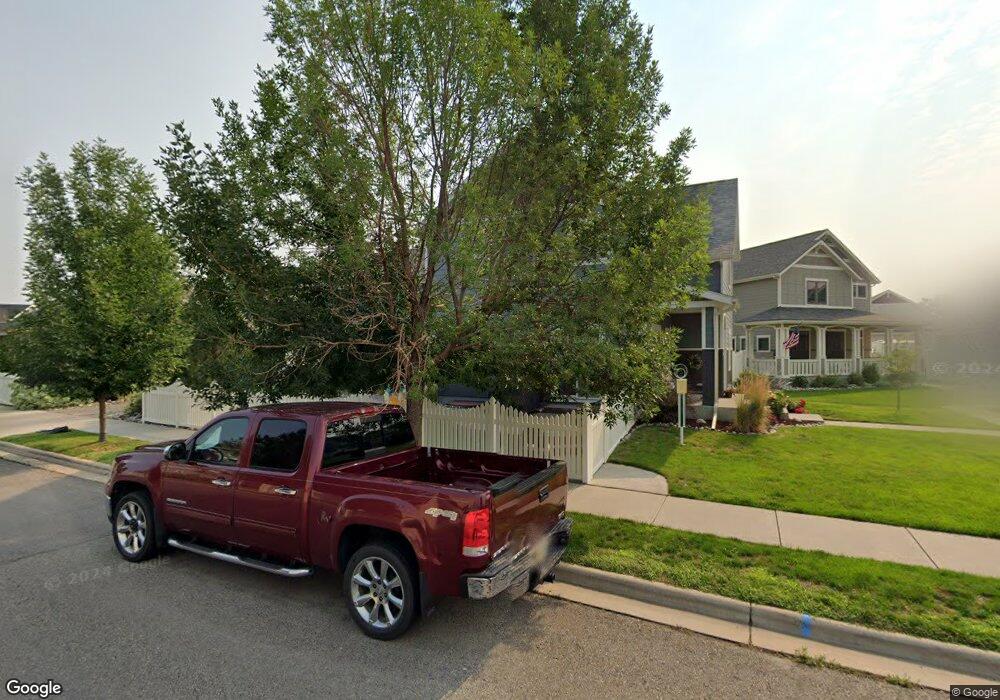
1723 Front St Billings, MT 59101
South Central Billings NeighborhoodEstimated Value: $446,000 - $484,000
4
Beds
3
Baths
2,566
Sq Ft
$180/Sq Ft
Est. Value
About This Home
This home is located at 1723 Front St, Billings, MT 59101 and is currently estimated at $461,060, approximately $179 per square foot. 1723 Front St is a home located in Yellowstone County with nearby schools including Elysian Elementary School, Elysian School, and Billings West High School.
Ownership History
Date
Name
Owned For
Owner Type
Purchase Details
Closed on
May 7, 2021
Sold by
Bassingthwaighte Mark C S and Baskett Kathleen Thomas
Bought by
Mcdonald Deborah V
Current Estimated Value
Purchase Details
Closed on
Jun 21, 2011
Sold by
Mccall Homes Llc
Bought by
Bassingthwaighte Mark C S and Baskett Kathleen T
Home Financials for this Owner
Home Financials are based on the most recent Mortgage that was taken out on this home.
Original Mortgage
$265,600
Interest Rate
4.54%
Mortgage Type
New Conventional
Create a Home Valuation Report for This Property
The Home Valuation Report is an in-depth analysis detailing your home's value as well as a comparison with similar homes in the area
Home Values in the Area
Average Home Value in this Area
Purchase History
| Date | Buyer | Sale Price | Title Company |
|---|---|---|---|
| Mcdonald Deborah V | -- | First Montana Title Co | |
| Bassingthwaighte Mark C S | -- | None Available | |
| Mccall Homes Llc | -- | None Available |
Source: Public Records
Mortgage History
| Date | Status | Borrower | Loan Amount |
|---|---|---|---|
| Previous Owner | Mccall Homes Llc | $265,600 |
Source: Public Records
Tax History
| Year | Tax Paid | Tax Assessment Tax Assessment Total Assessment is a certain percentage of the fair market value that is determined by local assessors to be the total taxable value of land and additions on the property. | Land | Improvement |
|---|---|---|---|---|
| 2025 | $3,472 | $443,600 | $63,466 | $380,134 |
| 2024 | $3,472 | $391,000 | $70,152 | $320,848 |
| 2023 | $3,528 | $391,000 | $70,152 | $320,848 |
| 2022 | $3,205 | $314,500 | $0 | $0 |
| 2021 | $2,945 | $314,500 | $0 | $0 |
| 2020 | $2,976 | $310,800 | $0 | $0 |
| 2019 | $2,828 | $310,800 | $0 | $0 |
| 2018 | $2,839 | $303,100 | $0 | $0 |
| 2017 | $2,297 | $303,100 | $0 | $0 |
| 2016 | $2,551 | $289,600 | $0 | $0 |
| 2015 | $2,468 | $289,600 | $0 | $0 |
| 2014 | $2,456 | $150,573 | $0 | $0 |
Source: Public Records
Map
Nearby Homes
- 1610 Lone Pine Dr
- 1618 Hollyhock St
- 1615 Stony Meadow Ln
- 5238 Golden Hollow Rd
- 1813 Island View Dr
- 5233 Golden Hollow Rd
- 1616 Island View Dr
- 5454 Elysian Rd
- 5474 Elysian Rd
- 5327 Frontier Dr Unit 2
- 6102 Northstead Ave Unit 202
- 6102 Northstead Ave Unit 201
- 6046 Norma Jean Ln
- 2503 Blue Creek Rd
- 6126 Norma Jean Ln
- 6108 Northstead Ave Unit 201
- 6108 Northstead Ave Unit 202
- 1814 Saint George Blvd
- 6140 Johanns Meadow Ln
- Lamar Plan at Annafeld