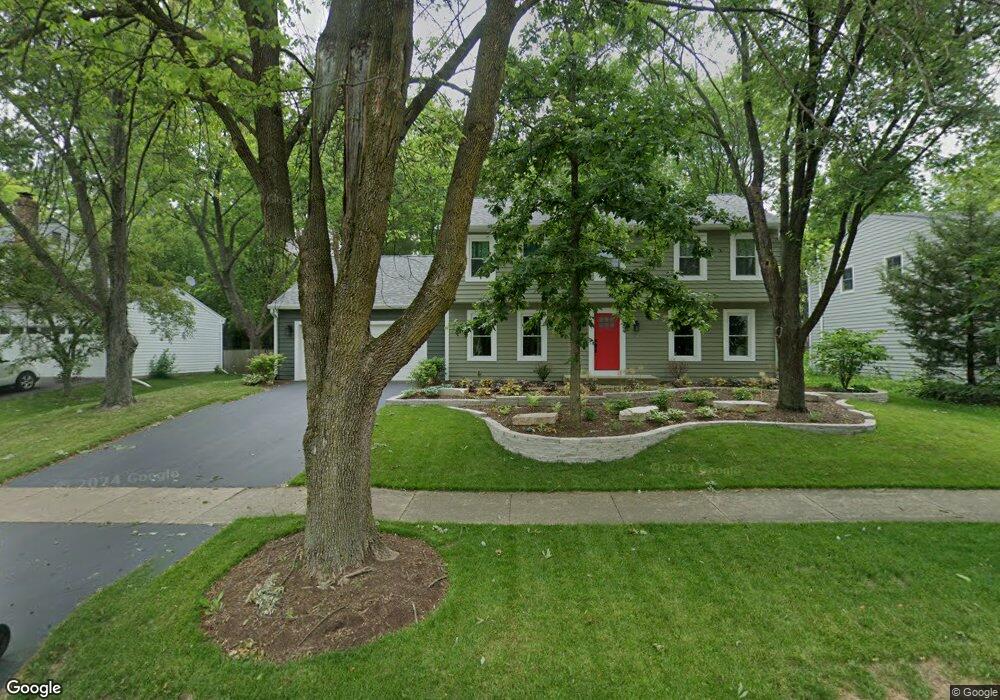
1726 Fender Rd Naperville, IL 60565
Signal Point NeighborhoodEstimated Value: $567,261 - $639,000
--
Bed
1
Bath
2,520
Sq Ft
$243/Sq Ft
Est. Value
About This Home
This home is located at 1726 Fender Rd, Naperville, IL 60565 and is currently estimated at $613,565, approximately $243 per square foot. 1726 Fender Rd is a home located in DuPage County with nearby schools including Scott Elementary School, Madison Jr High School, and Naperville Central High School.
Ownership History
Date
Name
Owned For
Owner Type
Purchase Details
Closed on
Oct 7, 1995
Sold by
Tuller Edwin H and Tuller Gail F
Bought by
Redford Stephen N and Redford Catherine A
Current Estimated Value
Home Financials for this Owner
Home Financials are based on the most recent Mortgage that was taken out on this home.
Original Mortgage
$140,000
Outstanding Balance
$990
Interest Rate
7.68%
Estimated Equity
$612,575
Create a Home Valuation Report for This Property
The Home Valuation Report is an in-depth analysis detailing your home's value as well as a comparison with similar homes in the area
Home Values in the Area
Average Home Value in this Area
Purchase History
| Date | Buyer | Sale Price | Title Company |
|---|---|---|---|
| Redford Stephen N | $207,000 | Law Title |
Source: Public Records
Mortgage History
| Date | Status | Borrower | Loan Amount |
|---|---|---|---|
| Open | Redford Stephen N | $140,000 |
Source: Public Records
Tax History Compared to Growth
Tax History
| Year | Tax Paid | Tax Assessment Tax Assessment Total Assessment is a certain percentage of the fair market value that is determined by local assessors to be the total taxable value of land and additions on the property. | Land | Improvement |
|---|---|---|---|---|
| 2024 | $9,797 | $167,916 | $69,566 | $98,350 |
| 2023 | $9,438 | $153,250 | $63,490 | $89,760 |
| 2022 | $9,022 | $145,410 | $60,240 | $85,170 |
| 2021 | $8,692 | $139,910 | $57,960 | $81,950 |
| 2020 | $8,507 | $137,400 | $56,920 | $80,480 |
| 2019 | $8,258 | $131,460 | $54,460 | $77,000 |
| 2018 | $8,260 | $131,460 | $54,460 | $77,000 |
| 2017 | $8,093 | $127,020 | $52,620 | $74,400 |
| 2016 | $7,930 | $122,430 | $50,720 | $71,710 |
| 2015 | $7,878 | $115,290 | $47,760 | $67,530 |
| 2014 | $7,932 | $112,560 | $45,700 | $66,860 |
| 2013 | $7,812 | $112,830 | $45,810 | $67,020 |
Source: Public Records
Map
Nearby Homes
- 1717 Drake Ct
- 1340 Auburn Ave
- 1323 Auburn Ave
- 1704 Kenyon Dr
- 614 Bakewell Ln
- 456 Timber Trail Ct
- 621 Bourbon Ct
- 1519 77th St
- 431 Orleans Ave
- 517 Sheffield Rd
- 1449 Whitespire Ct Unit 5104
- 816 Spindletree Ave
- 1896 Appaloosa Dr Unit 7
- 158 E Bailey Rd Unit F
- 144 E Bailey Rd Unit L
- 1877 Appaloosa Dr
- 138 E Bailey Rd Unit M
- 1817 Appaloosa Dr
- 128 E Bailey Rd Unit G
- 805 Potomac Ave
- 1720 Fender Rd
- 1732 Fender Rd
- 1300 Monmouth Ave
- 1301 Monmouth Ave
- 1716 Fender Rd
- 1740 Fender Rd
- 1123 Mill Race Ln
- 1305 Monmouth Ave
- 1304 Monmouth Ave
- 1735 Fender Rd
- 1717 Fender Rd
- 1713 Fender Rd
- 1120 Mill Race Ln
- 1308 Monmouth Ave
- 1754 Fender Rd
- 1704 Fender Rd
- 1725 Drake Ct
- 1709 Fender Rd
- 1107 Darius Ln
- 1313 Monmouth Ave