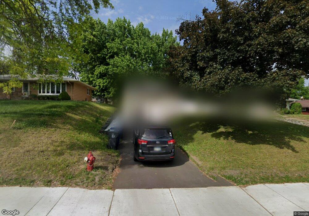
1727 Upper Afton Rd Saint Paul, MN 55106
Battle Creek NeighborhoodEstimated Value: $278,000 - $315,000
3
Beds
1
Bath
815
Sq Ft
$354/Sq Ft
Est. Value
About This Home
This home is located at 1727 Upper Afton Rd, Saint Paul, MN 55106 and is currently estimated at $288,652, approximately $354 per square foot. 1727 Upper Afton Rd is a home located in Ramsey County with nearby schools including Highwood Hills Elementary School, Battle Creek Middle School, and Harding Senior High School.
Ownership History
Date
Name
Owned For
Owner Type
Purchase Details
Closed on
Sep 3, 2019
Sold by
Her Blong and Lor Kia
Bought by
Johnson Carrie N and Johnson Briana R
Current Estimated Value
Home Financials for this Owner
Home Financials are based on the most recent Mortgage that was taken out on this home.
Original Mortgage
$191,900
Outstanding Balance
$168,433
Interest Rate
3.7%
Mortgage Type
New Conventional
Estimated Equity
$120,219
Purchase Details
Closed on
Oct 19, 2017
Sold by
Jensen Amy R and Jensen Douglas H
Bought by
Her Blong
Home Financials for this Owner
Home Financials are based on the most recent Mortgage that was taken out on this home.
Original Mortgage
$197,149
Interest Rate
3.78%
Mortgage Type
VA
Create a Home Valuation Report for This Property
The Home Valuation Report is an in-depth analysis detailing your home's value as well as a comparison with similar homes in the area
Home Values in the Area
Average Home Value in this Area
Purchase History
| Date | Buyer | Sale Price | Title Company |
|---|---|---|---|
| Johnson Carrie N | $202,000 | North American Title Company | |
| Her Blong | $198,849 | Edina Reality Title Inc |
Source: Public Records
Mortgage History
| Date | Status | Borrower | Loan Amount |
|---|---|---|---|
| Open | Johnson Carrie N | $191,900 | |
| Previous Owner | Her Blong | $197,149 |
Source: Public Records
Tax History Compared to Growth
Tax History
| Year | Tax Paid | Tax Assessment Tax Assessment Total Assessment is a certain percentage of the fair market value that is determined by local assessors to be the total taxable value of land and additions on the property. | Land | Improvement |
|---|---|---|---|---|
| 2025 | $4,044 | $268,900 | $35,100 | $233,800 |
| 2023 | $4,044 | $262,100 | $35,100 | $227,000 |
| 2022 | $3,352 | $256,100 | $35,100 | $221,000 |
| 2021 | $2,886 | $213,400 | $35,100 | $178,300 |
| 2020 | $3,088 | $198,700 | $35,100 | $163,600 |
| 2019 | $2,928 | $186,100 | $35,100 | $151,000 |
| 2018 | $2,274 | $186,500 | $35,100 | $151,400 |
| 2017 | $1,850 | $154,800 | $30,900 | $123,900 |
| 2016 | $1,622 | $0 | $0 | $0 |
| 2015 | $1,838 | $118,500 | $30,900 | $87,600 |
| 2014 | $1,454 | $0 | $0 | $0 |
Source: Public Records
Map
Nearby Homes
- 136 White Bear Ave N
- 125 Battle Creek Place
- 49 Battle Creek Place
- 1747 Louise Ave
- 237 Sigurd St
- 1935 Warbler Ln
- 267 Hazelwood St
- 1989 N Park Dr
- 201 Dora Ct W
- 138 Ruth St N Unit 9
- 2059 Parkside Dr Unit 29
- 2063 N Park Dr Unit 6
- 1600 Old Hudson Rd
- 1821 Wilson Ave
- 1443 Pacific St
- 1538 Wilson Ave
- 244 Point Douglas Rd N
- 465 Ruth St N
- 1685 Fremont Ave
- 1333 Pacific St
- 1727 1727 Upper Afton-Road-
- 1727 1727 Upper Afton Rd
- 1733 Upper Afton Rd
- 1721 Upper Afton Rd
- 1721 1721 Upper Afton-Road-
- 1739 Upper Afton Rd
- 1715 Upper Afton Rd
- 1745 Upper Afton Rd
- 1736 Rowe Place
- 1728 Rowe Place
- 1712 1712 Upper Afton Rd
- 1712 Upper Afton Rd
- 1744 Rowe Place
- 1744 1744 Rowe Place
- 1744 1744 Rowe-Place-
- 1751 1751 Upper Afton Rd
- 1751 Upper Afton Rd
- 1738 Upper Afton Rd
- 1750 Rowe Place
- 1757 1757 Upper Afton-Road-