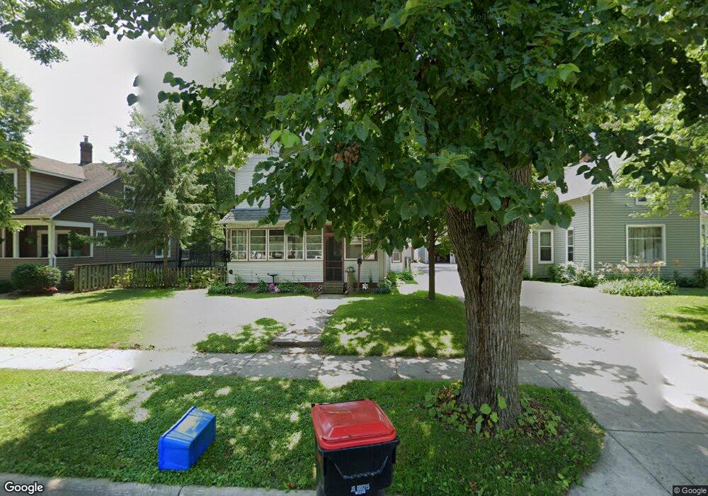
1727 W 6th St Red Wing, MN 55066
Estimated Value: $253,215 - $309,000
3
Beds
2
Baths
2,006
Sq Ft
$142/Sq Ft
Est. Value
About This Home
This home is located at 1727 W 6th St, Red Wing, MN 55066 and is currently estimated at $284,304, approximately $141 per square foot. 1727 W 6th St is a home located in Goodhue County with nearby schools including Sunnyside Elementary School, Burnside Elementary School, and Twin Bluff Middle School.
Ownership History
Date
Name
Owned For
Owner Type
Purchase Details
Closed on
May 2, 2022
Sold by
Brandi Cline
Bought by
Watson Broderick Thomas
Current Estimated Value
Home Financials for this Owner
Home Financials are based on the most recent Mortgage that was taken out on this home.
Original Mortgage
$248,417
Outstanding Balance
$233,103
Interest Rate
4.62%
Mortgage Type
FHA
Estimated Equity
$51,201
Purchase Details
Closed on
Apr 29, 2022
Sold by
Cline Brandi
Bought by
Watson Broderick
Home Financials for this Owner
Home Financials are based on the most recent Mortgage that was taken out on this home.
Original Mortgage
$248,417
Outstanding Balance
$233,103
Interest Rate
4.62%
Mortgage Type
FHA
Estimated Equity
$51,201
Purchase Details
Closed on
Mar 30, 2018
Sold by
Anderson Steven J and Anderson Leanne C
Bought by
Cline Brandi
Create a Home Valuation Report for This Property
The Home Valuation Report is an in-depth analysis detailing your home's value as well as a comparison with similar homes in the area
Home Values in the Area
Average Home Value in this Area
Purchase History
| Date | Buyer | Sale Price | Title Company |
|---|---|---|---|
| Watson Broderick Thomas | $253,000 | None Listed On Document | |
| Watson Broderick | $253,000 | -- | |
| Cline Brandi | $170,000 | -- |
Source: Public Records
Mortgage History
| Date | Status | Borrower | Loan Amount |
|---|---|---|---|
| Open | Watson Broderick Thomas | $248,417 | |
| Closed | Watson Broderick | $248,417 |
Source: Public Records
Tax History
| Year | Tax Paid | Tax Assessment Tax Assessment Total Assessment is a certain percentage of the fair market value that is determined by local assessors to be the total taxable value of land and additions on the property. | Land | Improvement |
|---|---|---|---|---|
| 2025 | -- | $245,300 | $59,600 | $185,700 |
| 2024 | -- | $241,000 | $59,600 | $181,400 |
| 2023 | $3,210 | $227,900 | $59,600 | $168,300 |
| 2022 | $2,678 | $225,000 | $58,000 | $167,000 |
| 2021 | $2,480 | $195,600 | $58,000 | $137,600 |
| 2020 | $2,476 | $185,200 | $58,000 | $127,200 |
| 2019 | $2,458 | $174,200 | $58,000 | $116,200 |
| 2018 | $2,002 | $174,800 | $58,000 | $116,800 |
| 2017 | $1,948 | $156,200 | $58,000 | $98,200 |
| 2016 | $1,928 | $154,300 | $58,000 | $96,300 |
| 2015 | $1,876 | $149,900 | $58,000 | $91,900 |
| 2014 | -- | $144,900 | $58,000 | $86,900 |
Source: Public Records
Map
Nearby Homes
- 1738 W 6th St
- 1715 W 5th St
- 717 Blaine St
- 1528 W 6th St
- 1227 W 4th St
- 430 Harrison St
- 1130 W 4th St
- 1330 Hillside Dr
- 1348 Hillside Dr
- 1684 Siewert St
- 1004 College Ave
- 1050 Sturtevant St
- 1108 Hawthorne St
- 815 W 4th St
- 1020 Hawthorne St
- 617 W 3rd St
- 1606 Reichert Ave
- 1828 Perlich Ave Unit 2G
- 818 Hawthorne St
- 814 Central Ave
- 1737 W 6th St
- 1719 W 6th St
- 1715 W 6th St
- 1743 W 6th St
- 626 Featherstone Rd
- 1709 W 6th St
- 1732 W 7th St
- 1749 W 6th St
- 1722 W 6th St
- 1722 1722 6th-Street-w
- 1732 W 6th St
- 1740 W 7th St
- 1718 W 6th St
- 614 Buchanan St
- 620 Buchanan St Unit 622
- 620 - 622 Buchanan St
- 1746 W 7th St
- 620 Buchanan St
- 1744 W 6th St
- 1746 1746 7th-Street-w
Your Personal Tour Guide
Ask me questions while you tour the home.