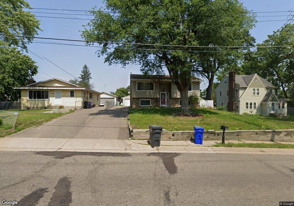
1729 Burns Ave Saint Paul, MN 55106
Battle Creek NeighborhoodEstimated Value: $297,000 - $327,000
4
Beds
2
Baths
1,632
Sq Ft
$194/Sq Ft
Est. Value
About This Home
This home is located at 1729 Burns Ave, Saint Paul, MN 55106 and is currently estimated at $316,771, approximately $194 per square foot. 1729 Burns Ave is a home located in Ramsey County with nearby schools including Highwood Hills Elementary School, Battle Creek Middle School, and Harding Senior High School.
Ownership History
Date
Name
Owned For
Owner Type
Purchase Details
Closed on
Mar 5, 2021
Sold by
Leonard Fontaine Denise and Fontaine Daryll Paul
Bought by
Moua Seng
Current Estimated Value
Home Financials for this Owner
Home Financials are based on the most recent Mortgage that was taken out on this home.
Original Mortgage
$9,000
Outstanding Balance
$8,148
Interest Rate
3.17%
Mortgage Type
New Conventional
Estimated Equity
$308,623
Purchase Details
Closed on
Jun 24, 2019
Sold by
Leonard Fontaine Denise and Fontaine Daryll Paul
Bought by
Leonard Fontaine Denise and Fontaine Daryll Paul
Create a Home Valuation Report for This Property
The Home Valuation Report is an in-depth analysis detailing your home's value as well as a comparison with similar homes in the area
Home Values in the Area
Average Home Value in this Area
Purchase History
| Date | Buyer | Sale Price | Title Company |
|---|---|---|---|
| Moua Seng | $257,000 | Land Title Inc | |
| Leonard Fontaine Denise | -- | None Available | |
| Moua Seng Seng | $257,000 | -- |
Source: Public Records
Mortgage History
| Date | Status | Borrower | Loan Amount |
|---|---|---|---|
| Open | Moua Seng | $9,000 | |
| Open | Moua Seng | $248,000 | |
| Closed | Moua Seng Seng | $257,000 |
Source: Public Records
Tax History Compared to Growth
Tax History
| Year | Tax Paid | Tax Assessment Tax Assessment Total Assessment is a certain percentage of the fair market value that is determined by local assessors to be the total taxable value of land and additions on the property. | Land | Improvement |
|---|---|---|---|---|
| 2025 | $4,514 | $283,400 | $43,700 | $239,700 |
| 2023 | $4,514 | $290,900 | $27,200 | $263,700 |
| 2022 | $3,772 | $288,300 | $27,200 | $261,100 |
| 2021 | $3,512 | $244,000 | $27,200 | $216,800 |
| 2020 | $3,612 | $224,000 | $27,200 | $196,800 |
| 2019 | $3,110 | $216,000 | $27,200 | $188,800 |
| 2018 | $2,994 | $186,200 | $27,200 | $159,000 |
| 2017 | $2,726 | $186,900 | $27,200 | $159,700 |
| 2016 | $2,706 | $0 | $0 | $0 |
| 2015 | $2,436 | $160,300 | $27,200 | $133,100 |
| 2014 | $2,352 | $0 | $0 | $0 |
Source: Public Records
Map
Nearby Homes
- 1747 Louise Ave
- 125 Battle Creek Place
- 237 Sigurd St
- 267 Hazelwood St
- 1600 Old Hudson Rd
- 1821 Wilson Ave
- 1935 Warbler Ln
- 49 Battle Creek Place
- 1538 Wilson Ave
- 1989 N Park Dr
- 1685 Fremont Ave
- 138 Ruth St N Unit 9
- 2023 Parkside Dr
- 2059 Parkside Dr Unit 29
- 465 Ruth St N
- 2063 N Park Dr Unit 6
- 1935 Fremont Ave E
- 1991 3rd St E
- 1964 4th St E
- 244 Point Douglas Rd N
- 1723 Burns Ave
- 1731 Burns Ave
- 1751 Burns Ave
- 1717 Burns Ave
- 1730 Burns Ave
- 1734 Burns Ave
- 1726 Burns Ave
- 1740 Burns Ave
- 1709 1709 Burns-Avenue-
- 1709 Burns Ave
- 1757 Burns Ave
- 1746 Burns Ave
- 1720 Burns Ave
- 1712 1712 Burns-Avenue-
- 1699 Burns Ave
- 1752 Burns Ave
- 1712 Burns Ave
- 1763 Burns Ave
- 1695 Burns Ave
- 1702 Burns Ave