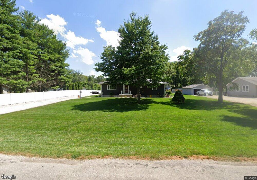
173 E Lockhart St Niantic, IL 62551
Estimated Value: $133,000 - $177,000
Studio
1
Bath
1,140
Sq Ft
$129/Sq Ft
Est. Value
About This Home
This home is located at 173 E Lockhart St, Niantic, IL 62551 and is currently estimated at $147,206, approximately $129 per square foot. 173 E Lockhart St is a home located in Macon County.
Ownership History
Date
Name
Owned For
Owner Type
Purchase Details
Closed on
May 24, 2012
Sold by
Moore Sharon E and Moore Jo Ellen
Bought by
German Shanon and German Erice L
Current Estimated Value
Home Financials for this Owner
Home Financials are based on the most recent Mortgage that was taken out on this home.
Original Mortgage
$66,000
Outstanding Balance
$45,771
Interest Rate
3.92%
Mortgage Type
New Conventional
Estimated Equity
$101,435
Create a Home Valuation Report for This Property
The Home Valuation Report is an in-depth analysis detailing your home's value as well as a comparison with similar homes in the area
Purchase History
| Date | Buyer | Sale Price | Title Company |
|---|---|---|---|
| German Shanon | $85,000 | None Available | |
| German Shanon | $85,000 | None Available |
Source: Public Records
Mortgage History
| Date | Status | Borrower | Loan Amount |
|---|---|---|---|
| Open | German Shanon | $66,000 | |
| Closed | German Shanon | $65,000 |
Source: Public Records
Tax History
| Year | Tax Paid | Tax Assessment Tax Assessment Total Assessment is a certain percentage of the fair market value that is determined by local assessors to be the total taxable value of land and additions on the property. | Land | Improvement |
|---|---|---|---|---|
| 2024 | $3,644 | $49,034 | $3,693 | $45,341 |
| 2023 | $2,975 | $41,666 | $3,571 | $38,095 |
| 2022 | $2,815 | $38,532 | $3,303 | $35,229 |
| 2021 | $2,739 | $36,599 | $3,137 | $33,462 |
| 2020 | $2,592 | $34,489 | $2,956 | $31,533 |
| 2019 | $2,592 | $34,489 | $2,956 | $31,533 |
| 2018 | $2,545 | $33,671 | $2,886 | $30,785 |
| 2017 | $2,590 | $33,813 | $2,898 | $30,915 |
| 2016 | $2,603 | $33,773 | $2,895 | $30,878 |
| 2015 | $3,042 | $32,790 | $2,811 | $29,979 |
| 2014 | $2,925 | $32,465 | $2,783 | $29,682 |
| 2013 | $3,267 | $32,465 | $2,783 | $29,682 |
Source: Public Records
Map
Nearby Homes
- 295 N Pritchett St
- 223 W Montgomery St
- 108 N Folly St
- 0 Bill Wall Dr
- 1359 S Bridge Rd
- 414 5th St
- 0 Elizabeth St
- 243 4th St Unit 1
- 345 Louisa St Unit 1
- 8090 W Wood St
- 275 N Camp St
- 270 S Birks St
- 100 Beaman Dr Unit 1
- 5595 W Main St
- 6 W Westway Dr
- 10 W Westway Dr
- 8 Warren Ct
- 1955 E 2700 North Rd
- 123 Indiana St
- 1720 N Sunnyside Rd
- 155 E Lockhart St
- 208 E Lockhart St
- 182 E Lockhart St
- 146 E Lockhart St
- 123 E Lockhart St
- 242 E Lockhart St
- 150 E Montgomery St
- 128 E Lockhart St
- 134 E Montgomery St
- 362 N Main St
- 180 E Montgomery St
- 160 E Lockhart St
- 246 E Montgomery St
- 124 E Montgomery St
- 259 E Lockhart St
- 208 E Montgomery St
- 116 E Lockhart St
- 116 E Montgomery St
- 248 E Lockhart St
- 153 E Montgomery St
Your Personal Tour Guide
Ask me questions while you tour the home.