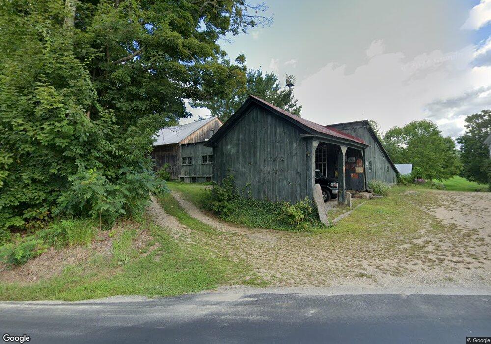
173 Prescott Rd Epping, NH 03042
Estimated Value: $647,000 - $1,503,000
8
Beds
5
Baths
5,515
Sq Ft
$177/Sq Ft
Est. Value
About This Home
This home is located at 173 Prescott Rd, Epping, NH 03042 and is currently estimated at $978,501, approximately $177 per square foot. 173 Prescott Rd is a home with nearby schools including Epping Elementary School, Epping Middle School, and Epping High School.
Ownership History
Date
Name
Owned For
Owner Type
Purchase Details
Closed on
Nov 1, 2019
Sold by
Mcphee Willard H
Bought by
Mcphee 2019 Ret
Current Estimated Value
Purchase Details
Closed on
Apr 16, 2014
Sold by
Mcphee Willard H and Mcphee Erica
Bought by
Mcphee Cory W and Ditursi Julie
Purchase Details
Closed on
Sep 21, 1998
Sold by
Weaver Daniel V and Weaver Ella May
Bought by
Mcphee Willard H
Home Financials for this Owner
Home Financials are based on the most recent Mortgage that was taken out on this home.
Original Mortgage
$359,200
Interest Rate
6.9%
Mortgage Type
Purchase Money Mortgage
Create a Home Valuation Report for This Property
The Home Valuation Report is an in-depth analysis detailing your home's value as well as a comparison with similar homes in the area
Home Values in the Area
Average Home Value in this Area
Purchase History
| Date | Buyer | Sale Price | Title Company |
|---|---|---|---|
| Mcphee 2019 Ret | -- | -- | |
| Mcphee Cory W | -- | -- | |
| Mcphee Willard H | $444,900 | -- |
Source: Public Records
Mortgage History
| Date | Status | Borrower | Loan Amount |
|---|---|---|---|
| Previous Owner | Mcphee Willard H | $359,200 |
Source: Public Records
Tax History
| Year | Tax Paid | Tax Assessment Tax Assessment Total Assessment is a certain percentage of the fair market value that is determined by local assessors to be the total taxable value of land and additions on the property. | Land | Improvement |
|---|---|---|---|---|
| 2024 | $12,837 | $508,800 | $104,600 | $404,200 |
| 2023 | $11,906 | $508,800 | $104,600 | $404,200 |
| 2022 | $11,443 | $508,800 | $104,600 | $404,200 |
| 2021 | $11,407 | $508,800 | $104,600 | $404,200 |
| 2020 | $12,030 | $508,900 | $104,700 | $404,200 |
| 2019 | $0 | $485,700 | $95,900 | $389,800 |
| 2018 | $12,613 | $485,700 | $95,900 | $389,800 |
| 2017 | $12,617 | $486,400 | $96,600 | $389,800 |
| 2016 | $12,625 | $486,700 | $96,900 | $389,800 |
| 2015 | $12,641 | $487,300 | $97,500 | $389,800 |
| 2014 | $12,672 | $518,900 | $96,100 | $422,800 |
| 2013 | $12,613 | $519,700 | $96,900 | $422,800 |
Source: Public Records
Map
Nearby Homes
- 1 Olde Bridge Ln
- 16 Molly Way
- 5A Connor Ct Unit 5A
- 3B Connor Ct Unit 3B
- 55 Sunset Ridge Rd Unit 55A
- 55 Sunset Ridge Rd Unit 55B
- 54 Sunset Ridge Rd Unit 54B
- 1A Connor Ct Unit 1A
- 3A Connor Ct Unit 3A
- 1B Connor Ct Unit 1B
- 65 Sunset Ridge Rd Unit 65A
- 65 Sunset Ridge Rd Unit 65B
- 63 Sunset Ridge Rd Unit 63A
- 63 Sunset Ridge Rd Unit 63B
- 2 Prescott Rd
- lot 103 Megans Way Unit 103
- 8 Megans Way Unit 95
- 101 Megans Way Unit 101
- 96 Megans Way
- 97 Megans Way Unit 97
- 174 Prescott Rd
- 176 Prescott Rd
- 170 Prescott Rd
- 7 Dearborn Rd
- 208 Prescott Rd
- 158 Prescott Rd
- 212 Prescott Rd
- 156 Prescott Rd
- 11 Anthony Ln
- Lot 14 Prescott Orchards
- Lot 9 Prescott Orchards
- 216 Prescott Rd
- Lot 5 Prescott Orchards
- 12 Anthony Ln
- 1 Orchard Hill Rd
- Lot 64 Prescott Orchards
- 154 Prescott Rd
- LOT F3 Prescott Orchards
- 3 Orchard Hill Rd
- 3 Orchard Hill Rd
Your Personal Tour Guide
Ask me questions while you tour the home.