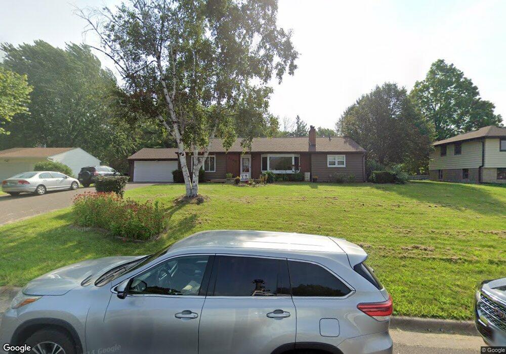
1730 Kennard St Saint Paul, MN 55109
Gladstone NeighborhoodEstimated Value: $338,000 - $417,000
4
Beds
2
Baths
2,672
Sq Ft
$142/Sq Ft
Est. Value
About This Home
This home is located at 1730 Kennard St, Saint Paul, MN 55109 and is currently estimated at $380,556, approximately $142 per square foot. 1730 Kennard St is a home located in Ramsey County with nearby schools including Weaver Elementary School, John Glenn Middle School, and Mounds Park Academy.
Ownership History
Date
Name
Owned For
Owner Type
Purchase Details
Closed on
May 23, 2014
Sold by
Cunnien Stephen Douglas
Bought by
Wessel Jon D and Wessel Angela K
Current Estimated Value
Home Financials for this Owner
Home Financials are based on the most recent Mortgage that was taken out on this home.
Original Mortgage
$215,033
Outstanding Balance
$160,252
Interest Rate
3.75%
Mortgage Type
FHA
Estimated Equity
$220,304
Purchase Details
Closed on
Nov 19, 2007
Sold by
Cunnien Shannon M
Bought by
Cunnien Stephen D
Create a Home Valuation Report for This Property
The Home Valuation Report is an in-depth analysis detailing your home's value as well as a comparison with similar homes in the area
Home Values in the Area
Average Home Value in this Area
Purchase History
| Date | Buyer | Sale Price | Title Company |
|---|---|---|---|
| Wessel Jon D | $225,636 | Partners Title | |
| Cunnien Stephen D | $35,000 | -- |
Source: Public Records
Mortgage History
| Date | Status | Borrower | Loan Amount |
|---|---|---|---|
| Open | Wessel Jon D | $215,033 |
Source: Public Records
Tax History Compared to Growth
Tax History
| Year | Tax Paid | Tax Assessment Tax Assessment Total Assessment is a certain percentage of the fair market value that is determined by local assessors to be the total taxable value of land and additions on the property. | Land | Improvement |
|---|---|---|---|---|
| 2025 | $4,904 | $379,300 | $84,800 | $294,500 |
| 2023 | $4,904 | $348,700 | $84,800 | $263,900 |
| 2022 | $4,154 | $335,100 | $84,800 | $250,300 |
| 2021 | $3,580 | $286,300 | $84,800 | $201,500 |
| 2020 | $3,706 | $255,700 | $84,800 | $170,900 |
| 2019 | $3,356 | $247,500 | $84,800 | $162,700 |
| 2018 | $3,350 | $229,900 | $84,800 | $145,100 |
| 2017 | $3,426 | $223,900 | $84,800 | $139,100 |
| 2016 | $3,190 | $0 | $0 | $0 |
| 2015 | $3,370 | $206,200 | $77,800 | $128,400 |
| 2014 | $2,756 | $0 | $0 | $0 |
Source: Public Records
Map
Nearby Homes
- 1627 Christie Place
- 1743 White Bear Ave N
- 1740 California Ave E
- 1637 Iowa Ave E
- 1849 Kennard St
- 1856 Flandrau St
- 1607 Hoyt Ave E
- 1676 Montana Ave E
- 1672 Manton St
- 1840 Iowa Ave E
- 1854 Barclay St
- 1435 Price Ave
- 1937 Flandrau St
- 1651 Manton St
- 1840 Hoyt Ave E
- 1696 Nevada Ave E
- 1874 Hoyt Ave E
- 1844 Montana Ave E
- 1685 Arlington Ave E
- 1984 Prosperity Rd
- 1722 Kennard St
- 1740 Kennard St
- 1746 Kennard St
- 1708 Kennard St
- 1750 Kennard St
- 1745 Kennard St
- 1756 Kennard St
- 1698 Kennard St
- 1759 Maryknoll Ave
- 1766 Kennard St
- 1759 Maryknoll Ave N
- 1765 Kennard St
- 1667 Larpenteur Ave E
- 1673 Larpenteur Ave E
- 1707 Flandrau St
- 1683 Larpenteur Ave E
- 1719 Flandrau St
- 1772 Kennard St
- 1725 Flandrau St
- 1733 Flandrau St