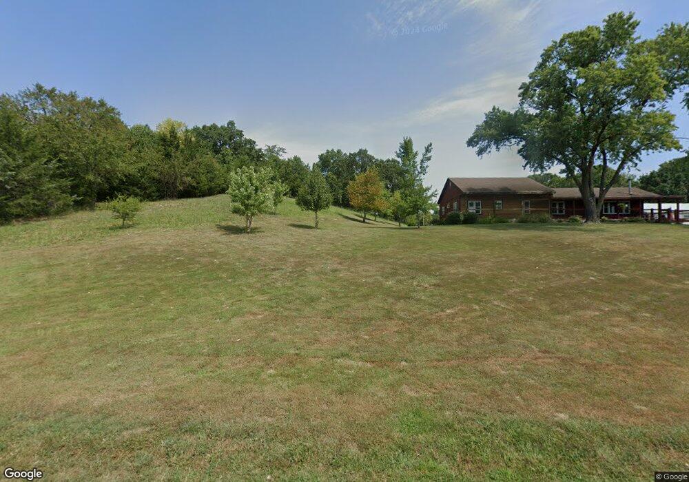
17319 Golden Rd Linwood, KS 66052
Estimated Value: $344,000 - $690,000
3
Beds
2
Baths
1,940
Sq Ft
$279/Sq Ft
Est. Value
About This Home
This home is located at 17319 Golden Rd, Linwood, KS 66052 and is currently estimated at $542,019, approximately $279 per square foot. 17319 Golden Rd is a home located in Leavenworth County with nearby schools including Linwood Elementary School, Basehor-Linwood Middle School, and Basehor-Linwood High School.
Ownership History
Date
Name
Owned For
Owner Type
Purchase Details
Closed on
Aug 4, 2025
Sold by
Schmitt Anthony W and Schmitt Stacey A
Bought by
Schmitt Living Trust and Schmitt
Current Estimated Value
Purchase Details
Closed on
Jul 1, 1996
Bought by
Schmitt Anthony W and Schmitt Stacey A
Home Financials for this Owner
Home Financials are based on the most recent Mortgage that was taken out on this home.
Original Mortgage
$60,000
Interest Rate
8.29%
Mortgage Type
New Conventional
Create a Home Valuation Report for This Property
The Home Valuation Report is an in-depth analysis detailing your home's value as well as a comparison with similar homes in the area
Home Values in the Area
Average Home Value in this Area
Purchase History
| Date | Buyer | Sale Price | Title Company |
|---|---|---|---|
| Schmitt Living Trust | -- | None Listed On Document | |
| Schmitt Anthony W | -- | -- |
Source: Public Records
Mortgage History
| Date | Status | Borrower | Loan Amount |
|---|---|---|---|
| Previous Owner | Schmitt Anthony W | $60,000 | |
| Closed | Schmitt Anthony W | $140,000 |
Source: Public Records
Tax History Compared to Growth
Tax History
| Year | Tax Paid | Tax Assessment Tax Assessment Total Assessment is a certain percentage of the fair market value that is determined by local assessors to be the total taxable value of land and additions on the property. | Land | Improvement |
|---|---|---|---|---|
| 2025 | $5,950 | $53,477 | $19,678 | $33,799 |
| 2024 | $5,549 | $51,373 | $17,620 | $33,753 |
| 2023 | $5,549 | $50,330 | $16,446 | $33,884 |
| 2022 | $5,051 | $43,885 | $13,459 | $30,426 |
| 2021 | $4,586 | $39,956 | $11,632 | $28,324 |
| 2020 | $4,368 | $37,272 | $10,902 | $26,370 |
| 2019 | $4,123 | $35,300 | $10,294 | $25,006 |
| 2018 | $3,790 | $32,446 | $9,076 | $23,370 |
| 2017 | $3,519 | $30,098 | $8,625 | $21,473 |
| 2016 | $3,364 | $28,705 | $8,531 | $20,174 |
| 2015 | -- | $27,294 | $8,241 | $19,053 |
| 2014 | -- | $26,283 | $8,241 | $18,042 |
Source: Public Records
Map
Nearby Homes
- Parcel 5A SE Stanley Rd
- Parcel 3A SE Stanley Rd
- Parcel 4A SE Stanley Rd
- 29655 W 83rd St
- 8315 Primrose St
- 34571 W 83rd St
- 8335 Frederick Ct
- 8386 Timber Trails Dr
- 8459 Primrose St
- 8220 Wyandotte St
- 34275 W 84th Terrace
- 8525 Penner Ave
- 8375 Wyandotte St
- 32845 W 84th St
- 32550 Lexington Ave
- 8620 Thorp St
- 0 174th St
- 33321 Lexington Ave
- 13348 185th St
- 8355 Kill Creek Rd
- 17264 Golden Rd
- 17548 Golden Rd
- 12469 170th St
- 42759 Tannenbaum Platz
- 42759 Tannenbaum Platz Unit PLATZ
- 12675 170th St
- 12480 170th St
- 16982 Golden Rd
- 16961 Golden Rd
- 12520 170th St
- 12560 170th St
- 12657 170th St
- 12648 170th St
- 12654 170th St
- 12781 170th St
- 12718 170th St
- 12849 170th St
- 12927 170th St
- 12750 170th St
- 16708 Joy Meadows Dr