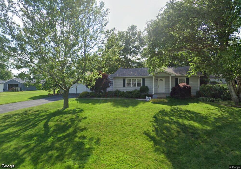
1732 Arrowhead Dr Fremont, OH 43420
Estimated Value: $199,000 - $249,000
3
Beds
2
Baths
1,344
Sq Ft
$168/Sq Ft
Est. Value
About This Home
This home is located at 1732 Arrowhead Dr, Fremont, OH 43420 and is currently estimated at $225,324, approximately $167 per square foot. 1732 Arrowhead Dr is a home located in Sandusky County with nearby schools including Fremont Ross High School, Bishop Hoffman Catholic School - This is St Joe's School now, and St. Joseph School.
Ownership History
Date
Name
Owned For
Owner Type
Purchase Details
Closed on
Sep 18, 1996
Sold by
Soska Paul J
Bought by
Foos Steven J and Gonya Deanna L
Current Estimated Value
Home Financials for this Owner
Home Financials are based on the most recent Mortgage that was taken out on this home.
Original Mortgage
$49,000
Interest Rate
8.38%
Mortgage Type
New Conventional
Purchase Details
Closed on
Sep 1, 1993
Bought by
Foos Steven J and Gonya Deanna L
Create a Home Valuation Report for This Property
The Home Valuation Report is an in-depth analysis detailing your home's value as well as a comparison with similar homes in the area
Home Values in the Area
Average Home Value in this Area
Purchase History
| Date | Buyer | Sale Price | Title Company |
|---|---|---|---|
| Foos Steven J | $97,000 | -- | |
| Foos Steven J | $87,000 | -- |
Source: Public Records
Mortgage History
| Date | Status | Borrower | Loan Amount |
|---|---|---|---|
| Closed | Foos Steven J | $49,000 |
Source: Public Records
Tax History Compared to Growth
Tax History
| Year | Tax Paid | Tax Assessment Tax Assessment Total Assessment is a certain percentage of the fair market value that is determined by local assessors to be the total taxable value of land and additions on the property. | Land | Improvement |
|---|---|---|---|---|
| 2024 | $2,305 | $59,260 | $10,120 | $49,140 |
| 2023 | $2,305 | $44,910 | $7,670 | $37,240 |
| 2022 | $1,866 | $44,910 | $7,670 | $37,240 |
| 2021 | $1,923 | $44,910 | $7,670 | $37,240 |
| 2020 | $1,750 | $40,080 | $7,670 | $32,410 |
| 2019 | $1,748 | $40,080 | $7,670 | $32,410 |
| 2018 | $1,701 | $40,080 | $7,670 | $32,410 |
| 2017 | $1,543 | $36,160 | $7,670 | $28,490 |
| 2016 | $1,353 | $36,160 | $7,670 | $28,490 |
| 2015 | $1,331 | $36,160 | $7,670 | $28,490 |
| 2014 | $1,455 | $37,840 | $7,600 | $30,240 |
| 2013 | $1,424 | $37,840 | $7,600 | $30,240 |
Source: Public Records
Map
Nearby Homes
- 10 Meadowbrook Dr
- 10 Meadowbrook Ln
- 1420 Center St
- 64 River Run Dr Unit J
- 350 Conner Dr
- 135 Briarwood Cir
- 1818 Finley Dr
- 1970 Morrison Rd
- 1832 Myrtle St
- 1485 Autumn Woods Dr
- 1719 Buckland Ave
- 2484 Buckland Ave
- 1013 Whittlesey St
- 905 Twinn St
- 933 E Cole Rd
- 1028 June St
- 18 Katlyn Dr
- 625 Bush Place
- 815 South St
- 616 S Wood St
- 1718 Arrowhead Dr
- 1749 Tomahawk Trace
- 1710 Arrowhead Dr
- 1745 Tomahawk Trace
- 1727 Arrowhead Dr
- 1508 W Cole Rd
- 1735 Arrowhead Dr
- 1514 W Cole Rd
- 1731 Tomahawk Trace
- 1704 Arrowhead Dr
- 1753 Tomahawk Trace
- 1470 Chieftain Cir
- 1520 W Cole Rd
- 1715 Tomahawk Trace
- 1462 Chieftain Cir
- 1700 Arrowhead Dr
- 1748 Tomahawk Trace
- 1530 W Cole Rd
- 1517 W Cole Rd
- 1744 Tomahawk Trace