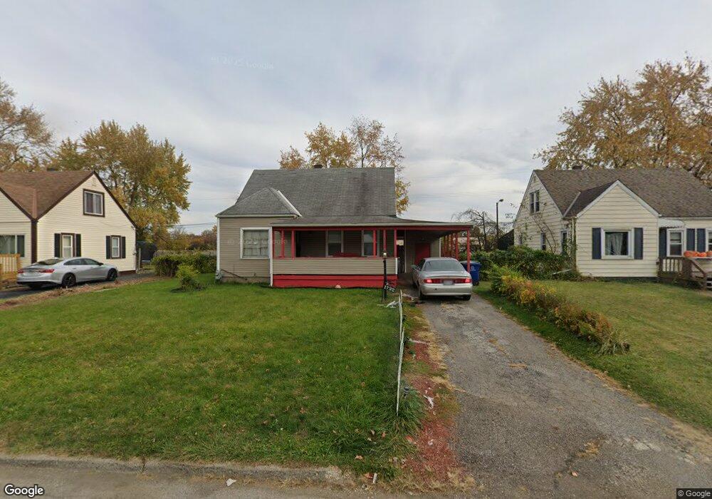
1732 Lancashire Rd Columbus, OH 43219
Brittany Hills NeighborhoodEstimated Value: $143,332 - $164,000
3
Beds
1
Bath
1,072
Sq Ft
$146/Sq Ft
Est. Value
About This Home
This home is located at 1732 Lancashire Rd, Columbus, OH 43219 and is currently estimated at $156,583, approximately $146 per square foot. 1732 Lancashire Rd is a home located in Franklin County with nearby schools including South Mifflin Stem Academy (K-6), Linden-Mckinley Stem School On Arcadia, and Cesar Chavez College Preparatory School.
Ownership History
Date
Name
Owned For
Owner Type
Purchase Details
Closed on
Sep 4, 1996
Sold by
Huston Richard A
Bought by
Mary L Jones
Current Estimated Value
Home Financials for this Owner
Home Financials are based on the most recent Mortgage that was taken out on this home.
Original Mortgage
$33,947
Outstanding Balance
$2,933
Interest Rate
8.27%
Mortgage Type
FHA
Estimated Equity
$153,650
Purchase Details
Closed on
Oct 5, 1987
Purchase Details
Closed on
Mar 1, 1987
Create a Home Valuation Report for This Property
The Home Valuation Report is an in-depth analysis detailing your home's value as well as a comparison with similar homes in the area
Home Values in the Area
Average Home Value in this Area
Purchase History
| Date | Buyer | Sale Price | Title Company |
|---|---|---|---|
| Mary L Jones | $35,000 | -- | |
| -- | -- | -- | |
| -- | -- | -- |
Source: Public Records
Mortgage History
| Date | Status | Borrower | Loan Amount |
|---|---|---|---|
| Open | Mary L Jones | $33,947 |
Source: Public Records
Tax History Compared to Growth
Tax History
| Year | Tax Paid | Tax Assessment Tax Assessment Total Assessment is a certain percentage of the fair market value that is determined by local assessors to be the total taxable value of land and additions on the property. | Land | Improvement |
|---|---|---|---|---|
| 2024 | $1,539 | $34,300 | $7,980 | $26,320 |
| 2023 | $1,520 | $34,300 | $7,980 | $26,320 |
| 2022 | $1,028 | $19,820 | $2,630 | $17,190 |
| 2021 | $1,030 | $19,820 | $2,630 | $17,190 |
| 2020 | $1,031 | $19,820 | $2,630 | $17,190 |
| 2019 | $954 | $15,720 | $2,100 | $13,620 |
| 2018 | $967 | $15,720 | $2,100 | $13,620 |
| 2017 | $953 | $15,720 | $2,100 | $13,620 |
| 2016 | $1,081 | $16,320 | $2,630 | $13,690 |
| 2015 | $981 | $16,320 | $2,630 | $13,690 |
| 2014 | $984 | $16,320 | $2,630 | $13,690 |
| 2013 | $538 | $18,095 | $2,905 | $15,190 |
Source: Public Records
Map
Nearby Homes
- 1794 Devonshire Rd
- 1808 Brentnell Ave
- 1790 Marston Rd
- 1882 Dunning Rd
- 2398 Dunkirk Dr
- 1789 Marston Rd
- 2336 Edenburgh Dr S
- 2228 Holt Ave
- 2483 Vendome Dr
- 2363 Holt Ave
- 2424 Holt Ave
- 2471 Mock Rd
- 0 Mock Rd
- 1978 Argyle Dr
- 1991 Woodland Ave
- 2054 Jermain Dr
- 1860 Meadowlawn Dr Unit 75
- 2736 Bellero Way Unit 94
- 0 Danby Dr
- 0 Rankin Ave Unit (Rear)
- 1734 Lancashire Rd
- 1740 Lancashire Rd
- 1724 Lancashire Rd
- 1748 Lancashire Rd
- 1716 Lancashire Rd
- 1733 Lancashire Rd
- 1756 Lancashire Rd
- 1741 Lancashire Rd
- 1710 Lancashire Rd
- 1749 Lancashire Rd
- 1717 Lancashire Rd
- 1764 Lancashire Rd
- 1757 Lancashire Rd
- 1704 Lancashire Rd
- 1707 Lancashire Rd
- 1765 Lancashire Rd
- 1738 Devonshire Rd
- 1748 Devonshire Rd
- 1772 Lancashire Rd
- 1754 Devonshire Rd