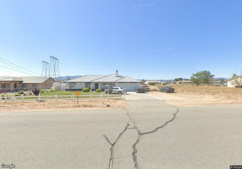
17345 Redding St Hesperia, CA 92345
The Mesa NeighborhoodEstimated Value: $453,997 - $505,000
4
Beds
2
Baths
1,716
Sq Ft
$276/Sq Ft
Est. Value
About This Home
This home is located at 17345 Redding St, Hesperia, CA 92345 and is currently estimated at $473,249, approximately $275 per square foot. 17345 Redding St is a home located in San Bernardino County with nearby schools including Kingston Elementary School, Ranchero Middle School, and Sultana High School.
Ownership History
Date
Name
Owned For
Owner Type
Purchase Details
Closed on
Jul 18, 2019
Sold by
Demasi Laurel and De Masi Anthony
Bought by
Herrera Crystal and Fernandez Angel Esquivel
Current Estimated Value
Home Financials for this Owner
Home Financials are based on the most recent Mortgage that was taken out on this home.
Original Mortgage
$279,837
Interest Rate
4.12%
Mortgage Type
FHA
Purchase Details
Closed on
May 22, 2009
Sold by
Demasi Anthony and De Masi Laurel
Bought by
Demasi Laurel and Demasi Anthony
Home Financials for this Owner
Home Financials are based on the most recent Mortgage that was taken out on this home.
Original Mortgage
$186,239
Interest Rate
4.78%
Mortgage Type
FHA
Purchase Details
Closed on
Aug 27, 2008
Sold by
Deutsche Bank National Trust Co
Bought by
Demasi Anthony and Demasi Laurel
Home Financials for this Owner
Home Financials are based on the most recent Mortgage that was taken out on this home.
Original Mortgage
$183,487
Interest Rate
5.9%
Mortgage Type
FHA
Purchase Details
Closed on
May 29, 2008
Sold by
Fritsch Sharon
Bought by
Deutsche Bank National Trust Co and Morgan Stanley Abs Capital I Inc Trust 2
Purchase Details
Closed on
Jul 6, 2001
Sold by
Tri M Builders Inc
Bought by
Fritsch Sharon
Home Financials for this Owner
Home Financials are based on the most recent Mortgage that was taken out on this home.
Original Mortgage
$127,597
Interest Rate
7.19%
Mortgage Type
FHA
Purchase Details
Closed on
Dec 20, 2000
Sold by
Christian & Missionary Alliance Church
Bought by
Tri M Builders Inc
Home Financials for this Owner
Home Financials are based on the most recent Mortgage that was taken out on this home.
Original Mortgage
$98,500
Interest Rate
7.54%
Mortgage Type
Construction
Purchase Details
Closed on
Dec 28, 1999
Sold by
Gross Genevieve
Bought by
Gross Dale P
Purchase Details
Closed on
Dec 27, 1999
Sold by
Gross Dale P
Bought by
Christian & Missionary Alliance Church
Purchase Details
Closed on
Nov 22, 1999
Sold by
Gross Wayne D
Bought by
Gross Dale P
Create a Home Valuation Report for This Property
The Home Valuation Report is an in-depth analysis detailing your home's value as well as a comparison with similar homes in the area
Home Values in the Area
Average Home Value in this Area
Purchase History
| Date | Buyer | Sale Price | Title Company |
|---|---|---|---|
| Herrera Crystal | $285,000 | Chicago Title Company | |
| Demasi Laurel | -- | Fidelity National Title Co S | |
| Demasi Anthony | $185,000 | Landsafe Title | |
| Deutsche Bank National Trust Co | $191,250 | Landsafe | |
| Fritsch Sharon | $130,000 | Lawyers Title Company | |
| Tri M Builders Inc | $10,000 | Lawyers Title Company | |
| Gross Dale P | -- | First American Title Ins Co | |
| Christian & Missionary Alliance Church | -- | First American Title Ins Co | |
| Gross Dale P | $18,000 | -- |
Source: Public Records
Mortgage History
| Date | Status | Borrower | Loan Amount |
|---|---|---|---|
| Previous Owner | Herrera Crystal | $279,837 | |
| Previous Owner | Demasi Laurel | $186,239 | |
| Previous Owner | Demasi Anthony | $183,487 | |
| Previous Owner | Fritsch Sharon | $127,597 | |
| Previous Owner | Tri M Builders Inc | $98,500 | |
| Closed | Fritsch Sharon | $6,480 |
Source: Public Records
Tax History
| Year | Tax Paid | Tax Assessment Tax Assessment Total Assessment is a certain percentage of the fair market value that is determined by local assessors to be the total taxable value of land and additions on the property. | Land | Improvement |
|---|---|---|---|---|
| 2025 | $3,484 | $311,688 | $62,338 | $249,350 |
| 2024 | $3,405 | $305,577 | $61,116 | $244,461 |
| 2023 | $3,367 | $299,586 | $59,918 | $239,668 |
| 2022 | $3,290 | $293,712 | $58,743 | $234,969 |
| 2021 | $3,230 | $287,953 | $57,591 | $230,362 |
| 2020 | $3,192 | $285,000 | $57,000 | $228,000 |
| 2019 | $2,364 | $217,838 | $29,438 | $188,400 |
| 2018 | $2,317 | $213,567 | $28,861 | $184,706 |
| 2017 | $2,275 | $209,379 | $28,295 | $181,084 |
| 2016 | $2,226 | $205,273 | $27,740 | $177,533 |
| 2015 | $2,197 | $202,189 | $27,323 | $174,866 |
| 2014 | $1,960 | $178,300 | $35,700 | $142,600 |
Source: Public Records
Map
Nearby Homes
- 17375 Redding St
- 7821 Lyons Ave
- 7864 Newhall Ave
- 7653 Montrose Ave
- 7610 Glider Ave
- 7485 Glider Ave
- 0 Oxford Ave Unit HD25072687
- 17412 Danbury Ave
- 7407 Kenyon Ave
- 16 Bangor Ave
- 18132 Bangor Ave
- 7413 Montrose Ave
- 8178 Kingston Ave
- 7486 Earhart Ave
- 0 Kenyon Ave
- 16920 Danbury Ave
- 17041 Fairburn St
- 0000 Ranchero St
- 17111 Ranchero St
- 17405 Adobe St
- 17361 Redding St
- 17331 Redding St
- 17315 Redding St
- 7806 Lyons Ave
- 7807 Lyons Ave
- 17387 Redding St
- 17299 Redding St
- 7820 Lyons Ave
- 7795 Kenyon Ave
- 7824 Montrose Ave
- 17275 Redding St
- 17399 Redding St
- 7834 Lyons Ave
- 7835 Lyons Ave
- 7805 Kenyon Ave
- 7838 Montrose Ave
- 17370 Seaforth St
- 17356 Seaforth St
- 17342 Seaforth St
- 17409 Redding St
Your Personal Tour Guide
Ask me questions while you tour the home.