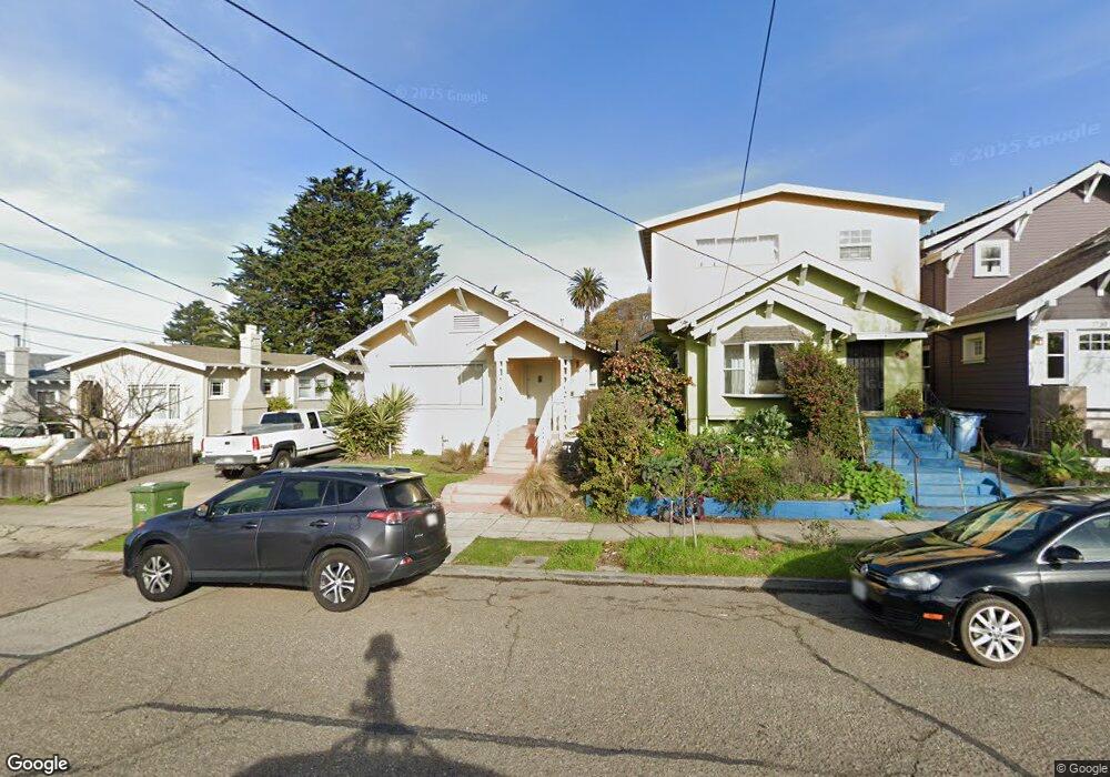
1735 Derby St Berkeley, CA 94703
South Berkeley NeighborhoodEstimated Value: $894,000 - $1,392,000
2
Beds
1
Bath
1,133
Sq Ft
$1,028/Sq Ft
Est. Value
About This Home
This home is located at 1735 Derby St, Berkeley, CA 94703 and is currently estimated at $1,164,225, approximately $1,027 per square foot. 1735 Derby St is a home located in Alameda County with nearby schools including Malcolm X Elementary School, Emerson Elementary School, and John Muir Elementary School.
Ownership History
Date
Name
Owned For
Owner Type
Purchase Details
Closed on
May 6, 2021
Sold by
Urdang Dave A
Bought by
Urdang David A and David A Urdang Living Trust
Current Estimated Value
Purchase Details
Closed on
Sep 12, 2003
Sold by
Mcneill Mary Beth
Bought by
Urdang Dave A
Home Financials for this Owner
Home Financials are based on the most recent Mortgage that was taken out on this home.
Original Mortgage
$357,600
Outstanding Balance
$166,575
Interest Rate
6.3%
Mortgage Type
Stand Alone First
Estimated Equity
$997,650
Purchase Details
Closed on
Sep 19, 2000
Sold by
Martinez Oscar Albert
Bought by
Mcneill Mary Beth
Create a Home Valuation Report for This Property
The Home Valuation Report is an in-depth analysis detailing your home's value as well as a comparison with similar homes in the area
Home Values in the Area
Average Home Value in this Area
Purchase History
| Date | Buyer | Sale Price | Title Company |
|---|---|---|---|
| Urdang David A | -- | None Available | |
| Urdang Dave A | $447,000 | First California Title Co | |
| Mcneill Mary Beth | -- | -- |
Source: Public Records
Mortgage History
| Date | Status | Borrower | Loan Amount |
|---|---|---|---|
| Open | Urdang Dave A | $357,600 | |
| Closed | Urdang Dave A | $44,700 |
Source: Public Records
Tax History
| Year | Tax Paid | Tax Assessment Tax Assessment Total Assessment is a certain percentage of the fair market value that is determined by local assessors to be the total taxable value of land and additions on the property. | Land | Improvement |
|---|---|---|---|---|
| 2025 | $11,281 | $635,504 | $190,651 | $444,853 |
| 2024 | $11,281 | $623,045 | $186,913 | $436,132 |
| 2023 | $10,986 | $610,828 | $183,248 | $427,580 |
| 2022 | $10,931 | $598,854 | $179,656 | $419,198 |
| 2021 | $10,945 | $587,115 | $176,134 | $410,981 |
| 2020 | $10,394 | $581,100 | $174,330 | $406,770 |
| 2019 | $10,003 | $569,705 | $170,911 | $398,794 |
| 2018 | $9,804 | $558,534 | $167,560 | $390,974 |
| 2017 | $9,453 | $547,583 | $164,275 | $383,308 |
| 2016 | $9,130 | $536,846 | $161,054 | $375,792 |
| 2015 | $8,990 | $528,782 | $158,634 | $370,148 |
| 2014 | $8,852 | $518,425 | $155,527 | $362,898 |
Source: Public Records
Map
Nearby Homes
- 1726 Parker St Unit 2
- 1726 Parker St Unit 1
- 2701 Grant St
- 1819 Carleton St
- 2533 Grant St
- 1634 Blake St
- 1612 Parker St
- 1901 Parker St Unit 3
- 1604 Dwight Way
- 1515 Derby St
- 1524 Blake St
- 2829 California St
- 1516 Blake St
- 1516 Blake St Unit A
- 2750 Sacramento St
- 1450 Ward St
- 2758 Sacramento St
- 2926 Ellis St
- 2774 Sacramento St
- 2782 Sacramento St
- 1737 Derby St
- 1733 Derby St
- 1739 Derby St
- 1727 Derby St
- 1741 Derby St
- 1725 Derby St
- 1732 Carleton St
- 1734 Carleton St
- 1730 Carleton St
- 1736 Carleton St
- 2634 Grant St
- 2632 Grant St
- 1723 Derby St
- 1747 Derby St
- 1724 Carleton St
- 2630 Grant St
- 1728 Derby St
- 1721 Derby St
- 1734 Derby St Unit A
- 1734 Derby St
Your Personal Tour Guide
Ask me questions while you tour the home.