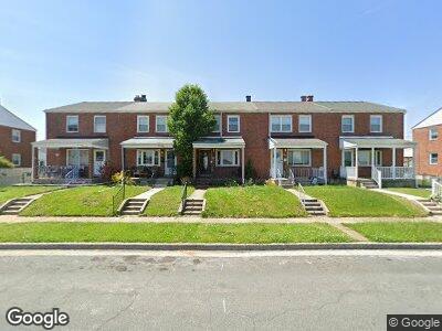
1736 Langport Ave Dundalk, MD 21222
Estimated Value: $210,000 - $230,000
--
Bed
2
Baths
1,216
Sq Ft
$182/Sq Ft
Est. Value
About This Home
This home is located at 1736 Langport Ave, Dundalk, MD 21222 and is currently estimated at $221,719, approximately $182 per square foot. 1736 Langport Ave is a home located in Baltimore County with nearby schools including Bear Creek Elementary School, General John Stricker Middle School, and Patapsco High & Center for Arts.
Ownership History
Date
Name
Owned For
Owner Type
Purchase Details
Closed on
Dec 1, 2010
Sold by
Schuler Jaime N
Bought by
Gentry Jamie N and Gentry Mitchell
Current Estimated Value
Home Financials for this Owner
Home Financials are based on the most recent Mortgage that was taken out on this home.
Original Mortgage
$134,970
Interest Rate
4.63%
Mortgage Type
FHA
Purchase Details
Closed on
Apr 20, 2000
Sold by
Lehto George W
Bought by
Schuler Jaime N
Purchase Details
Closed on
Jun 29, 1972
Sold by
Hildebrandt L A
Bought by
Lehto George W
Create a Home Valuation Report for This Property
The Home Valuation Report is an in-depth analysis detailing your home's value as well as a comparison with similar homes in the area
Home Values in the Area
Average Home Value in this Area
Purchase History
| Date | Buyer | Sale Price | Title Company |
|---|---|---|---|
| Gentry Jamie N | -- | -- | |
| Schuler Jaime N | $75,000 | -- | |
| Lehto George W | $18,500 | -- |
Source: Public Records
Mortgage History
| Date | Status | Borrower | Loan Amount |
|---|---|---|---|
| Open | Gentry Jaime N | $108,200 | |
| Closed | Gentry Jamie N | $134,970 |
Source: Public Records
Tax History Compared to Growth
Tax History
| Year | Tax Paid | Tax Assessment Tax Assessment Total Assessment is a certain percentage of the fair market value that is determined by local assessors to be the total taxable value of land and additions on the property. | Land | Improvement |
|---|---|---|---|---|
| 2024 | $2,354 | $150,300 | $0 | $0 |
| 2023 | $1,107 | $134,400 | $36,000 | $98,400 |
| 2022 | $2,262 | $130,933 | $0 | $0 |
| 2021 | $2,602 | $127,467 | $0 | $0 |
| 2020 | $2,602 | $124,000 | $36,000 | $88,000 |
| 2019 | $2,001 | $119,267 | $0 | $0 |
| 2018 | $1,891 | $114,533 | $0 | $0 |
| 2017 | $1,725 | $109,800 | $0 | $0 |
| 2016 | $2,401 | $109,800 | $0 | $0 |
| 2015 | $2,401 | $109,800 | $0 | $0 |
| 2014 | $2,401 | $133,100 | $0 | $0 |
Source: Public Records
Map
Nearby Homes
- 1740 Stokesley Rd
- 8037 N Boundary Rd
- 8112 Kavanagh Rd
- 1783 Inverness Ave
- 1704 Melbourne Rd
- 1912 Barry Rd
- 47 Mavista Ave
- 8186 Gray Haven Rd
- 94 Avalon Ave
- 1907 Guy Way
- 7856 Harold Rd
- 71 Del Rio Rd
- 2007 Dineen Dr
- 1614 Lynch Rd
- 1587 Lynch Rd
- 8211 Beach Dr
- 7851 Kentley Rd
- 1921 Inverton Rd
- 8031 Stratman Rd
- 317 Trappe Rd
- 1736 Langport Ave
- 1734 Langport Ave
- 1738 Langport Ave
- 1732 Langport Ave
- 1730 Langport Ave
- 1742 Langport Ave
- 1728 Langport Ave
- 1744 Langport Ave
- 1726 Langport Ave
- 1737 Stokesley Rd
- 1739 Stokesley Rd
- 1735 Stokesley Rd
- 1733 Stokesley Rd
- 1746 Langport Ave
- 1741 Stokesley Rd
- 1731 Stokesley Rd
- 1724 Langport Ave
- 1748 Langport Ave
- 1743 Stokesley Rd
- 1722 Langport Ave