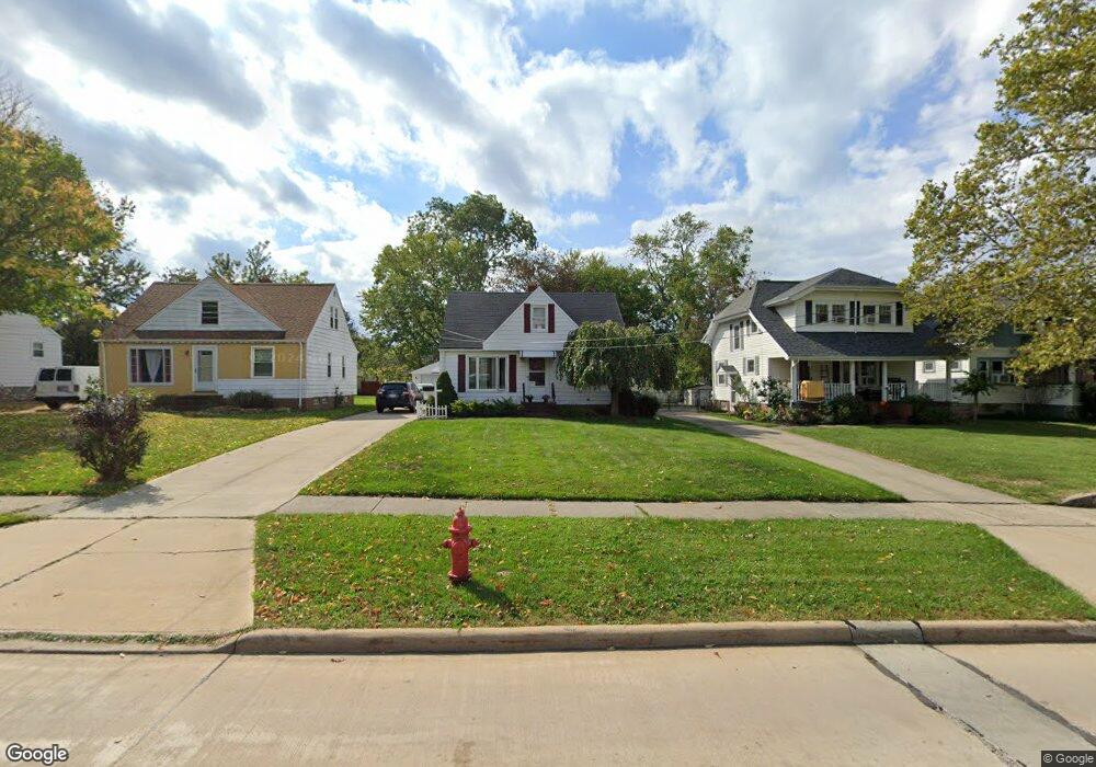
1736 Lincoln Rd Wickliffe, OH 44092
Estimated Value: $195,545 - $215,000
3
Beds
2
Baths
858
Sq Ft
$241/Sq Ft
Est. Value
About This Home
This home is located at 1736 Lincoln Rd, Wickliffe, OH 44092 and is currently estimated at $206,386, approximately $240 per square foot. 1736 Lincoln Rd is a home located in Lake County with nearby schools including Wickliffe Elementary School, Wickliffe Middle School, and Wickliffe High School.
Ownership History
Date
Name
Owned For
Owner Type
Purchase Details
Closed on
Apr 18, 2003
Sold by
Liuzzo Kenneth R and Liuzzo Heather A
Bought by
Smith Daniel and Smith Sara
Current Estimated Value
Home Financials for this Owner
Home Financials are based on the most recent Mortgage that was taken out on this home.
Original Mortgage
$104,800
Outstanding Balance
$44,889
Interest Rate
5.71%
Mortgage Type
Purchase Money Mortgage
Estimated Equity
$161,497
Purchase Details
Closed on
Jul 30, 1993
Bought by
Hunziker Charles J
Create a Home Valuation Report for This Property
The Home Valuation Report is an in-depth analysis detailing your home's value as well as a comparison with similar homes in the area
Home Values in the Area
Average Home Value in this Area
Purchase History
| Date | Buyer | Sale Price | Title Company |
|---|---|---|---|
| Smith Daniel | $131,000 | Progressive Land Title | |
| Hunziker Charles J | $90,000 | -- |
Source: Public Records
Mortgage History
| Date | Status | Borrower | Loan Amount |
|---|---|---|---|
| Open | Smith Daniel | $104,800 | |
| Closed | Smith Daniel | $18,700 |
Source: Public Records
Tax History Compared to Growth
Tax History
| Year | Tax Paid | Tax Assessment Tax Assessment Total Assessment is a certain percentage of the fair market value that is determined by local assessors to be the total taxable value of land and additions on the property. | Land | Improvement |
|---|---|---|---|---|
| 2024 | -- | $58,920 | $16,270 | $42,650 |
| 2023 | $5,711 | $46,440 | $13,750 | $32,690 |
| 2022 | $3,886 | $46,440 | $13,750 | $32,690 |
| 2021 | $3,892 | $46,440 | $13,750 | $32,690 |
| 2020 | $3,718 | $38,060 | $11,270 | $26,790 |
| 2019 | $3,225 | $38,060 | $11,270 | $26,790 |
| 2018 | $2,955 | $32,570 | $12,350 | $20,220 |
| 2017 | $2,767 | $32,570 | $12,350 | $20,220 |
| 2016 | $2,282 | $32,570 | $12,350 | $20,220 |
| 2015 | $2,242 | $32,570 | $12,350 | $20,220 |
| 2014 | $1,975 | $32,570 | $12,350 | $20,220 |
| 2013 | $1,974 | $32,570 | $12,350 | $20,220 |
Source: Public Records
Map
Nearby Homes
- 1811 Lincoln Rd
- Birch Plan at Old School Village
- Elder Plan at Old School Village
- Cedar Plan at Old School Village
- Aspen Plan at Old School Village
- Tupelo Plan at Old School Village
- 1821 Lincoln Rd
- 25 Arlington Cir
- 29 Arlington Cir
- 1836 E 294th St
- 1807 E 294th St
- 1820 Rockefeller Rd
- 1457 E 289th St
- 28900 Euclid Ave
- 0 Green Ridge Dr
- 2253 E 290th St
- 1824 Robindale St
- 1834 Robindale St
- 1526 E 298th St
- 1354 Craneing Rd
- 1730 Lincoln Rd
- 1802 Lincoln Rd
- 1806 Lincoln Rd
- 1722 Lincoln Rd
- 1735 Maple St
- 1810 Lincoln Rd
- 1739 Maple St
- 1729 Maple St
- 1805 Maple St
- 1725 Maple St
- 1718 Lincoln Rd
- 1816 Lincoln Rd
- 1719 Maple St
- 1712 Lincoln Rd
- 1815 Maple St
- 1715 Maple St
- 1820 Lincoln Rd
- 1819 Maple St
- 1711 Maple St
- 1711 Maple St Unit 12