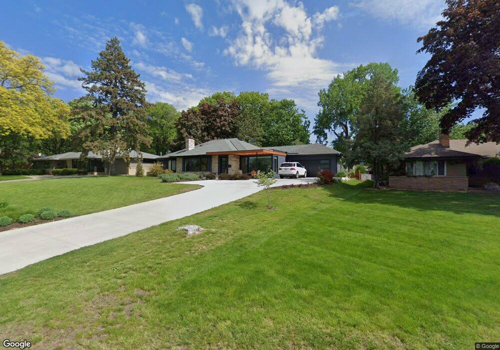
1736 Mississippi River Blvd S Saint Paul, MN 55116
Highland Park NeighborhoodEstimated Value: $870,000 - $1,089,498
3
Beds
3
Baths
1,831
Sq Ft
$526/Sq Ft
Est. Value
About This Home
This home is located at 1736 Mississippi River Blvd S, Saint Paul, MN 55116 and is currently estimated at $963,375, approximately $526 per square foot. 1736 Mississippi River Blvd S is a home located in Ramsey County with nearby schools including Horace Mann School, Highland Park Middle School, and Highland Park Senior High.
Ownership History
Date
Name
Owned For
Owner Type
Purchase Details
Closed on
Apr 25, 2022
Sold by
David E And Solveig H Westgard Trust and Westgard David E
Bought by
Crosby Christopher D and Crosby Kate
Current Estimated Value
Purchase Details
Closed on
Jul 10, 2021
Sold by
Missaghi Alexander Peyman and Missaghi Maya E
Bought by
Missaghi Alexander Peyman and Missaghi Maya E
Home Financials for this Owner
Home Financials are based on the most recent Mortgage that was taken out on this home.
Original Mortgage
$548,250
Interest Rate
2.9%
Mortgage Type
New Conventional
Purchase Details
Closed on
Feb 17, 2000
Sold by
Swanson David C and Swanson Annette N
Bought by
Zak Robert L and Zak Sandra I
Create a Home Valuation Report for This Property
The Home Valuation Report is an in-depth analysis detailing your home's value as well as a comparison with similar homes in the area
Home Values in the Area
Average Home Value in this Area
Purchase History
| Date | Buyer | Sale Price | Title Company |
|---|---|---|---|
| Crosby Christopher D | $1,005,000 | None Listed On Document | |
| Missaghi Alexander Peyman | -- | Burnet Title | |
| Zak Robert L | $395,000 | -- |
Source: Public Records
Mortgage History
| Date | Status | Borrower | Loan Amount |
|---|---|---|---|
| Previous Owner | Missaghi Alexander Peyman | $548,250 |
Source: Public Records
Tax History Compared to Growth
Tax History
| Year | Tax Paid | Tax Assessment Tax Assessment Total Assessment is a certain percentage of the fair market value that is determined by local assessors to be the total taxable value of land and additions on the property. | Land | Improvement |
|---|---|---|---|---|
| 2025 | $14,886 | $957,600 | $283,000 | $674,600 |
| 2023 | $14,886 | $876,900 | $283,000 | $593,900 |
| 2022 | $14,080 | $808,100 | $283,000 | $525,100 |
| 2021 | $10,102 | $808,100 | $283,000 | $525,100 |
| 2020 | $9,472 | $608,000 | $283,000 | $325,000 |
| 2019 | $9,672 | $553,700 | $283,000 | $270,700 |
| 2018 | $12,206 | $544,800 | $283,000 | $261,800 |
| 2017 | $12,268 | $678,100 | $283,000 | $395,100 |
| 2016 | $12,782 | $0 | $0 | $0 |
| 2015 | $11,870 | $685,700 | $283,000 | $402,700 |
| 2014 | $11,992 | $0 | $0 | $0 |
Source: Public Records
Map
Nearby Homes
- 1331 Murray St
- 1920 Norfolk Ave
- 1872 Mississippi River Blvd S
- 1544 Mississippi River Blvd S
- 1913 Morgan Ave
- 1800 Graham Ave Unit 334
- 1800 Graham Ave Unit 126
- 1166 Colette Place
- 2051 Itasca Ave
- 1775 Morgan Ave
- 1075 Saint Paul Ave
- 1065 Colby St
- 1068 Prior Ave S
- 896 Mississippi River Blvd S
- 878 Mississippi River Blvd S
- 2046 Montreal Ave
- 1022 Fairview Ave S
- 2135 Lower Saint Dennis Rd
- 898 Wilder St S
- 5724 46th Ave S
- 1722 Mississippi River Blvd S
- 1722 1722 S Mississippi River-Boulevard-
- 1722 1722 S Mississippi River-Boulevard-s
- 1716 Mississippi River Blvd S
- 2020 Norfolk Ave
- 2014 Norfolk Ave
- 2026 Norfolk Ave
- 2006 Norfolk Ave
- 2032 Norfolk Ave
- 2002 Norfolk Ave
- 2038 Norfolk Ave
- 1750 Mississippi River Blvd S
- 1406 Cleveland Ave S
- 1434 Kenneth St
- 2000 Norfolk Ave
- 2050 Norfolk Ave
- 1392 Cleveland Ave S
- 1770 Mississippi River Blvd S
- 1992 Norfolk Ave
- 2005 Norfolk Ave