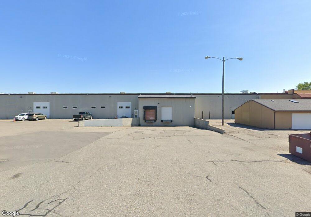
1737 King Ave W Billings, MT 59102
East Central Billings Neighborhood
--
Bed
--
Bath
45,573
Sq Ft
5.53
Acres
About This Home
This home is located at 1737 King Ave W, Billings, MT 59102. 1737 King Ave W is a home located in Yellowstone County with nearby schools including Miles Avenue School, Lewis & Clark Junior High School, and Billings West High School.
Ownership History
Date
Name
Owned For
Owner Type
Purchase Details
Closed on
Aug 17, 2010
Sold by
Rsp Holdings Llc
Bought by
Beartooth Bank
Purchase Details
Closed on
Jan 13, 2010
Sold by
Clk Inc
Bought by
Rsp Holdings Llc
Purchase Details
Closed on
Nov 21, 2007
Sold by
Rsp Holdings Llc
Bought by
Clk Inc
Purchase Details
Closed on
Mar 31, 2006
Sold by
Gerharter Daniel and Gerharter Aimee
Bought by
Rsp Holdings Llc
Home Financials for this Owner
Home Financials are based on the most recent Mortgage that was taken out on this home.
Original Mortgage
$2,279,280
Interest Rate
6.25%
Mortgage Type
Commercial
Create a Home Valuation Report for This Property
The Home Valuation Report is an in-depth analysis detailing your home's value as well as a comparison with similar homes in the area
Home Values in the Area
Average Home Value in this Area
Purchase History
| Date | Buyer | Sale Price | Title Company |
|---|---|---|---|
| Beartooth Bank | $1,088,162 | None Available | |
| Rsp Holdings Llc | -- | None Available | |
| Mc Real Estate Holdings Inc | -- | None Available | |
| Clk Inc | -- | None Available | |
| Rsp Holdings Llc | -- | None Available |
Source: Public Records
Mortgage History
| Date | Status | Borrower | Loan Amount |
|---|---|---|---|
| Previous Owner | Rsp Holdings Llc | $2,279,280 |
Source: Public Records
Tax History Compared to Growth
Tax History
| Year | Tax Paid | Tax Assessment Tax Assessment Total Assessment is a certain percentage of the fair market value that is determined by local assessors to be the total taxable value of land and additions on the property. | Land | Improvement |
|---|---|---|---|---|
| 2025 | $32,897 | $6,577,369 | $1,941,739 | $4,635,630 |
| 2024 | $32,897 | $5,055,946 | $1,614,816 | $3,441,130 |
| 2023 | $35,467 | $5,055,946 | $1,614,816 | $3,441,130 |
| 2022 | $33,734 | $4,193,917 | $0 | $0 |
| 2021 | $32,468 | $4,193,917 | $0 | $0 |
| 2020 | $32,107 | $4,074,349 | $0 | $0 |
| 2019 | $30,837 | $4,074,349 | $0 | $0 |
| 2018 | $30,065 | $3,971,831 | $0 | $0 |
| 2017 | $30,117 | $4,041,621 | $0 | $0 |
| 2016 | $29,697 | $4,064,588 | $0 | $0 |
| 2015 | $29,033 | $4,064,588 | $0 | $0 |
| 2014 | $27,108 | $2,841,440 | $0 | $0 |
Source: Public Records
Map
Nearby Homes
- 2014 George St
- 2016 Monad Rd
- 19 Patton Ave
- 669 S 22nd St W
- 2109 George St
- 2225 Rosebud Dr
- 12 Macarthur Ave
- 240 Birchwood Dr
- 126 Ardmore Dr
- 231 S 12th St W
- 5325 Frontier Dr Unit 2
- 2150 Eldorado Dr
- 102 S Santa fe Dr
- 16 19th St W
- 1219 Fairvale Dr
- 5412 Denali Dr
- 141 S 12th St W
- 28 19th St W
- 2 Mcbride St
- 5531 Elysian Rd
- 647 S 18th St W
- 1911 King
- 712 Carbon Suite B St
- 712 Carbon St
- 909 Mullowney Ln
- 5448 Laurel Rd
- 2021 Overland Ave
- 619 Daniel St
- 525 Daniel St
- 2001 Rosebud Dr
- 0 King Park Dr
- 744 Parkway Ln
- 2032 Lampman Dr Lease
- 1804 Monad Rd
- 670 King Park Dr
- 6 Marshall Dr
- 2060 Overland Ave
- 1812 Monad Rd
- 2220 Grant Rd
- 8 Marshall Dr