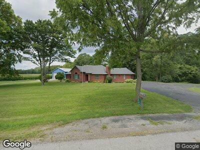
1738 W Flat Rock Rd Flat Rock, IN 47234
Estimated Value: $251,000 - $488,608
3
Beds
2
Baths
2,047
Sq Ft
$167/Sq Ft
Est. Value
About This Home
This home is located at 1738 W Flat Rock Rd, Flat Rock, IN 47234 and is currently estimated at $341,402, approximately $166 per square foot. 1738 W Flat Rock Rd is a home located in Shelby County with nearby schools including Southwestern Elementary School and Southwestern High School.
Ownership History
Date
Name
Owned For
Owner Type
Purchase Details
Closed on
Mar 10, 2022
Sold by
Sanders Donna J
Bought by
Donna J Sanders Irrevocable Trust
Current Estimated Value
Purchase Details
Closed on
Nov 20, 2014
Sold by
Sanders Fred A and Sanders Donna J
Bought by
Fred A Sanders Revocable Trust
Create a Home Valuation Report for This Property
The Home Valuation Report is an in-depth analysis detailing your home's value as well as a comparison with similar homes in the area
Home Values in the Area
Average Home Value in this Area
Purchase History
| Date | Buyer | Sale Price | Title Company |
|---|---|---|---|
| Donna J Sanders Irrevocable Trust | -- | Karmire Jason L | |
| Sanders Donna J | -- | Karmire Jason L | |
| Fred A Sanders Revocable Trust | -- | None Available |
Source: Public Records
Mortgage History
| Date | Status | Borrower | Loan Amount |
|---|---|---|---|
| Previous Owner | Sanders Fred A | $134,500 | |
| Previous Owner | Sanders Fred A | $91,400 | |
| Previous Owner | Sanders Fred A | $94,800 |
Source: Public Records
Tax History Compared to Growth
Tax History
| Year | Tax Paid | Tax Assessment Tax Assessment Total Assessment is a certain percentage of the fair market value that is determined by local assessors to be the total taxable value of land and additions on the property. | Land | Improvement |
|---|---|---|---|---|
| 2024 | $2,267 | $342,300 | $42,500 | $299,800 |
| 2023 | $2,101 | $330,200 | $42,500 | $287,700 |
| 2022 | $2,034 | $289,800 | $37,300 | $252,500 |
| 2021 | $1,961 | $268,600 | $37,300 | $231,300 |
| 2020 | $1,884 | $259,600 | $37,300 | $222,300 |
| 2019 | $1,725 | $255,800 | $37,300 | $218,500 |
| 2018 | $1,633 | $256,700 | $37,300 | $219,400 |
| 2017 | $1,565 | $244,700 | $37,300 | $207,400 |
| 2016 | $1,569 | $244,500 | $35,300 | $209,200 |
| 2014 | $1,390 | $235,800 | $33,600 | $202,200 |
| 2013 | $1,390 | $239,300 | $33,600 | $205,700 |
Source: Public Records
Map
Nearby Homes
- 10776 S 250 W
- 2451 W Flat Rock Rd
- 2650 W State Road 252
- 5299 W Pr Black Hawk Hills
- 0 St 9 Rd Unit MBR21894364
- 6063 W Mount Auburn 2nd St
- 6086 W 850 S
- 7934 S 600 W
- 0 Parkway Dr Unit MBR21991969
- 828 Main St
- 822 Main St
- 9278 S Geneva Rd
- 334 Vine St
- 219 High St
- 648 Market St
- 217 Main St
- 3149 E 900 S
- 504 Union St
- 325 Elm St
- 320 Union St
- 1738 W Flat Rock Rd
- 1501 W Flat Rock Rd
- 10316 S 150 W
- 11035 S 200 W
- 11063 S 200 W
- 11063 S 200 W
- 2222 W Flat Rock Rd
- 1390 W Flat Rock Rd
- 1349 W Flat Rock Rd
- 1349 W Flat Rock Rd
- 1328 W Flat Rock Rd
- 2250 W Flat Rock Rd
- 10573 S 125 W
- 1502 W Flat Rock Rd
- 1100 W Flat Rock Rd
- 2353 W Flat Rock Rd
- 2335 W Flat Rock Rd
- 1099 W Flat Rock Rd
- 2381 W Flat Rock Rd
- 2407 W Flat Rock Rd