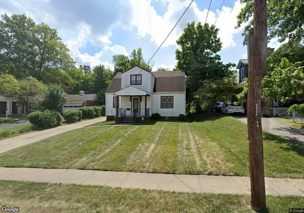
1739 Adams Rd Cincinnati, OH 45231
Estimated Value: $142,000 - $542,000
4
Beds
2
Baths
--
Sq Ft
1,002
Sq Ft Lot
About This Home
This home is located at 1739 Adams Rd, Cincinnati, OH 45231 and is currently estimated at $295,000. 1739 Adams Rd is a home located in Hamilton County with nearby schools including Mt Healthy High School and Central Montessori Academy.
Ownership History
Date
Name
Owned For
Owner Type
Purchase Details
Closed on
Jan 4, 2013
Sold by
Birch Marilyn and Birch Timothy
Bought by
Birch Marilyn and Birch Timothy
Current Estimated Value
Purchase Details
Closed on
Dec 22, 1999
Sold by
Wilkinson Martha J and Vickers Sandra L
Bought by
Birch Marylin
Home Financials for this Owner
Home Financials are based on the most recent Mortgage that was taken out on this home.
Original Mortgage
$79,443
Outstanding Balance
$27,622
Interest Rate
10.34%
Estimated Equity
$267,378
Purchase Details
Closed on
Jun 4, 1998
Sold by
Rechel Robert C and Rechel Ardelta M
Bought by
Vickers Sandra L and Wilkinson Martha J
Home Financials for this Owner
Home Financials are based on the most recent Mortgage that was taken out on this home.
Original Mortgage
$71,900
Interest Rate
7.5%
Create a Home Valuation Report for This Property
The Home Valuation Report is an in-depth analysis detailing your home's value as well as a comparison with similar homes in the area
Home Values in the Area
Average Home Value in this Area
Purchase History
| Date | Buyer | Sale Price | Title Company |
|---|---|---|---|
| Birch Marilyn | -- | None Available | |
| Birch Marylin | $89,900 | -- | |
| Vickers Sandra L | $89,900 | Cambridge Land Title Agency |
Source: Public Records
Mortgage History
| Date | Status | Borrower | Loan Amount |
|---|---|---|---|
| Open | Birch Marylin | $79,443 | |
| Previous Owner | Vickers Sandra L | $71,900 | |
| Closed | Vickers Sandra L | $8,000 |
Source: Public Records
Tax History
| Year | Tax Paid | Tax Assessment Tax Assessment Total Assessment is a certain percentage of the fair market value that is determined by local assessors to be the total taxable value of land and additions on the property. | Land | Improvement |
|---|---|---|---|---|
| 2025 | $15 | $280 | $280 | -- |
| 2023 | $15 | $280 | $280 | $0 |
| 2022 | $24 | $315 | $315 | $0 |
| 2021 | $24 | $315 | $315 | $0 |
| 2020 | $24 | $315 | $315 | $0 |
| 2019 | $20 | $280 | $280 | $0 |
| 2018 | $20 | $280 | $280 | $0 |
| 2017 | $20 | $280 | $280 | $0 |
| 2016 | $18 | $245 | $245 | $0 |
| 2015 | $18 | $245 | $245 | $0 |
| 2014 | $18 | $245 | $245 | $0 |
| 2013 | $19 | $280 | $280 | $0 |
Source: Public Records
Map
Nearby Homes
- 7832 Lincoln Ave
- 7718 Hamilton Ave
- 1545 Mcmakin Ave
- 1579 Meredith Dr
- 1722 Stevens Ave
- 1559 Meredith Dr
- 1457 Adams Rd
- 7404 Perry St
- 7918 Southampton Ct
- 9151 Tag Dr
- 1556 Meredith Dr
- 2175 Carlsbory Dr
- 7508 Elizabeth St
- 1503 Kinney Ave
- 7849 Seward Ave
- 1965 Stevens Ave
- 9577 Creekhill Dr
- 1461 Kinney Ave
- 2238 Pacora Dr
- 1500 Madison Ave
- 1980 Adams Rd
- 1737 Adams Rd
- 1741 Adams Rd
- 7839 Lincoln Ave
- 7839 Lincoln Ave Unit 5
- 7839 Lincoln Ave Unit 7
- 7839 Lincoln Ave Unit 2
- 7839 Lincoln Ave Unit 9
- 1731 Adams Rd
- 1807 Adams Rd
- 1736 Adams Rd
- 1734 Adams Rd
- 1740 Adams Rd
- 7831 Lincoln Ave
- 1728 Adams Rd
- 1744 Adams Rd
- 1811 Adams Rd
- 1724 Adams Rd
- 1802 Adams Rd
- 7827 Lincoln Ave