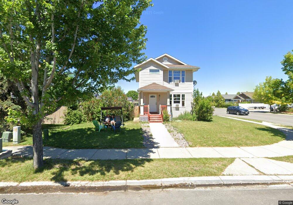
1739 Bluestone Dr Kalispell, MT 59901
Estimated Value: $463,790 - $473,000
3
Beds
2
Baths
1,398
Sq Ft
$334/Sq Ft
Est. Value
About This Home
This home is located at 1739 Bluestone Dr, Kalispell, MT 59901 and is currently estimated at $467,448, approximately $334 per square foot. 1739 Bluestone Dr is a home located in Flathead County with nearby schools including Lillian Peterson School, Kalispell Middle School, and Flathead High School.
Ownership History
Date
Name
Owned For
Owner Type
Purchase Details
Closed on
Aug 25, 2017
Sold by
Brim David T and Brim Theresa A
Bought by
Murray Justin Charles and Murray Shayla Jo
Current Estimated Value
Home Financials for this Owner
Home Financials are based on the most recent Mortgage that was taken out on this home.
Original Mortgage
$6,500
Outstanding Balance
$5,432
Interest Rate
3.93%
Mortgage Type
Stand Alone Second
Estimated Equity
$462,016
Create a Home Valuation Report for This Property
The Home Valuation Report is an in-depth analysis detailing your home's value as well as a comparison with similar homes in the area
Purchase History
| Date | Buyer | Sale Price | Title Company |
|---|---|---|---|
| Murray Justin Charles | -- | First American Title Company |
Source: Public Records
Mortgage History
| Date | Status | Borrower | Loan Amount |
|---|---|---|---|
| Open | Murray Justin Charles | $6,500 | |
| Open | Murray Justin Charles | $147,954 |
Source: Public Records
Tax History
| Year | Tax Paid | Tax Assessment Tax Assessment Total Assessment is a certain percentage of the fair market value that is determined by local assessors to be the total taxable value of land and additions on the property. | Land | Improvement |
|---|---|---|---|---|
| 2025 | $2,401 | $468,600 | $0 | $0 |
| 2024 | $3,007 | $386,100 | $0 | $0 |
| 2023 | $3,321 | $386,100 | $0 | $0 |
| 2022 | $3,242 | $283,000 | $0 | $0 |
| 2021 | $3,045 | $283,000 | $0 | $0 |
| 2020 | $3,004 | $245,600 | $0 | $0 |
| 2019 | $3,009 | $245,600 | $0 | $0 |
| 2018 | $2,583 | $197,756 | $0 | $0 |
| 2017 | $2,073 | $197,756 | $0 | $0 |
| 2016 | $2,089 | $171,600 | $0 | $0 |
| 2015 | $2,086 | $171,600 | $0 | $0 |
| 2014 | $2,207 | $110,664 | $0 | $0 |
Source: Public Records
Map
Nearby Homes
- 135 Rimrock Ct
- 1906 Bluestone Dr
- 1945 S Meadows Dr
- 1996/1998 Greatview
- 2035 Teal Dr
- 1483 & 1485 Western Dr
- 8 Primrose Ct
- 1418 6th Ave W
- 1313 7th Ave W
- 1517 5th Ave W
- 1308 7th Ave W
- 2224 Pintail Ct
- 605 Valley View Dr
- 2208 Ruddy Duck Dr
- 2253 Canvasback Ct
- 2303 Kismet Ct
- 1467 Destiny Ln
- 2318 Kismet Ct
- 865 9th St W
- NHN 11th St W
- 120 Denver Ave
- 1731 Bluestone Dr
- 1805 Bluestone Dr
- 302 Bismarck St
- 1742 Bluestone Dr
- 304 Bismarck St
- 1738 Bluestone Dr
- 1727 Bluestone Dr
- 125 Denver Ave
- 1809 Bluestone Dr
- 1810 Bluestone Dr
- 1734 Bluestone Dr
- 306 Bismarck St
- 306 Bismark St
- 1723 Bluestone Dr
- 303 Bismark St
- 118 Denver Ave
- 121 Denver Ave
- 1815 Bluestone Dr
- 1905 Teal Dr
Your Personal Tour Guide
Ask me questions while you tour the home.