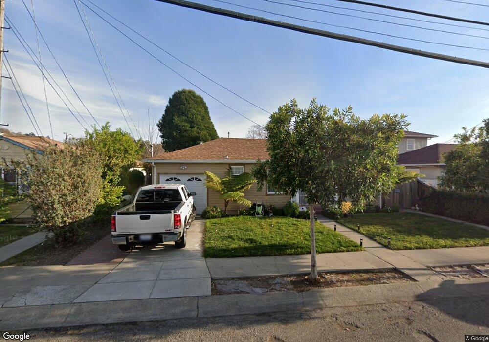
1740 142nd Ave San Leandro, CA 94578
Upper Bal NeighborhoodEstimated Value: $943,395 - $1,139,000
Studio
3
Baths
1,796
Sq Ft
$584/Sq Ft
Est. Value
About This Home
This home is located at 1740 142nd Ave, San Leandro, CA 94578 and is currently estimated at $1,049,465, approximately $584 per square foot. 1740 142nd Ave is a home located in Alameda County with nearby schools including Jefferson Elementary School, Bancroft Middle School, and San Leandro High School.
Ownership History
Date
Name
Owned For
Owner Type
Purchase Details
Closed on
Mar 19, 2025
Sold by
Tang Kang Kwong
Bought by
He Joyce Liying
Current Estimated Value
Purchase Details
Closed on
Jun 25, 2015
Sold by
Labayog Michael and Loo Wing Jung
Bought by
He Joyce Liying
Purchase Details
Closed on
May 14, 2007
Sold by
Deutsche Bank National Trust Co
Bought by
Labayog Michael and Loo Wing Jung
Home Financials for this Owner
Home Financials are based on the most recent Mortgage that was taken out on this home.
Original Mortgage
$345,600
Interest Rate
6.14%
Mortgage Type
Commercial
Purchase Details
Closed on
Mar 10, 2007
Sold by
Maiden Gregory Alan
Bought by
Deutsche Bank National Trust Co and Long Beach Mortgage Loan Trust 2006-2
Purchase Details
Closed on
Jan 18, 2006
Sold by
Lawler Catherine and Joanna Roberts Trust
Bought by
Maiden Gregory Alan
Home Financials for this Owner
Home Financials are based on the most recent Mortgage that was taken out on this home.
Original Mortgage
$441,000
Interest Rate
9.9%
Mortgage Type
Commercial
Purchase Details
Closed on
Mar 18, 1998
Sold by
Roberts Joanna
Bought by
Roberts Joanna and Joanna Roberts Trust
Create a Home Valuation Report for This Property
The Home Valuation Report is an in-depth analysis detailing your home's value as well as a comparison with similar homes in the area
Home Values in the Area
Average Home Value in this Area
Purchase History
| Date | Buyer | Sale Price | Title Company |
|---|---|---|---|
| He Joyce Liying | -- | None Listed On Document | |
| He Joyce Liying | $600,000 | Old Republic Title Company | |
| Labayog Michael | $432,000 | Lsi Title | |
| Deutsche Bank National Trust Co | $435,125 | Lsi Title | |
| Maiden Gregory Alan | $490,000 | Financial Title Company | |
| Roberts Joanna | -- | -- |
Source: Public Records
Mortgage History
| Date | Status | Borrower | Loan Amount |
|---|---|---|---|
| Previous Owner | Labayog Michael | $345,600 | |
| Previous Owner | Maiden Gregory Alan | $441,000 |
Source: Public Records
Tax History
| Year | Tax Paid | Tax Assessment Tax Assessment Total Assessment is a certain percentage of the fair market value that is determined by local assessors to be the total taxable value of land and additions on the property. | Land | Improvement |
|---|---|---|---|---|
| 2025 | $10,612 | $710,261 | $213,078 | $497,183 |
| 2024 | $10,612 | $696,335 | $208,900 | $487,435 |
| 2023 | $10,493 | $682,685 | $204,805 | $477,880 |
| 2022 | $10,612 | $669,300 | $200,790 | $468,510 |
| 2021 | $9,869 | $656,177 | $196,853 | $459,324 |
| 2020 | $9,519 | $649,451 | $194,835 | $454,616 |
| 2019 | $8,670 | $636,720 | $191,016 | $445,704 |
| 2018 | $8,427 | $624,240 | $187,272 | $436,968 |
| 2017 | $8,243 | $612,000 | $183,600 | $428,400 |
| 2016 | $7,841 | $600,000 | $180,000 | $420,000 |
| 2015 | $7,100 | $543,534 | $144,470 | $399,064 |
| 2014 | $6,660 | $500,000 | $150,000 | $350,000 |
Source: Public Records
Map
Nearby Homes
- 2724 Benedict Dr
- 1269 Gabriel Ct
- 0 Montrose Dr
- 0 Saturn Dr
- 14831 Bancroft Ave Unit Space 27
- 1233 Benedict Ct
- 1316 135th Ave
- 1864 Lakeview Ct
- 2245 Sol St
- 2399 E 14th St Unit 24
- 2399 E 14th St Unit 112
- 2399 E 14th St Unit 44
- 824 Maud Ave
- 845 Dolores Ave
- 1541 152nd Ave
- 1468 Grand Ave Unit 21
- 14787 Oleander St
- 15065 Hesperian Blvd Unit 22
- 1550 Bancroft Ave Unit 112
- 1550 Bancroft Ave Unit 223
Your Personal Tour Guide
Ask me questions while you tour the home.