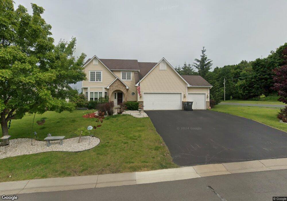
1744 Mathias Rd Shakopee, MN 55379
Estimated Value: $475,945 - $538,000
4
Beds
3
Baths
2,508
Sq Ft
$200/Sq Ft
Est. Value
About This Home
This home is located at 1744 Mathias Rd, Shakopee, MN 55379 and is currently estimated at $500,736, approximately $199 per square foot. 1744 Mathias Rd is a home located in Scott County with nearby schools including Sun Path Elementary School, Shakopee West Middle School, and Shakopee Senior High School.
Ownership History
Date
Name
Owned For
Owner Type
Purchase Details
Closed on
Jan 12, 2007
Sold by
Robinson David and Robinson Myle
Bought by
Bhatia Vishal and Bhatia Shaila
Current Estimated Value
Purchase Details
Closed on
Jun 25, 2004
Sold by
Us Home Corp
Bought by
Robinson David W and Robinson My Le
Create a Home Valuation Report for This Property
The Home Valuation Report is an in-depth analysis detailing your home's value as well as a comparison with similar homes in the area
Home Values in the Area
Average Home Value in this Area
Purchase History
| Date | Buyer | Sale Price | Title Company |
|---|---|---|---|
| Bhatia Vishal | $353,000 | -- | |
| Robinson David W | -- | -- |
Source: Public Records
Tax History Compared to Growth
Tax History
| Year | Tax Paid | Tax Assessment Tax Assessment Total Assessment is a certain percentage of the fair market value that is determined by local assessors to be the total taxable value of land and additions on the property. | Land | Improvement |
|---|---|---|---|---|
| 2025 | $4,528 | $452,600 | $131,300 | $321,300 |
| 2024 | $4,428 | $429,100 | $137,800 | $291,300 |
| 2023 | $4,652 | $413,200 | $132,500 | $280,700 |
| 2022 | $4,338 | $426,200 | $150,500 | $275,700 |
| 2021 | $3,938 | $340,100 | $115,700 | $224,400 |
| 2020 | $4,330 | $336,500 | $110,900 | $225,600 |
| 2019 | $4,454 | $324,200 | $98,600 | $225,600 |
| 2018 | $4,868 | $0 | $0 | $0 |
| 2016 | $5,130 | $0 | $0 | $0 |
| 2014 | -- | $0 | $0 | $0 |
Source: Public Records
Map
Nearby Homes
- 2052 Wilhelm Ct
- 2518 Green Ash Ave
- 2529 Green Ash Ave
- Berkley Plan at Arbor Bluff - Venture Collection
- 2551 Aspen Ct
- Clark Plan at Arbor Bluff - Venture Collection
- 2548 Aspen Ct
- Itasca Plan at Arbor Bluff - Landmark Collection
- Sequoia Plan at Arbor Bluff - Venture Collection
- Markham Plan at Arbor Bluff - Venture Collection
- 2340 Rock Elm Rd
- Lewis Plan at Arbor Bluff - Landmark Collection
- McKinley Plan at Arbor Bluff - Landmark Collection
- 2584 Aspen Ct
- 2606 Green Ash Ave
- Marquette Plan at Arbor Bluff - Venture Collection
- 2689 Aspen Dr
- Sinclair Plan at Arbor Bluff - Landmark Collection
- Burnham Plan at Arbor Bluff - Venture Collection
- Washburn Plan at Arbor Bluff - Landmark Collection
- 1942 Wilhelm Ct
- 2111 Valley View Rd
- 1964 Wilhelm Ct
- 1876 Wilhelm Place
- 1986 Wilhelm Ct
- 1933 Wilhelm Ct
- 2175 Valley View Rd
- 1889 Wilhelm Place
- 1955 Wilhelm Ct
- 1810 Wilhelm Place
- 1898 Valley View Rd
- 2008 Wilhelm Ct
- 1977 Wilhelm Ct
- 1867 Wilhelm Place
- 2185 Valley View Rd
- 1999 Wilhelm Ct
- 1902 Valley View Rd
- 1928 Alden Ave
- 1845 Wilhelm Place
- 2030 Wilhelm Ct