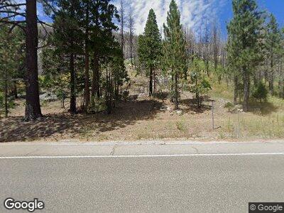
17441 Highway 50 Kyburz, CA 95720
Estimated Value: $575,000 - $958,000
3
Beds
2
Baths
1,576
Sq Ft
$444/Sq Ft
Est. Value
About This Home
This home is located at 17441 Highway 50, Kyburz, CA 95720 and is currently estimated at $700,190, approximately $444 per square foot. 17441 Highway 50 is a home located in El Dorado County with nearby schools including El Dorado High School.
Ownership History
Date
Name
Owned For
Owner Type
Purchase Details
Closed on
Oct 6, 2000
Sold by
Christman Paul D and Christman Geri L
Bought by
Christman Sean and Christman Heather
Current Estimated Value
Home Financials for this Owner
Home Financials are based on the most recent Mortgage that was taken out on this home.
Original Mortgage
$208,014
Interest Rate
7.71%
Mortgage Type
Seller Take Back
Purchase Details
Closed on
Sep 28, 2000
Sold by
Faulk Scott D
Bought by
Christman Paul D and Christman Geri L
Home Financials for this Owner
Home Financials are based on the most recent Mortgage that was taken out on this home.
Original Mortgage
$208,014
Interest Rate
7.71%
Mortgage Type
Seller Take Back
Purchase Details
Closed on
Mar 30, 1999
Sold by
Rhodes Eugene L
Bought by
Faulk Scott D
Create a Home Valuation Report for This Property
The Home Valuation Report is an in-depth analysis detailing your home's value as well as a comparison with similar homes in the area
Home Values in the Area
Average Home Value in this Area
Purchase History
| Date | Buyer | Sale Price | Title Company |
|---|---|---|---|
| Christman Sean | -- | -- | |
| Christman Paul D | $205,000 | Old Republic Title Company | |
| Faulk Scott D | $177,000 | First American Title Ins Co |
Source: Public Records
Mortgage History
| Date | Status | Borrower | Loan Amount |
|---|---|---|---|
| Open | Christman Sean | $265,000 | |
| Closed | Christman Sean | $229,500 | |
| Closed | Christman Sean | $208,014 | |
| Closed | Christman Paul D | $164,000 |
Source: Public Records
Tax History Compared to Growth
Tax History
| Year | Tax Paid | Tax Assessment Tax Assessment Total Assessment is a certain percentage of the fair market value that is determined by local assessors to be the total taxable value of land and additions on the property. | Land | Improvement |
|---|---|---|---|---|
| 2024 | $2,606 | $244,211 | $111,978 | $132,233 |
| 2023 | $2,604 | $244,211 | $111,978 | $132,233 |
| 2022 | $2,614 | $244,211 | $111,978 | $132,233 |
| 2021 | $3,054 | $285,352 | $153,119 | $132,233 |
| 2020 | $3,014 | $282,427 | $151,549 | $130,878 |
| 2019 | $2,967 | $276,890 | $148,578 | $128,312 |
| 2018 | $2,886 | $271,462 | $145,665 | $125,797 |
| 2017 | $2,820 | $266,140 | $142,809 | $123,331 |
| 2016 | $2,781 | $260,922 | $140,009 | $120,913 |
| 2015 | $2,687 | $257,005 | $137,907 | $119,098 |
| 2014 | $2,687 | $251,972 | $135,206 | $116,766 |
Source: Public Records
Map
Nearby Homes
- 191 Margaret Dr
- 164 Margaret Dr
- 7150 Sayles Canyon Rd Unit 13
- 39 Milestone Unit 20
- 7176 Sayles Canyon Trail Unit 6
- 7046 Sierra Pines Rd
- 7834 Phillips Heights Ave
- 7845 Hemlock Ave
- 7864 Tamarack Ave
- 2051 Huckleberry Rd
- 20625 Us Highway 50
- 36 Milestone Rd Unit 12
- 3446 E River Park Dr
- 2051 Nez Perce Dr
- 2045 Nez Perce Dr
- 816 Kekin St
- 1909 Mewuk Dr
- 2004 Kickapoo St
- 1966 Nez Perce Dr
- 2900 Santa Claus Dr
- 17441 Highway 50
- 111111 U S 50
- 17395 42 Mile Stone Rd Unit 5
- 13315 Us Hwy 50
- 17387 42 Mile Stone Rd
- 0 42 Mile Stone Rd Unit 21
- 17481 U S 50
- 17381 42 Mile Stone Rd
- 17480 Us Highway 50
- 17480 U S 50
- 17480 Highway 50
- 17441 Us Highway 50
- 9 42 Milestone Tr
- 17365 42 Mile Stone Rd
- 17480 50 Hwy
- 17510 Highway 50
- 17349 42 Mile Stone # 11 Rd
- 17510 U S 50
- 17356 42 Mile Stone Rd
- 16360 Strawberry Ln
