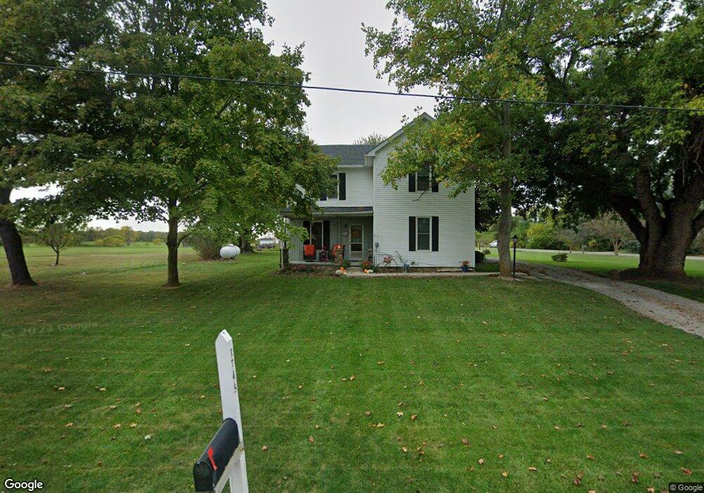
1745 State Route 257 N Ostrander, OH 43061
Scioto NeighborhoodEstimated Value: $270,000
4
Beds
2
Baths
1,990
Sq Ft
$136/Sq Ft
Est. Value
About This Home
This home is located at 1745 State Route 257 N, Ostrander, OH 43061 and is currently priced at $270,000, approximately $135 per square foot. 1745 State Route 257 N is a home located in Delaware County with nearby schools including Buckeye Valley High School.
Ownership History
Date
Name
Owned For
Owner Type
Purchase Details
Closed on
Apr 30, 2021
Sold by
Land Of T1me Llc
Bought by
Land Of T1me Llc
Current Estimated Value
Purchase Details
Closed on
Jan 26, 2021
Sold by
Land Of Time Llc
Bought by
Land Of Time Llc
Purchase Details
Closed on
Jun 30, 2011
Sold by
Thomson Margaret E
Bought by
Thompson Margaret E
Purchase Details
Closed on
Jan 16, 2008
Sold by
Thompson Margaret E
Bought by
Thompson Margaret E and The Edgar K & Margaret E Thompson Revoca
Create a Home Valuation Report for This Property
The Home Valuation Report is an in-depth analysis detailing your home's value as well as a comparison with similar homes in the area
Home Values in the Area
Average Home Value in this Area
Purchase History
| Date | Buyer | Sale Price | Title Company |
|---|---|---|---|
| Land Of T1me Llc | -- | None Listed On Document | |
| Land Of T1me Llc | -- | None Listed On Document | |
| Land Of T1me Llc | -- | None Listed On Document | |
| Land Of T1me Llc | -- | None Listed On Document | |
| Land Of Time Llc | -- | None Available | |
| Land Of Time Llc | -- | None Available | |
| Thompson Margaret E | -- | Lawyers Title | |
| Thompson Margaret E | -- | None Available |
Source: Public Records
Tax History Compared to Growth
Tax History
| Year | Tax Paid | Tax Assessment Tax Assessment Total Assessment is a certain percentage of the fair market value that is determined by local assessors to be the total taxable value of land and additions on the property. | Land | Improvement |
|---|---|---|---|---|
| 2021 | $1,257 | $35,460 | $35,460 | $0 |
| 2020 | $3,111 | $35,460 | $35,460 | $0 |
| 2019 | $1,509 | $91,910 | $60,130 | $31,780 |
| 2018 | $1,589 | $91,910 | $60,130 | $31,780 |
| 2017 | $1,532 | $78,890 | $47,250 | $31,640 |
| 2016 | $1,551 | $78,890 | $47,250 | $31,640 |
| 2015 | $1,643 | $78,890 | $47,250 | $31,640 |
| 2014 | $1,538 | $78,890 | $47,250 | $31,640 |
| 2013 | $1,290 | $73,820 | $42,180 | $31,640 |
Source: Public Records
Map
Nearby Homes
- 1859 State Route 257 N
- 2132 Ohio 257
- 3414 State Route 203
- 8405 Mink Street Rd
- 4093 State Route 257
- 2390 Penry Rd
- 0 Marsh Rd Unit 225031436
- 4518 State Route 257
- 1131 Ohio 257
- 3935 N Section Line Rd
- 3284 Radnor Rd
- 0 Carr Rd Unit 225016840
- 210 Glemsbury Dr
- 2266 Dates St
- 2238 Farmland Dr
- Holcombe Plan at Springer Woods
- Aldridge Plan at Springer Woods
- Harmony Plan at Springer Woods
- Fairton Plan at Springer Woods
- Bellamy Plan at Springer Woods
- 5930 Mink Street Rd
- 5970 Mink Street Rd
- 6000 Mink Street Rd
- 6030 Mink Street Rd
- 6064 Mink Street Rd
- 1909 State Route 257 N
- 1607 State Route 257 N
- 6057 Mink Street Rd
- 6163 Mink Street Rd
- 6091 Mink Street Rd
- 6094 Mink Street Rd
- 6122 Mink Street Rd
- 1683 State Route 257 N
- 6150 Mink Street Rd
- 1905 River Rd
- 1835 River Rd
- 1940 Ohio 257
- 1907 River Rd
- 6180 Mink Street Rd
- 1939 State Route 257 N