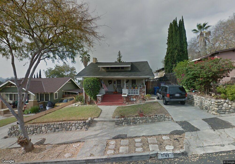
1749 Phillips Way Los Angeles, CA 90042
Highland Park NeighborhoodEstimated Value: $789,000 - $1,087,000
2
Beds
1
Bath
1,032
Sq Ft
$947/Sq Ft
Est. Value
About This Home
This home is located at 1749 Phillips Way, Los Angeles, CA 90042 and is currently estimated at $977,729, approximately $947 per square foot. 1749 Phillips Way is a home located in Los Angeles County with nearby schools including Buchanan Street Elementary, Benjamin Franklin High School, and Luther Burbank Middle School.
Ownership History
Date
Name
Owned For
Owner Type
Purchase Details
Closed on
Jan 12, 1999
Sold by
Santos Francisco M
Bought by
Mancilla Victor Manuel and Mancilla Irma Villegas
Current Estimated Value
Home Financials for this Owner
Home Financials are based on the most recent Mortgage that was taken out on this home.
Original Mortgage
$153,970
Outstanding Balance
$35,313
Interest Rate
6.63%
Mortgage Type
FHA
Estimated Equity
$942,416
Purchase Details
Closed on
Oct 3, 1994
Sold by
Shao Peter K M
Bought by
Santos Francisco M and Santos Anita
Home Financials for this Owner
Home Financials are based on the most recent Mortgage that was taken out on this home.
Original Mortgage
$100,000
Interest Rate
8.86%
Create a Home Valuation Report for This Property
The Home Valuation Report is an in-depth analysis detailing your home's value as well as a comparison with similar homes in the area
Home Values in the Area
Average Home Value in this Area
Purchase History
| Date | Buyer | Sale Price | Title Company |
|---|---|---|---|
| Mancilla Victor Manuel | $155,000 | American Title Co | |
| Santos Francisco M | $125,000 | Commonwealth Land Title |
Source: Public Records
Mortgage History
| Date | Status | Borrower | Loan Amount |
|---|---|---|---|
| Open | Mancilla Victor Manuel | $153,970 | |
| Previous Owner | Santos Francisco M | $100,000 |
Source: Public Records
Tax History
| Year | Tax Paid | Tax Assessment Tax Assessment Total Assessment is a certain percentage of the fair market value that is determined by local assessors to be the total taxable value of land and additions on the property. | Land | Improvement |
|---|---|---|---|---|
| 2025 | $3,086 | $242,967 | $163,340 | $79,627 |
| 2024 | $3,086 | $238,204 | $160,138 | $78,066 |
| 2023 | $3,029 | $233,535 | $156,999 | $76,536 |
| 2022 | $2,892 | $228,957 | $153,921 | $75,036 |
| 2021 | $2,853 | $224,468 | $150,903 | $73,565 |
| 2019 | $2,770 | $217,812 | $146,428 | $71,384 |
| 2018 | $2,695 | $213,542 | $143,557 | $69,985 |
| 2016 | $2,568 | $205,252 | $137,984 | $67,268 |
| 2015 | $2,532 | $202,170 | $135,912 | $66,258 |
| 2014 | $2,549 | $198,211 | $133,250 | $64,961 |
Source: Public Records
Map
Nearby Homes
- 1688 N Avenue 52
- 1711 N Avenue 53
- 5252 Range View Ave
- 1635 N Avenue 54
- 1932 Phillips Way
- 1800 N Avenue 55
- 1929 Phillips Way
- 1942 Phillips Way
- 1938 Phillips Way
- 5125 Buchanan St
- 1333 Wildwood Dr
- 4631 4637 Loleta Place
- 4816 Stratford Rd
- 1425 Highgate Ave
- 5118 Hub St
- 715 Nolden St
- 1048 Dexter St
- 1321 Wildwood Dr
- 1913 Nolden St
- 1419 Oak Grove Dr
- 1753 Phillips Way
- 1743 Phillips Way
- 5246 Coringa Dr
- 1739 Phillips Way
- 5242 Coringa Dr
- 5219 Almaden Dr
- 1731 Phillips Way
- 1733 Phillips Way
- 5238 Coringa Dr
- 5215 Almaden Dr
- 1754 Phillips Way
- 1742 Phillips Way
- 1748 Phillips Way
- 1811 Phillips Way
- 1802 Phillips Way
- 1738 Phillips Way
- 5211 Almaden Dr
- 5211 Almaden Dr
- 5234 Coringa Dr
- 1734 Phillips Way