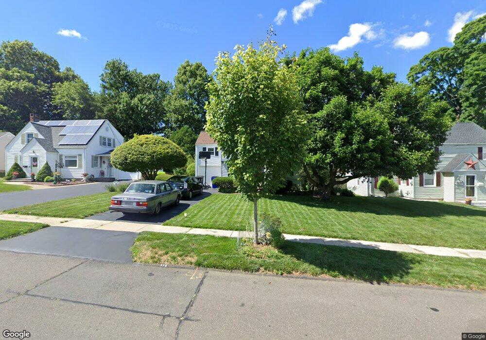
175 Beverly Rd Wethersfield, CT 06109
Estimated Value: $351,000 - $381,000
3
Beds
1
Bath
1,203
Sq Ft
$302/Sq Ft
Est. Value
About This Home
This home is located at 175 Beverly Rd, Wethersfield, CT 06109 and is currently estimated at $363,290, approximately $301 per square foot. 175 Beverly Rd is a home located in Hartford County with nearby schools including Alfred W. Hanmer School, Silas Deane Middle School, and Wethersfield High School.
Ownership History
Date
Name
Owned For
Owner Type
Purchase Details
Closed on
May 1, 1998
Sold by
Devlin Ann and Devlin Martin
Bought by
Rodriguez Raul A
Current Estimated Value
Home Financials for this Owner
Home Financials are based on the most recent Mortgage that was taken out on this home.
Original Mortgage
$128,579
Outstanding Balance
$21,389
Interest Rate
7.04%
Mortgage Type
Unknown
Estimated Equity
$341,901
Purchase Details
Closed on
Mar 26, 1990
Sold by
Holowesko A Netty
Bought by
Devlin Ann
Home Financials for this Owner
Home Financials are based on the most recent Mortgage that was taken out on this home.
Original Mortgage
$144,900
Interest Rate
10.15%
Create a Home Valuation Report for This Property
The Home Valuation Report is an in-depth analysis detailing your home's value as well as a comparison with similar homes in the area
Home Values in the Area
Average Home Value in this Area
Purchase History
| Date | Buyer | Sale Price | Title Company |
|---|---|---|---|
| Rodriguez Raul A | $130,000 | -- | |
| Devlin Ann | $161,000 | -- |
Source: Public Records
Mortgage History
| Date | Status | Borrower | Loan Amount |
|---|---|---|---|
| Closed | Devlin Ann | $21,000 | |
| Open | Devlin Ann | $128,579 | |
| Previous Owner | Devlin Ann | $144,900 |
Source: Public Records
Tax History
| Year | Tax Paid | Tax Assessment Tax Assessment Total Assessment is a certain percentage of the fair market value that is determined by local assessors to be the total taxable value of land and additions on the property. | Land | Improvement |
|---|---|---|---|---|
| 2025 | $9,388 | $227,750 | $87,330 | $140,420 |
| 2024 | $6,069 | $140,430 | $65,100 | $75,330 |
| 2023 | $5,867 | $140,430 | $65,100 | $75,330 |
| 2022 | $5,769 | $140,430 | $65,100 | $75,330 |
| 2021 | $5,711 | $140,430 | $65,100 | $75,330 |
| 2020 | $5,714 | $140,430 | $65,100 | $75,330 |
| 2019 | $5,721 | $140,430 | $65,100 | $75,330 |
| 2018 | $5,889 | $144,400 | $62,500 | $81,900 |
| 2017 | $5,743 | $144,400 | $62,500 | $81,900 |
| 2016 | $5,565 | $144,400 | $62,500 | $81,900 |
| 2015 | $5,515 | $144,400 | $62,500 | $81,900 |
| 2014 | $5,305 | $144,400 | $62,500 | $81,900 |
Source: Public Records
Map
Nearby Homes
- 131 Coleman Rd
- 108 Chamberlain Rd
- 147 Spring St
- 99 Maple St
- 35 Stillwold Dr
- 750 Wolcott Hill Rd
- 91 Somerset St
- 87 Somerset St
- 31 Ox Yoke Dr
- 38 Wheeler Rd
- 137 Dale Rd
- 158 Dix Rd
- 250 Edward St
- 11 Charter Rd
- 89 Merriman Rd
- 1 Fernwood St
- 455 Brimfield Rd
- 23 Hillcrest Ave
- 317-319 Garden St
- 70 Mountain Laurel Dr Unit 70
- 169 Beverly Rd
- 179 Beverly Rd
- 165 Beverly Rd
- 183 Beverly Rd
- 139 Coleman Rd
- 159 Beverly Rd
- 143 Coleman Rd
- 135 Coleman Rd
- 176 Beverly Rd
- 170 Beverly Rd
- 180 Beverly Rd
- 147 Coleman Rd
- 189 Beverly Rd
- 839 Silas Deane Hwy
- 166 Beverly Rd
- 184 Beverly Rd
- 155 Beverly Rd
- 151 Coleman Rd
- 190 Beverly Rd
- 127 Coleman Rd
Your Personal Tour Guide
Ask me questions while you tour the home.