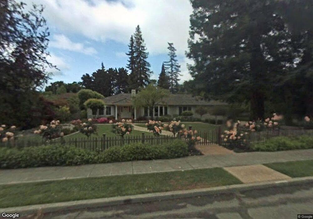
1750 Bryant St Palo Alto, CA 94301
Old Palo Alto NeighborhoodEstimated Value: $6,622,000 - $8,834,454
4
Beds
3
Baths
2,898
Sq Ft
$2,645/Sq Ft
Est. Value
About This Home
This home is located at 1750 Bryant St, Palo Alto, CA 94301 and is currently estimated at $7,666,485, approximately $2,645 per square foot. 1750 Bryant St is a home located in Santa Clara County with nearby schools including Walter Hays Elementary, Frank S. Greene Jr. Middle, and Palo Alto High School.
Ownership History
Date
Name
Owned For
Owner Type
Purchase Details
Closed on
Jul 29, 2008
Sold by
Cohen Melvin and Cohen Margaret M
Bought by
Ben Efraim Gideon and Ben Efraim Bina
Current Estimated Value
Purchase Details
Closed on
Oct 27, 1994
Sold by
Cohen Melvin and Cohen Margaret M
Bought by
Cohen Melvin and Cohen Margaret M
Create a Home Valuation Report for This Property
The Home Valuation Report is an in-depth analysis detailing your home's value as well as a comparison with similar homes in the area
Home Values in the Area
Average Home Value in this Area
Purchase History
| Date | Buyer | Sale Price | Title Company |
|---|---|---|---|
| Ben Efraim Gideon | -- | First American Title Co | |
| Cohen Melvin | -- | -- | |
| Cohen Melvin | -- | -- | |
| Cohen Melvin | -- | -- | |
| Cohen Melvin | -- | -- | |
| Cohen Melvin | -- | -- | |
| Cohen Melvin | -- | -- | |
| Cohen Melvin | -- | -- | |
| Cohen Melvin | -- | -- |
Source: Public Records
Tax History Compared to Growth
Tax History
| Year | Tax Paid | Tax Assessment Tax Assessment Total Assessment is a certain percentage of the fair market value that is determined by local assessors to be the total taxable value of land and additions on the property. | Land | Improvement |
|---|---|---|---|---|
| 2025 | $104,719 | $9,014,350 | $7,726,592 | $1,287,758 |
| 2024 | $104,719 | $8,837,599 | $7,575,091 | $1,262,508 |
| 2023 | $103,189 | $8,664,313 | $7,426,560 | $1,237,753 |
| 2022 | $102,019 | $8,494,426 | $7,280,942 | $1,213,484 |
| 2021 | $100,012 | $8,327,870 | $7,138,179 | $1,189,691 |
| 2020 | $97,902 | $8,242,479 | $7,064,986 | $1,177,493 |
| 2019 | $96,836 | $8,080,862 | $6,926,457 | $1,154,405 |
| 2018 | $94,122 | $7,922,415 | $6,790,645 | $1,131,770 |
| 2017 | $92,475 | $7,767,075 | $6,657,496 | $1,109,579 |
| 2016 | $90,067 | $7,614,780 | $6,526,957 | $1,087,823 |
| 2015 | $89,210 | $7,500,400 | $6,428,917 | $1,071,483 |
| 2014 | $80,961 | $6,786,800 | $5,817,300 | $969,500 |
Source: Public Records
Map
Nearby Homes
- 184 Tennyson Ave
- 125 Lowell Ave
- 444 Tennyson Ave
- 1932 Emerson St
- 1555 Alma St
- 1827 Cowper St
- 1730 Webster St
- 627 Tennyson Ave
- 1630 Portola Ave
- 148 Kingsley Ave
- 2399 South Ct
- 1711 Guinda St
- 2573 Park Blvd Unit U204
- 535 Kingsley Ave
- 1119 Hopkins Ave
- 1218 Middlefield Rd
- 151 Colorado Ave
- 1027 Waverley St
- 326 Addison Ave
- 671 Kingsley Ave
- 299 Tennyson Ave
- 280 Lowell Ave
- 290 Lowell Ave
- 265 Tennyson Ave
- 243 Tennyson Ave
- 250 Lowell Ave
- 233 Tennyson Ave
- 1703 Bryant St
- 1749 Bryant St
- 225 Tennyson Ave
- 1701 Bryant St
- 1729 Emerson St
- 218 Lowell Ave
- 221 Tennyson Ave
- 1818 Bryant St
- 317 Tennyson Ave
- 275 Lowell Ave
- 270 Tennyson Ave
- 1680 Bryant St
- 258 Tennyson Ave