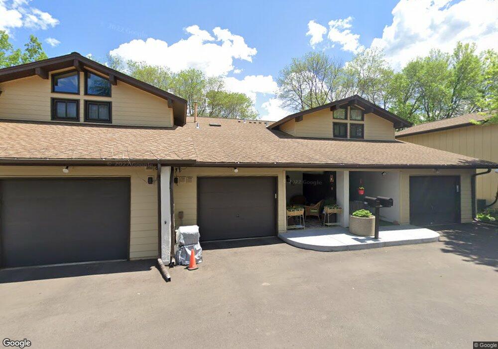
1750 Mcknight Rd N Unit 23 Saint Paul, MN 55109
Hillside NeighborhoodEstimated Value: $208,000 - $224,000
2
Beds
2
Baths
1,380
Sq Ft
$157/Sq Ft
Est. Value
About This Home
This home is located at 1750 Mcknight Rd N Unit 23, Saint Paul, MN 55109 and is currently estimated at $216,415, approximately $156 per square foot. 1750 Mcknight Rd N Unit 23 is a home located in Ramsey County with nearby schools including Cowern Elementary School, Justice Alan Page Elementary, and Lionsgate Academy AIM.
Ownership History
Date
Name
Owned For
Owner Type
Purchase Details
Closed on
Aug 28, 2015
Sold by
Federal Home Loan Mortgage Corporation
Bought by
Chamberlain Melody
Current Estimated Value
Home Financials for this Owner
Home Financials are based on the most recent Mortgage that was taken out on this home.
Original Mortgage
$5,000
Outstanding Balance
$3,946
Interest Rate
3.97%
Mortgage Type
Negative Amortization
Estimated Equity
$212,469
Purchase Details
Closed on
Apr 14, 2015
Sold by
Wells Fargo Bank Na
Bought by
Federal Home Loan Mortgage Corporation
Purchase Details
Closed on
Sep 30, 2014
Sold by
Sabanjo Marilyn A
Bought by
Wells Fargo Bank Na
Purchase Details
Closed on
Jun 8, 2001
Sold by
Bandelow Lowell E and Bandelow Ramona R
Bought by
Sabanjo Marilyn A
Create a Home Valuation Report for This Property
The Home Valuation Report is an in-depth analysis detailing your home's value as well as a comparison with similar homes in the area
Home Values in the Area
Average Home Value in this Area
Purchase History
| Date | Buyer | Sale Price | Title Company |
|---|---|---|---|
| Chamberlain Melody | -- | Title One Inc | |
| Chamberlin Melody Melody | $96,000 | -- | |
| Federal Home Loan Mortgage Corporation | -- | None Available | |
| Wells Fargo Bank Na | $170,069 | None Available | |
| Sabanjo Marilyn A | $115,900 | -- |
Source: Public Records
Mortgage History
| Date | Status | Borrower | Loan Amount |
|---|---|---|---|
| Open | Chamberlain Melody | $5,000 | |
| Previous Owner | Chamberlin Melody Melody | $93,200 |
Source: Public Records
Tax History Compared to Growth
Tax History
| Year | Tax Paid | Tax Assessment Tax Assessment Total Assessment is a certain percentage of the fair market value that is determined by local assessors to be the total taxable value of land and additions on the property. | Land | Improvement |
|---|---|---|---|---|
| 2025 | $2,520 | $210,400 | $30,000 | $180,400 |
| 2023 | $2,520 | $194,200 | $30,000 | $164,200 |
| 2022 | $1,952 | $179,000 | $30,000 | $149,000 |
| 2021 | $1,824 | $150,900 | $30,000 | $120,900 |
| 2020 | $1,646 | $145,300 | $30,000 | $115,300 |
| 2019 | $1,438 | $126,700 | $24,200 | $102,500 |
| 2018 | $1,230 | $115,800 | $24,200 | $91,600 |
| 2017 | $1,282 | $101,300 | $24,200 | $77,100 |
| 2016 | $1,254 | $0 | $0 | $0 |
| 2015 | $1,678 | $100,100 | $15,000 | $85,100 |
| 2014 | -- | $0 | $0 | $0 |
Source: Public Records
Map
Nearby Homes
- 2225 Larpenteur Ave E
- 1742 Howard St N
- 2076 Larpenteur Ave E
- 2165 Holloway Ave E
- 1279 Ripley Ave
- 2317 Arlington Ave E
- 1700 Stanich Place
- 2007 6th St N
- 2543 Montana Ave E
- 2092 Shryer Ave E
- 2054 Shryer Ct E
- 2075 Cardinal Glen
- 2102 Sherwood Ave
- 2112 Cottage Ave E
- 2507 Belmont Ln E
- 2226 South Ave E
- 2342 South Ave E
- 1406 Furness Pkwy
- 2191 Gateway Hill Rd
- 2189 Gateway Hill Rd N
- 1748 Mcknight Rd N Unit 24
- 1752 Mcknight Rd N Unit 22
- 1752 1752 McKnight Rd N
- 1752 1752 McKnight-road-n
- 1754 Mcknight Rd N Unit 21
- 1754 1754 McKnight Rd N
- 1744 1744 McKnight Rd N
- 1744 Mcknight Rd N Unit 25
- 1756 Mcknight Rd N Unit 20
- 1742 1742 McKnight Rd N
- 1742 Mcknight Rd N Unit 26
- 1758 Mcknight Rd N Unit 19
- 1760 Mcknight Rd N Unit 18
- 1760 Mcknight Rd N
- 1694 Mcknight Ln Unit 44
- 1738 1738 McKnight Rd N
- 1693 1693 McKnight Ln
- 1738 Mcknight Rd N Unit 28
- 1693 Mcknight Ln Unit 43
- 1762 Mcknight Rd N Unit 17