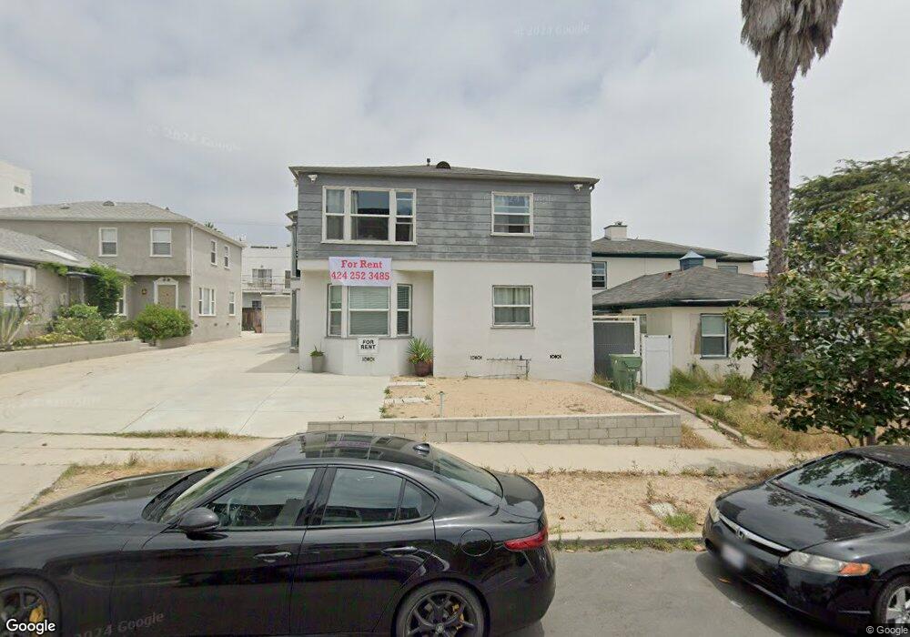
1752 Glendon Ave Unit 1752 1/2 Los Angeles, CA 90024
Westwood NeighborhoodEstimated Value: $826,115 - $2,381,000
1
Bed
1
Bath
900
Sq Ft
$1,985/Sq Ft
Est. Value
About This Home
This home is located at 1752 Glendon Ave Unit 1752 1/2, Los Angeles, CA 90024 and is currently estimated at $1,786,529, approximately $1,985 per square foot. 1752 Glendon Ave Unit 1752 1/2 is a home located in Los Angeles County with nearby schools including Fairburn Avenue Elementary, Westwood Charter School, and Ralph Waldo Emerson Community Charter Middle School.
Ownership History
Date
Name
Owned For
Owner Type
Purchase Details
Closed on
Jun 12, 2020
Sold by
Elisha Ilan and Linda M Brotman Trust
Bought by
Elisha Ilan
Current Estimated Value
Purchase Details
Closed on
Jun 12, 2008
Sold by
Brotman Linda M
Bought by
Brotman Linda M and Linda M Brothman Trust
Purchase Details
Closed on
Sep 29, 1994
Sold by
Brotman Lee
Bought by
Brotman Lee
Create a Home Valuation Report for This Property
The Home Valuation Report is an in-depth analysis detailing your home's value as well as a comparison with similar homes in the area
Home Values in the Area
Average Home Value in this Area
Purchase History
| Date | Buyer | Sale Price | Title Company |
|---|---|---|---|
| Elisha Ilan | -- | None Available | |
| Brotman Linda M | -- | None Available | |
| Brotman Linda | -- | None Available | |
| Brotman Linda | $375,000 | None Available | |
| Brotman Lee | -- | -- |
Source: Public Records
Tax History Compared to Growth
Tax History
| Year | Tax Paid | Tax Assessment Tax Assessment Total Assessment is a certain percentage of the fair market value that is determined by local assessors to be the total taxable value of land and additions on the property. | Land | Improvement |
|---|---|---|---|---|
| 2025 | $14,563 | $1,189,139 | $892,413 | $296,726 |
| 2024 | $14,563 | $1,165,823 | $874,915 | $290,908 |
| 2023 | $14,289 | $1,142,964 | $857,760 | $285,204 |
| 2022 | $13,637 | $1,120,554 | $840,942 | $279,612 |
| 2021 | $13,458 | $1,098,583 | $824,453 | $274,130 |
| 2020 | $7,906 | $613,515 | $381,153 | $232,362 |
| 2019 | $7,606 | $601,486 | $373,680 | $227,806 |
| 2018 | $7,470 | $589,693 | $366,353 | $223,340 |
| 2016 | $7,119 | $566,796 | $352,128 | $214,668 |
| 2015 | $7,019 | $558,283 | $346,839 | $211,444 |
| 2014 | $7,066 | $547,348 | $340,045 | $207,303 |
Source: Public Records
Map
Nearby Homes
- 1733 Malcolm Ave Unit 2
- 1645 Malcolm Ave Unit 302
- 1844 Midvale Ave Unit 6
- 1844 Midvale Ave Unit 4
- 1809 Overland Ave Unit 5
- 1825 Midvale Ave Unit 101
- 1850 Midvale Ave Unit 4
- 1818 Kelton Ave Unit 101
- 1768 Kelton Ave
- 1927 Glendon Ave Unit 301
- 1621 Manning Ave
- 1933 Selby Ave Unit 301
- 1944 Glendon Ave Unit 209
- 1650 Veteran Ave Unit 107
- 1916 Overland Ave Unit 2
- 1811 Manning Ave Unit 101
- 1512 Glendon Ave
- 1951 Glendon Ave
- 1880 Veteran Ave Unit 312
- 1880 Veteran Ave Unit 306
- 1752 Glendon Ave
- 1754 Glendon Ave Unit 1754 1/2
- 1754 1/2 Glendon Ave
- 1754 Glendon Ave
- 1756 Glendon Ave
- 1746 Glendon Ave
- 1756 Glendon Ave
- 1758 Glendon Ave
- 1748 Glendon Ave
- 1758 1/2 Glendon Ave
- 1762 Glendon Ave
- 1717 Malcolm Ave Unit 202
- 1717 Malcolm Ave Unit 301
- 1717 Malcolm Ave Unit PH2
- 1717 Malcolm Ave Unit 303
- 1717 Malcolm Ave Unit 302
- 1717 Malcolm Ave Unit PH3
- 1717 Malcolm Ave Unit PH3
- 1717 Malcolm Ave Unit PH2
- 1717 Malcolm Ave Unit PH1