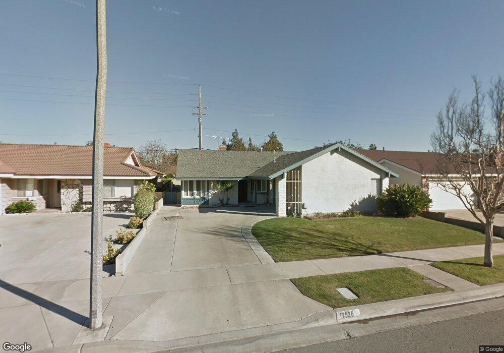
17526 Antonio Ave Cerritos, CA 90703
Estimated Value: $1,075,694 - $1,245,000
3
Beds
2
Baths
1,652
Sq Ft
$707/Sq Ft
Est. Value
About This Home
This home is located at 17526 Antonio Ave, Cerritos, CA 90703 and is currently estimated at $1,168,174, approximately $707 per square foot. 17526 Antonio Ave is a home located in Los Angeles County with nearby schools including Gonsalves Elementary School, Carmenita Middle School, and Cerritos High School.
Ownership History
Date
Name
Owned For
Owner Type
Purchase Details
Closed on
Mar 29, 2004
Sold by
Palacios Francisco A and Palacios Aida R
Bought by
Palacios Francisco A
Current Estimated Value
Purchase Details
Closed on
Nov 20, 2001
Sold by
Spoto Peter E and Spoto Mary A
Bought by
Palacios Francisco A
Home Financials for this Owner
Home Financials are based on the most recent Mortgage that was taken out on this home.
Original Mortgage
$288,000
Interest Rate
7.75%
Purchase Details
Closed on
Oct 10, 1995
Sold by
Spoto Peter E and Pearce Spoto Mary A
Bought by
Spoto Peter E
Create a Home Valuation Report for This Property
The Home Valuation Report is an in-depth analysis detailing your home's value as well as a comparison with similar homes in the area
Home Values in the Area
Average Home Value in this Area
Purchase History
| Date | Buyer | Sale Price | Title Company |
|---|---|---|---|
| Palacios Francisco A | -- | -- | |
| Palacios Francisco A | $320,000 | Chicago Title | |
| Spoto Peter E | -- | -- |
Source: Public Records
Mortgage History
| Date | Status | Borrower | Loan Amount |
|---|---|---|---|
| Previous Owner | Palacios Francisco A | $288,000 |
Source: Public Records
Tax History Compared to Growth
Tax History
| Year | Tax Paid | Tax Assessment Tax Assessment Total Assessment is a certain percentage of the fair market value that is determined by local assessors to be the total taxable value of land and additions on the property. | Land | Improvement |
|---|---|---|---|---|
| 2025 | $5,731 | $472,715 | $273,879 | $198,836 |
| 2024 | $5,731 | $463,447 | $268,509 | $194,938 |
| 2023 | $5,546 | $454,361 | $263,245 | $191,116 |
| 2022 | $5,460 | $445,453 | $258,084 | $187,369 |
| 2021 | $5,330 | $436,720 | $253,024 | $183,696 |
| 2019 | $5,206 | $423,769 | $245,520 | $178,249 |
| 2018 | $4,796 | $415,460 | $240,706 | $174,754 |
| 2016 | $4,599 | $399,329 | $231,360 | $167,969 |
| 2015 | $4,540 | $393,331 | $227,885 | $165,446 |
| 2014 | $4,451 | $385,628 | $223,422 | $162,206 |
Source: Public Records
Map
Nearby Homes
- 17105 Holmes Cir
- 18517 Betty Way
- 13370 Holly Oak Cir
- 13210 Sutton St
- 13548 Village Dr Unit A
- 18006 Point Conception Place
- 13010 Artesia Blvd
- 13044 Hedda Ln
- 7152 Caprice Cir
- 5412 Bransford Dr
- 19118 Martha Ave
- 5836 Trinidad Way
- 19008 Jeffrey Ave
- 6861 Frost Cir
- 5686 Panama Dr
- 5568 Ozawa Cir
- 7571 San Rafael Dr
- 12567 Semora St
- 12525 Semora St
- 7051 9th St
- 17520 Antonio Ave
- 17532 Antonio Ave
- 17514 Antonio Ave
- 17602 Antonio Ave
- 17527 Antonio Ave
- 17521 Antonio Ave
- 17608 Antonio Ave
- 17508 Antonio Ave
- 17521 Kensington Cir
- 17515 Kensington Cir
- 17511 Kensington Cir
- 13744 Acoro St
- 13802 Acoro St
- 17509 Antonio Ave
- 17614 Antonio Ave
- 17502 Antonio Ave
- 17536 Parkvalle Place
- 13738 Acoro St
- 17530 Parkvalle Place
- 13806 Acoro St