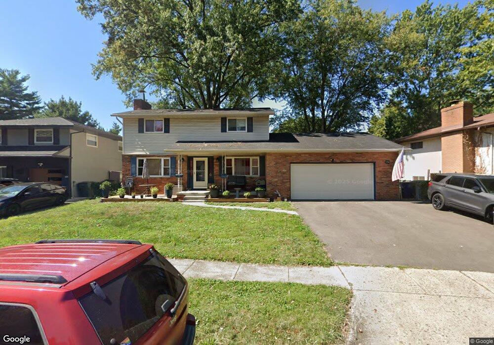
1753 Jason Dr Columbus, OH 43227
Leawood NeighborhoodEstimated Value: $217,000 - $366,000
4
Beds
2
Baths
1,825
Sq Ft
$150/Sq Ft
Est. Value
About This Home
This home is located at 1753 Jason Dr, Columbus, OH 43227 and is currently estimated at $274,383, approximately $150 per square foot. 1753 Jason Dr is a home located in Franklin County with nearby schools including Shady Lane Elementary School, Sherwood Middle School, and Walnut Ridge High School.
Ownership History
Date
Name
Owned For
Owner Type
Purchase Details
Closed on
Feb 10, 2003
Sold by
First Union Home Equity Bank Na
Bought by
Caldwell Clark A
Current Estimated Value
Home Financials for this Owner
Home Financials are based on the most recent Mortgage that was taken out on this home.
Original Mortgage
$81,700
Interest Rate
5.87%
Mortgage Type
Purchase Money Mortgage
Purchase Details
Closed on
Sep 22, 1992
Purchase Details
Closed on
Dec 1, 1986
Create a Home Valuation Report for This Property
The Home Valuation Report is an in-depth analysis detailing your home's value as well as a comparison with similar homes in the area
Home Values in the Area
Average Home Value in this Area
Purchase History
| Date | Buyer | Sale Price | Title Company |
|---|---|---|---|
| Caldwell Clark A | $86,000 | -- | |
| -- | -- | -- | |
| -- | $1,500 | -- |
Source: Public Records
Mortgage History
| Date | Status | Borrower | Loan Amount |
|---|---|---|---|
| Previous Owner | Caldwell Clark A | $81,700 |
Source: Public Records
Tax History Compared to Growth
Tax History
| Year | Tax Paid | Tax Assessment Tax Assessment Total Assessment is a certain percentage of the fair market value that is determined by local assessors to be the total taxable value of land and additions on the property. | Land | Improvement |
|---|---|---|---|---|
| 2024 | $3,414 | $76,060 | $15,160 | $60,900 |
| 2023 | $3,370 | $76,055 | $15,155 | $60,900 |
| 2022 | $2,618 | $50,480 | $7,530 | $42,950 |
| 2021 | $2,623 | $50,480 | $7,530 | $42,950 |
| 2020 | $2,626 | $50,480 | $7,530 | $42,950 |
| 2019 | $2,391 | $39,410 | $6,020 | $33,390 |
| 2018 | $2,227 | $39,410 | $6,020 | $33,390 |
| 2017 | $2,334 | $39,410 | $6,020 | $33,390 |
| 2016 | $2,279 | $34,410 | $6,370 | $28,040 |
| 2015 | $2,069 | $34,410 | $6,370 | $28,040 |
| 2014 | $2,074 | $34,410 | $6,370 | $28,040 |
| 2013 | $1,203 | $40,460 | $7,490 | $32,970 |
Source: Public Records
Map
Nearby Homes
- 1787 Lattimer Dr
- 1678 Huxley Dr
- 4701 Janis Dr
- 4589 Belfast Dr
- 1691 Shady Lane Rd
- 1607 Shady Lane Rd
- 4677 E Livingston Ave
- 4475 Ellery Dr
- 4571 Aragon Ave
- 1563 Genoa Place
- 1571 Baxter Dr
- 5036 Brinwood Place
- 1693 Gaynor Rd
- 1752 S Hamilton Rd
- 1618 S Hamilton Rd
- 1486 Efner Dr
- 1543 S Hamilton Rd
- 2173 Noe Bixby Rd
- 4467 Grimsby Rd
- 4484 Grimsby Rd