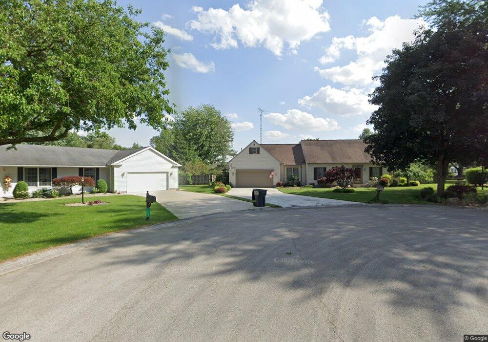
1753 Tomahawk Trace Fremont, OH 43420
Estimated Value: $248,000 - $384,000
3
Beds
3
Baths
2,342
Sq Ft
$136/Sq Ft
Est. Value
About This Home
This home is located at 1753 Tomahawk Trace, Fremont, OH 43420 and is currently estimated at $318,600, approximately $136 per square foot. 1753 Tomahawk Trace is a home located in Sandusky County with nearby schools including Fremont Ross High School, Bishop Hoffman Catholic School - This is St Joe's School now, and St. Joseph School.
Ownership History
Date
Name
Owned For
Owner Type
Purchase Details
Closed on
Mar 5, 2004
Sold by
Hintze Suzanna M and Hintze George R
Bought by
Hintze George R and Hintze Suzanna M
Current Estimated Value
Purchase Details
Closed on
Jul 16, 1998
Sold by
Scholdberg Jon P
Bought by
Sponseller Suzanna M
Home Financials for this Owner
Home Financials are based on the most recent Mortgage that was taken out on this home.
Original Mortgage
$145,000
Interest Rate
7.15%
Mortgage Type
New Conventional
Purchase Details
Closed on
Feb 29, 1996
Sold by
Kern Michael J
Bought by
Scholdberg Jon P and Scholdberg Linda M
Home Financials for this Owner
Home Financials are based on the most recent Mortgage that was taken out on this home.
Original Mortgage
$155,500
Interest Rate
7.07%
Mortgage Type
New Conventional
Purchase Details
Closed on
Jun 1, 1992
Sold by
Sponseller Suzanna M
Bought by
Hintze George R and Hintze Suzanna M
Create a Home Valuation Report for This Property
The Home Valuation Report is an in-depth analysis detailing your home's value as well as a comparison with similar homes in the area
Home Values in the Area
Average Home Value in this Area
Purchase History
| Date | Buyer | Sale Price | Title Company |
|---|---|---|---|
| Hintze George R | -- | -- | |
| Sponseller Suzanna M | $185,000 | -- | |
| Scholdberg Jon P | $171,500 | -- | |
| Hintze George R | $22,000 | -- |
Source: Public Records
Mortgage History
| Date | Status | Borrower | Loan Amount |
|---|---|---|---|
| Closed | Sponseller Suzanna M | $145,000 | |
| Previous Owner | Scholdberg Jon P | $155,500 |
Source: Public Records
Tax History Compared to Growth
Tax History
| Year | Tax Paid | Tax Assessment Tax Assessment Total Assessment is a certain percentage of the fair market value that is determined by local assessors to be the total taxable value of land and additions on the property. | Land | Improvement |
|---|---|---|---|---|
| 2024 | $4,123 | $105,630 | $15,540 | $90,090 |
| 2023 | $4,123 | $80,010 | $11,760 | $68,250 |
| 2022 | $3,339 | $80,010 | $11,760 | $68,250 |
| 2021 | $3,439 | $80,010 | $11,760 | $68,250 |
| 2020 | $3,048 | $69,790 | $11,760 | $58,030 |
| 2019 | $3,047 | $69,790 | $11,760 | $58,030 |
| 2018 | $2,965 | $69,790 | $11,760 | $58,030 |
| 2017 | $2,714 | $63,560 | $11,760 | $51,800 |
| 2016 | $2,390 | $63,560 | $11,760 | $51,800 |
| 2015 | $2,341 | $63,560 | $11,760 | $51,800 |
| 2014 | $2,455 | $63,880 | $11,800 | $52,080 |
| 2013 | $2,403 | $63,880 | $11,800 | $52,080 |
Source: Public Records
Map
Nearby Homes
- 10 Meadowbrook Dr
- 10 Meadowbrook Ln
- 1420 Center St
- 64 River Run Dr Unit J
- 350 Conner Dr
- 1818 Finley Dr
- 135 Briarwood Cir
- 1970 Morrison Rd
- 1832 Myrtle St
- 1719 Buckland Ave
- 1485 Autumn Woods Dr
- 2484 Buckland Ave
- 1013 Whittlesey St
- 905 Twinn St
- 933 E Cole Rd
- 18 Katlyn Dr
- 1028 June St
- 625 Bush Place
- 815 South St
- 616 S Wood St
- 1748 Tomahawk Trace
- 1749 Tomahawk Trace
- 1520 W Cole Rd
- 1530 W Cole Rd
- 1514 W Cole Rd
- 1744 Tomahawk Trace
- 1538 W Cole Rd
- 1745 Tomahawk Trace
- 1732 Arrowhead Dr
- 1600 W Cole Rd
- 1731 Tomahawk Trace
- 1508 W Cole Rd
- 1718 Arrowhead Dr
- 1533 W Cole Rd
- 1710 Arrowhead Dr
- 1714 Tomahawk Trace
- 1521 W Cole Rd
- 1715 Tomahawk Trace
- 1614 W Cole Rd
- 1517 W Cole Rd