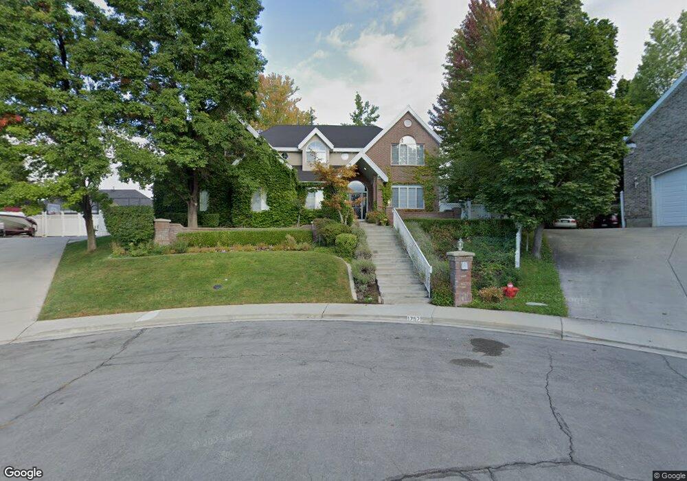
1757 N 710 E Orem, UT 84097
Northridge NeighborhoodEstimated Value: $902,000 - $1,152,000
4
Beds
4
Baths
4,197
Sq Ft
$250/Sq Ft
Est. Value
About This Home
This home is located at 1757 N 710 E, Orem, UT 84097 and is currently estimated at $1,048,894, approximately $249 per square foot. 1757 N 710 E is a home located in Utah County with nearby schools including Orchard Elementary School, Oak Canyon Junior High School, and Timpanogos High School.
Ownership History
Date
Name
Owned For
Owner Type
Purchase Details
Closed on
Jan 11, 2025
Sold by
Hanson Joseph C and Hanson Lisa D
Bought by
Hanson Joseph Clarence and Hanson Lisa Lynne
Current Estimated Value
Purchase Details
Closed on
Oct 19, 2018
Sold by
Sylvester Llc
Bought by
Hanson Lisa D and Hanson Joseph C
Purchase Details
Closed on
Dec 21, 2004
Sold by
Hanson Joseph C
Bought by
Sylvester Llc
Create a Home Valuation Report for This Property
The Home Valuation Report is an in-depth analysis detailing your home's value as well as a comparison with similar homes in the area
Home Values in the Area
Average Home Value in this Area
Purchase History
| Date | Buyer | Sale Price | Title Company |
|---|---|---|---|
| Hanson Joseph Clarence | -- | Metro National Title | |
| Hanson Joseph Clarence | -- | Metro National Title | |
| Hanson Lisa D | -- | None Available | |
| Sylvester Llc | -- | -- |
Source: Public Records
Tax History
| Year | Tax Paid | Tax Assessment Tax Assessment Total Assessment is a certain percentage of the fair market value that is determined by local assessors to be the total taxable value of land and additions on the property. | Land | Improvement |
|---|---|---|---|---|
| 2025 | $4,208 | $588,060 | -- | -- |
| 2024 | $4,208 | $514,525 | $0 | $0 |
| 2023 | $3,897 | $512,215 | $0 | $0 |
| 2022 | $3,712 | $472,670 | $0 | $0 |
| 2021 | $3,386 | $653,000 | $196,500 | $456,500 |
| 2020 | $3,196 | $605,700 | $170,900 | $434,800 |
| 2019 | $3,013 | $593,800 | $159,000 | $434,800 |
| 2018 | $2,944 | $593,800 | $159,000 | $434,800 |
| 2017 | $3,172 | $319,990 | $0 | $0 |
| 2016 | $3,249 | $302,225 | $0 | $0 |
| 2015 | $3,168 | $278,685 | $0 | $0 |
| 2014 | $2,944 | $257,785 | $0 | $0 |
Source: Public Records
Map
Nearby Homes
- 695 E 1870 N
- 540 E Quail Rd
- 1643 N Mountain Oaks Dr
- 110 S 1320 E
- 723 E 1450 N Unit 25
- 713 E 1500 St N Unit 19
- 747 E 1500 N Unit 13
- 1480 N 430 E
- 713 E 1450 N Unit 23
- 1366 N 750 E
- 1356 N 750 E Unit 11
- 733 E 1450 N Unit 5
- 1324 N 750 E Unit 3
- 1636 N 160 E
- 1638 N 160 E
- 363 E 1395 N Unit 22
- 710 E 1280 N
- 1371 N 330 E Unit 8
- 372 E 1165 N
- 1051 E 100 N
- 682 Cherapple Cir
- 1746 N 710 E
- 1746 N 710 E Unit 8
- 682 E 1780 N
- 695 E 1725 N
- 1745 N 710 E
- 668 Cherapple Cir
- 692 Cherapple Cir
- 1783 High Country Dr
- 1734 N 710 E
- 673 E 1725 N
- 1769 High Country Dr
- 654 Cherapple Cir
- 655 E 1725 N
- 683 Cherapple Cir
- 629 E 1725 N Unit 13
- 698 Cherapple Cir
- 1755 High Country Dr
- 676 E 1725 N
- 1701 Skyline Dr
Your Personal Tour Guide
Ask me questions while you tour the home.