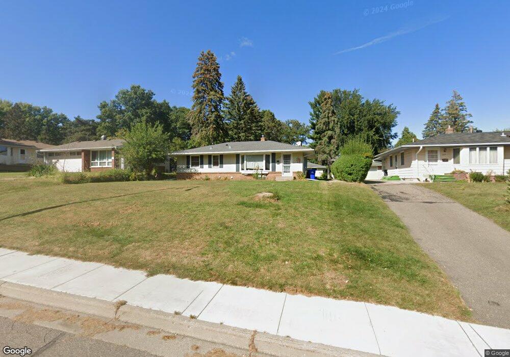
1757 Upper Afton Rd Saint Paul, MN 55106
Battle Creek NeighborhoodEstimated Value: $284,000 - $342,000
3
Beds
2
Baths
1,700
Sq Ft
$185/Sq Ft
Est. Value
About This Home
This home is located at 1757 Upper Afton Rd, Saint Paul, MN 55106 and is currently estimated at $314,988, approximately $185 per square foot. 1757 Upper Afton Rd is a home located in Ramsey County with nearby schools including Highwood Hills Elementary School, Battle Creek Middle School, and Harding Senior High School.
Ownership History
Date
Name
Owned For
Owner Type
Purchase Details
Closed on
Jul 19, 2019
Sold by
Young Matthew and Kaluva Jenny
Bought by
Kaluva Jenny
Current Estimated Value
Home Financials for this Owner
Home Financials are based on the most recent Mortgage that was taken out on this home.
Original Mortgage
$148,400
Outstanding Balance
$123,348
Interest Rate
3.73%
Mortgage Type
New Conventional
Estimated Equity
$191,640
Purchase Details
Closed on
Sep 25, 2013
Sold by
Swenson Steven and Swenson Carrie L
Bought by
Young Matthew and Young Jenny
Home Financials for this Owner
Home Financials are based on the most recent Mortgage that was taken out on this home.
Original Mortgage
$157,003
Interest Rate
4.59%
Mortgage Type
FHA
Purchase Details
Closed on
Sep 23, 2013
Sold by
Minnesota Housing Finance Agency
Bought by
Swenson Carrie L and Swenson Steven
Home Financials for this Owner
Home Financials are based on the most recent Mortgage that was taken out on this home.
Original Mortgage
$157,003
Interest Rate
4.59%
Mortgage Type
FHA
Create a Home Valuation Report for This Property
The Home Valuation Report is an in-depth analysis detailing your home's value as well as a comparison with similar homes in the area
Home Values in the Area
Average Home Value in this Area
Purchase History
| Date | Buyer | Sale Price | Title Company |
|---|---|---|---|
| Kaluva Jenny | -- | Ravenswood Title Company Llc | |
| Young Matthew | $164,745 | Fatco | |
| Swenson Carrie L | -- | Fatco |
Source: Public Records
Mortgage History
| Date | Status | Borrower | Loan Amount |
|---|---|---|---|
| Open | Kaluva Jenny | $148,400 | |
| Previous Owner | Young Matthew | $157,003 |
Source: Public Records
Tax History Compared to Growth
Tax History
| Year | Tax Paid | Tax Assessment Tax Assessment Total Assessment is a certain percentage of the fair market value that is determined by local assessors to be the total taxable value of land and additions on the property. | Land | Improvement |
|---|---|---|---|---|
| 2025 | $3,828 | $295,800 | $35,000 | $260,800 |
| 2023 | $3,828 | $256,000 | $35,000 | $221,000 |
| 2022 | $3,572 | $282,000 | $35,000 | $247,000 |
| 2021 | $3,212 | $232,400 | $35,000 | $197,400 |
| 2020 | $3,194 | $218,200 | $35,000 | $183,200 |
| 2019 | $3,410 | $204,100 | $35,000 | $169,100 |
| 2018 | $2,872 | $213,000 | $35,000 | $178,000 |
| 2017 | $2,362 | $188,400 | $30,900 | $157,500 |
| 2016 | $2,282 | $0 | $0 | $0 |
| 2015 | $2,190 | $155,100 | $30,900 | $124,200 |
| 2014 | $2,198 | $0 | $0 | $0 |
Source: Public Records
Map
Nearby Homes
- 136 White Bear Ave N
- 125 Battle Creek Place
- 49 Battle Creek Place
- 1747 Louise Ave
- 1935 Warbler Ln
- 237 Sigurd St
- 1989 N Park Dr
- 267 Hazelwood St
- 138 Ruth St N Unit 9
- 2059 Parkside Dr Unit 29
- 2063 N Park Dr Unit 6
- 201 Dora Ct W
- 1600 Old Hudson Rd
- 1821 Wilson Ave
- 1443 Pacific St
- 1538 Wilson Ave
- 465 Ruth St N
- 244 Point Douglas Rd N
- 2169 Glenridge Ave
- 1685 Fremont Ave
- 1757 1757 Upper Afton-Road-
- 1757 1757 Upper Afton Rd
- 1751 Upper Afton Rd
- 1765 Upper Afton Rd
- 1751 1751 Upper Afton Rd
- 1745 Upper Afton Rd
- 1773 Upper Afton Rd
- 1773 1773 Upper Afton-Road-
- 1739 Upper Afton Rd
- 1760 Rowe Place
- 1750 Rowe Place
- 1758 1758 Upper Afton Rd
- 1770 Rowe Place
- 1733 Upper Afton Rd
- 1744 Rowe Place
- 1758 Upper Afton Rd
- 1744 1744 Rowe Place
- 1744 1744 Rowe-Place-
- 1774 1774 Upper Afton-Road-
- 1748 Upper Afton Rd