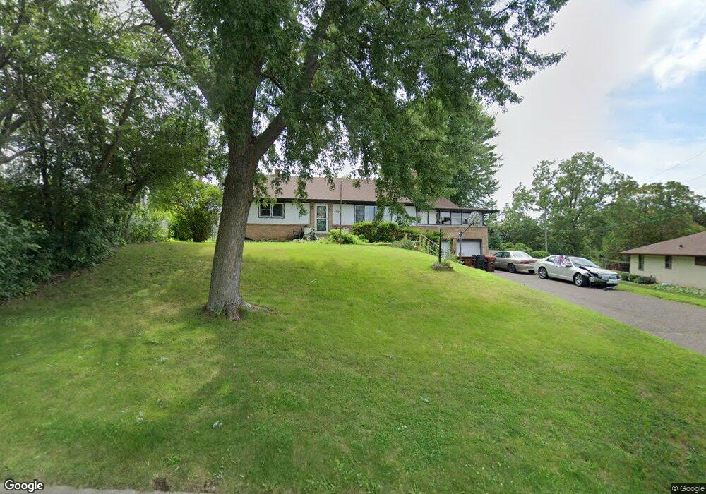
1759 Maryknoll Ave Saint Paul, MN 55109
Gladstone NeighborhoodEstimated Value: $323,611 - $363,000
3
Beds
2
Baths
1,458
Sq Ft
$233/Sq Ft
Est. Value
About This Home
This home is located at 1759 Maryknoll Ave, Saint Paul, MN 55109 and is currently estimated at $340,403, approximately $233 per square foot. 1759 Maryknoll Ave is a home located in Ramsey County with nearby schools including Weaver Elementary School, John Glenn Middle School, and Mounds Park Academy.
Ownership History
Date
Name
Owned For
Owner Type
Purchase Details
Closed on
May 22, 2020
Sold by
Good Domus Duo Llc
Bought by
Vargas Jorge Gallegos
Current Estimated Value
Home Financials for this Owner
Home Financials are based on the most recent Mortgage that was taken out on this home.
Original Mortgage
$245,373
Interest Rate
3.1%
Mortgage Type
FHA
Purchase Details
Closed on
Oct 31, 2019
Sold by
Dana Joayn
Bought by
Good Domus Duo Llc
Home Financials for this Owner
Home Financials are based on the most recent Mortgage that was taken out on this home.
Original Mortgage
$121,500
Interest Rate
3.6%
Mortgage Type
Commercial
Create a Home Valuation Report for This Property
The Home Valuation Report is an in-depth analysis detailing your home's value as well as a comparison with similar homes in the area
Home Values in the Area
Average Home Value in this Area
Purchase History
| Date | Buyer | Sale Price | Title Company |
|---|---|---|---|
| Vargas Jorge Gallegos | $249,900 | Title Specialists Inc | |
| Good Domus Duo Llc | $162,000 | None Available |
Source: Public Records
Mortgage History
| Date | Status | Borrower | Loan Amount |
|---|---|---|---|
| Previous Owner | Vargas Jorge Gallegos | $245,373 | |
| Previous Owner | Good Domus Duo Llc | $121,500 |
Source: Public Records
Tax History Compared to Growth
Tax History
| Year | Tax Paid | Tax Assessment Tax Assessment Total Assessment is a certain percentage of the fair market value that is determined by local assessors to be the total taxable value of land and additions on the property. | Land | Improvement |
|---|---|---|---|---|
| 2025 | $4,828 | $346,600 | $90,400 | $256,200 |
| 2023 | $4,828 | $343,800 | $90,400 | $253,400 |
| 2022 | $3,680 | $332,100 | $90,400 | $241,700 |
| 2021 | $3,602 | $257,100 | $90,400 | $166,700 |
| 2020 | $3,666 | $257,100 | $90,400 | $166,700 |
| 2019 | $3,340 | $245,100 | $90,400 | $154,700 |
| 2018 | $3,536 | $229,000 | $90,400 | $138,600 |
| 2017 | $3,628 | $217,500 | $90,400 | $127,100 |
| 2016 | $3,740 | $0 | $0 | $0 |
| 2015 | $3,944 | $218,200 | $82,900 | $135,300 |
| 2014 | $3,242 | $0 | $0 | $0 |
Source: Public Records
Map
Nearby Homes
- 1627 Christie Place
- 1849 Kennard St
- 1743 White Bear Ave N
- 1856 Flandrau St
- 1637 Iowa Ave E
- 1740 California Ave E
- 1607 Hoyt Ave E
- 1854 Barclay St
- 1672 Manton St
- 1435 Price Ave
- 1651 Manton St
- 1937 Flandrau St
- 1676 Montana Ave E
- 1940 Barclay St
- 1984 Prosperity Rd
- 1869 Birmingham St
- 1840 Iowa Ave E
- 1840 Hoyt Ave E
- 1751 Clarence St
- 1696 Nevada Ave E
- 1759 Maryknoll Ave N
- 1763 Maryknoll Ave
- 1745 Kennard St
- 1767 Maryknoll Ave
- 1764 Maryknoll Ave
- 1744 Prosperity Rd
- 1765 Kennard St
- 1756 Prosperity Rd
- 1771 Maryknoll Ave
- 1746 Kennard St
- 1750 Kennard St
- 1740 Kennard St
- 1776 Maryknoll Ave
- 1764 Prosperity Rd
- 1773 Kennard St
- 1730 Kennard St
- 1766 Kennard St
- 1779 Maryknoll Ave
- 1722 Kennard St
- 1756 Kennard St