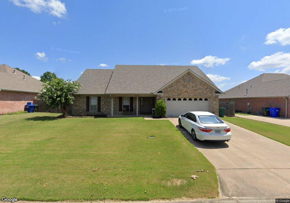
1760 John Bryant Dr Conway, AR 72034
Downtown Conway NeighborhoodEstimated Value: $307,917 - $323,000
Studio
2
Baths
1,907
Sq Ft
$167/Sq Ft
Est. Value
About This Home
This home is located at 1760 John Bryant Dr, Conway, AR 72034 and is currently estimated at $317,729, approximately $166 per square foot. 1760 John Bryant Dr is a home located in Faulkner County with nearby schools including Jim Stone Elementary School, Conway Junior High School, and Carl Stuart Middle School.
Ownership History
Date
Name
Owned For
Owner Type
Purchase Details
Closed on
Oct 31, 2022
Sold by
Lucy Scott A and Lucy Ken L
Bought by
Springer Alexus and Springer Marcus
Current Estimated Value
Home Financials for this Owner
Home Financials are based on the most recent Mortgage that was taken out on this home.
Original Mortgage
$279,248
Outstanding Balance
$269,892
Interest Rate
6.7%
Mortgage Type
FHA
Estimated Equity
$47,837
Purchase Details
Closed on
Jul 27, 2004
Bought by
Lucy
Purchase Details
Closed on
Jul 21, 2004
Bought by
Lucy
Purchase Details
Closed on
Feb 22, 1999
Bought by
Jackson
Purchase Details
Closed on
Apr 22, 1998
Bought by
Generation
Purchase Details
Closed on
Feb 24, 1997
Bought by
Llc
Create a Home Valuation Report for This Property
The Home Valuation Report is an in-depth analysis detailing your home's value as well as a comparison with similar homes in the area
Home Values in the Area
Average Home Value in this Area
Purchase History
| Date | Buyer | Sale Price | Title Company |
|---|---|---|---|
| Springer Alexus | $284,400 | Faulkner County Title | |
| Lucy | $153,000 | -- | |
| Lucy | $153,000 | -- | |
| Jackson | $140,000 | -- | |
| Generation | -- | -- | |
| Generation | $24,000 | -- | |
| Llc | -- | -- |
Source: Public Records
Mortgage History
| Date | Status | Borrower | Loan Amount |
|---|---|---|---|
| Open | Springer Alexus | $279,248 |
Source: Public Records
Tax History
| Year | Tax Paid | Tax Assessment Tax Assessment Total Assessment is a certain percentage of the fair market value that is determined by local assessors to be the total taxable value of land and additions on the property. | Land | Improvement |
|---|---|---|---|---|
| 2025 | $2,679 | $55,660 | $7,200 | $48,460 |
| 2024 | $2,456 | $55,660 | $7,200 | $48,460 |
| 2023 | $2,233 | $44,130 | $7,200 | $36,930 |
| 2022 | $1,585 | $44,130 | $7,200 | $36,930 |
| 2021 | $1,496 | $44,130 | $7,200 | $36,930 |
| 2020 | $1,407 | $35,220 | $7,200 | $28,020 |
| 2019 | $1,407 | $35,220 | $7,200 | $28,020 |
| 2018 | $1,432 | $35,220 | $7,200 | $28,020 |
| 2017 | $1,432 | $35,220 | $7,200 | $28,020 |
| 2016 | $1,432 | $35,220 | $7,200 | $28,020 |
| 2015 | $1,733 | $34,250 | $7,000 | $27,250 |
| 2014 | $1,383 | $34,250 | $7,000 | $27,250 |
Source: Public Records
Map
Nearby Homes
- 3615 Heidi Ct
- 3630 Aspen Cir
- 3720 Monarch Cove
- 1705 Poteete Dr
- 3525 Juniper Dr
- 1635 Poteete Dr
- 3805 Irby Dr
- 1750 Pearce Dr
- 1224 Turnberry Dr
- 3335 Nicklaus Dr
- 940 Doy B Rd
- 4325 Gazebo Dr
- 1655 Chicot Dr
- 4335 Gazebo Dr
- 1660 Chicot Dr
- 1045 Edinburgh Dr
- 14 Shady Valley Dr
- 1020 Edinburgh Dr
- 1760 Centennial Club Dr
- 950 Doy B Rd
- 1770 John Bryant Dr
- 1750 John Bryant Dr
- 1780 John Bryant Dr
- 1765 John Bryant Dr
- 1740 John Bryant Dr
- 1775 John Bryant Dr
- 3655 Butterfly Dr
- 3710 Mcconnell Dr
- 0 Butterfly Dr
- 3665 Butterfly Dr
- 1790 John Bryant Dr
- 1785 John Bryant Dr
- 3645 Butterfly Dr
- 0 Mcconnell Dr
- 1740 Brittany Cir
- 3640 Crepe Myrtle Cove
- 0 Brittany Cir
- 3650 Butterfly Dr
- 1730 Brittany Cir
- 1770 Brittany Cir
Your Personal Tour Guide
Ask me questions while you tour the home.