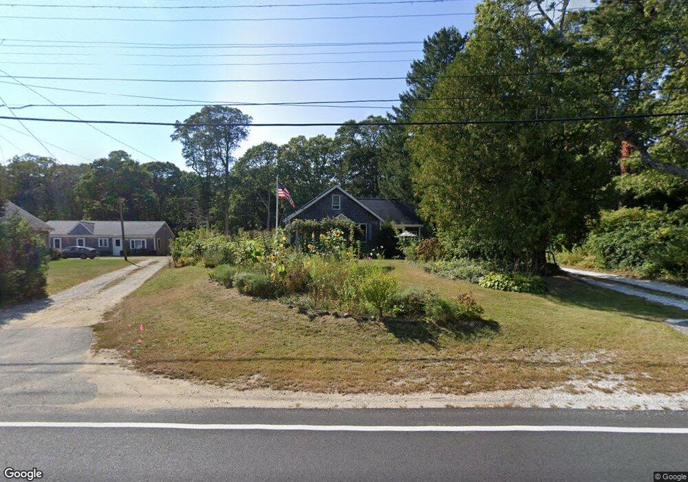
1761 Santuit Newtown Rd Cotuit, MA 02635
Cotuit NeighborhoodEstimated Value: $521,000 - $637,000
2
Beds
1
Bath
1,293
Sq Ft
$440/Sq Ft
Est. Value
About This Home
This home is located at 1761 Santuit Newtown Rd, Cotuit, MA 02635 and is currently estimated at $568,760, approximately $439 per square foot. 1761 Santuit Newtown Rd is a home located in Barnstable County with nearby schools including West Villages Elementary School, Barnstable United Elementary School, and Barnstable Intermediate School.
Ownership History
Date
Name
Owned For
Owner Type
Purchase Details
Closed on
Aug 27, 1999
Sold by
Kolker Robert J and Kolker Charlaine S
Bought by
Glavine Jane
Current Estimated Value
Purchase Details
Closed on
Oct 25, 1996
Sold by
Souza Donald E
Bought by
Kolker Robert J and Kolker Charlaine S
Create a Home Valuation Report for This Property
The Home Valuation Report is an in-depth analysis detailing your home's value as well as a comparison with similar homes in the area
Home Values in the Area
Average Home Value in this Area
Purchase History
| Date | Buyer | Sale Price | Title Company |
|---|---|---|---|
| Glavine Jane | $115,000 | -- | |
| Kolker Robert J | $58,000 | -- |
Source: Public Records
Mortgage History
| Date | Status | Borrower | Loan Amount |
|---|---|---|---|
| Open | Kolker Robert J | $55,000 |
Source: Public Records
Tax History Compared to Growth
Tax History
| Year | Tax Paid | Tax Assessment Tax Assessment Total Assessment is a certain percentage of the fair market value that is determined by local assessors to be the total taxable value of land and additions on the property. | Land | Improvement |
|---|---|---|---|---|
| 2025 | $3,748 | $448,900 | $173,100 | $275,800 |
| 2024 | $3,392 | $430,400 | $173,100 | $257,300 |
| 2023 | $3,218 | $384,500 | $157,300 | $227,200 |
| 2022 | $3,162 | $305,800 | $116,500 | $189,300 |
| 2021 | $4,602 | $276,600 | $116,500 | $160,100 |
| 2020 | $3,043 | $259,900 | $116,500 | $143,400 |
| 2019 | $5,381 | $243,200 | $116,500 | $126,700 |
| 2018 | $4,427 | $230,900 | $122,700 | $108,200 |
| 2017 | $2,663 | $225,700 | $122,700 | $103,000 |
| 2016 | $2,567 | $223,000 | $120,000 | $103,000 |
| 2015 | $2,760 | $239,600 | $121,500 | $118,100 |
Source: Public Records
Map
Nearby Homes
- 783
- 4701 Falmouth Rd
- 75 Bob White Run
- 226 Dunrobin Rd
- 220 Dunrobin Rd
- 70 Cape Dr Unit 14D
- 70 Cape Dr Unit 11D
- 70 Cape Dr Unit 11D
- 6 Mayfair Ct
- 6 Mayfair Ct Unit 6
- 16 Spring Brook Ln
- 4 Bishops Park
- 170 Forest Hills Rd
- 30 Windsor Point
- 5 Darby Point Unit 5
- 22 Stratford Ridge Unit 22
- 295 Pheasant Hill Cir
- 70 Simons Rd Unit E
- 70 Simons Rd
- 15 Geraldine Rd
- 1771 Santuit-Newtown Rd Unit 1-2
- 1771 Santuit Newtown Rd
- 1765 Santuit Newtown Rd
- 1776 Santuit-Newtown Rd
- 1783 Santuit Newtown Rd
- 1776 Santuit Newtown Rd
- 8 Mariner Cir
- 1726 Santuit Newtown Rd
- 1726 Santuit-Newtown Rd
- 645 Mariner Cir
- 657 Mariner Cir
- 1799 Santuit Newtown Rd
- 1799 Santuit-Newtown Rd
- 28 Mariner Cir
- 633 Mariner Cir
- 7 Mariner Cir
- 1716 Santuit Newtown Rd
- 9 Mariner Cir
- 1707 Santuit Newtown Rd
- 621 Mariner Cir