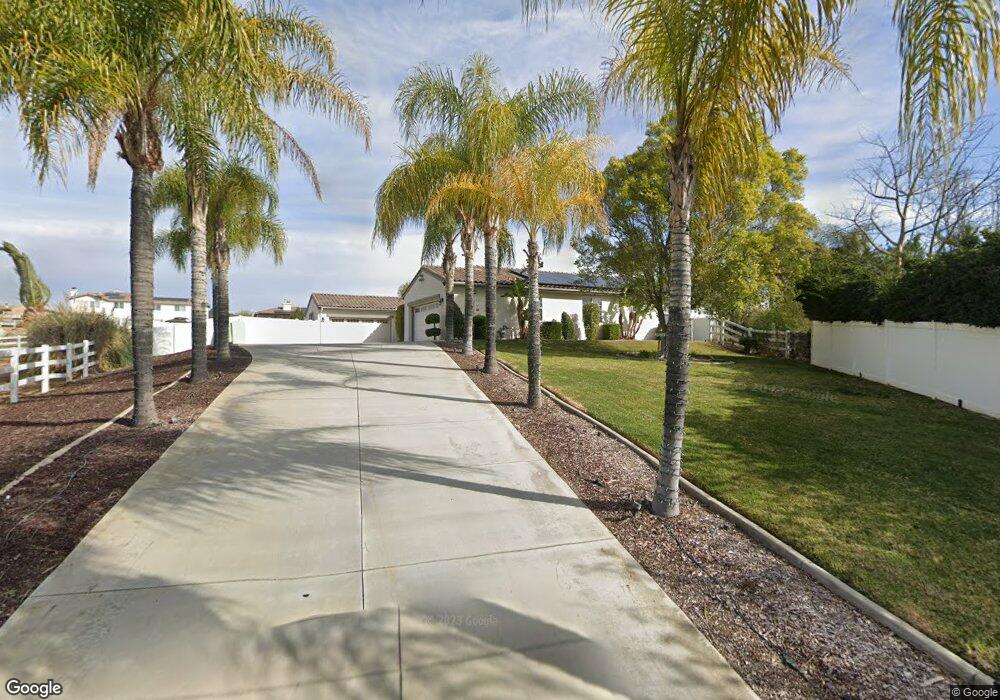
17612 Glen Hollow Way Riverside, CA 92504
Estimated Value: $1,117,000 - $1,371,000
4
Beds
4
Baths
3,701
Sq Ft
$343/Sq Ft
Est. Value
About This Home
This home is located at 17612 Glen Hollow Way, Riverside, CA 92504 and is currently estimated at $1,268,038, approximately $342 per square foot. 17612 Glen Hollow Way is a home located in Riverside County with nearby schools including Woodcrest Elementary School, Frank Augustus Miller Middle School, and Martin Luther King Junior High School.
Ownership History
Date
Name
Owned For
Owner Type
Purchase Details
Closed on
Oct 1, 2021
Sold by
Douty Michael
Bought by
Douty Michael and Douty Michael
Current Estimated Value
Purchase Details
Closed on
Mar 16, 2005
Sold by
William Lyon Homes Inc
Bought by
Douty Michael A
Home Financials for this Owner
Home Financials are based on the most recent Mortgage that was taken out on this home.
Original Mortgage
$665,600
Interest Rate
5.5%
Mortgage Type
Purchase Money Mortgage
Purchase Details
Closed on
Dec 10, 2004
Sold by
Douty Vanessa
Bought by
Douty Michael A
Create a Home Valuation Report for This Property
The Home Valuation Report is an in-depth analysis detailing your home's value as well as a comparison with similar homes in the area
Home Values in the Area
Average Home Value in this Area
Purchase History
| Date | Buyer | Sale Price | Title Company |
|---|---|---|---|
| Douty Michael | -- | None Available | |
| Douty Michael A | $833,000 | -- | |
| Douty Michael A | -- | -- |
Source: Public Records
Mortgage History
| Date | Status | Borrower | Loan Amount |
|---|---|---|---|
| Previous Owner | Douty Michael A | $665,600 | |
| Closed | Douty Michael A | $124,800 |
Source: Public Records
Tax History Compared to Growth
Tax History
| Year | Tax Paid | Tax Assessment Tax Assessment Total Assessment is a certain percentage of the fair market value that is determined by local assessors to be the total taxable value of land and additions on the property. | Land | Improvement |
|---|---|---|---|---|
| 2025 | $14,854 | $1,206,887 | $348,468 | $858,419 |
| 2023 | $14,854 | $1,144,592 | $330,141 | $814,451 |
| 2022 | $13,421 | $1,040,538 | $300,128 | $740,410 |
| 2021 | $11,675 | $881,812 | $254,346 | $627,466 |
| 2020 | $10,642 | $787,332 | $227,094 | $560,238 |
| 2019 | $10,386 | $764,400 | $220,480 | $543,920 |
| 2018 | $10,050 | $735,000 | $212,000 | $523,000 |
| 2017 | $9,812 | $713,000 | $206,000 | $507,000 |
| 2016 | $12,705 | $1,019,516 | $294,369 | $725,147 |
| 2015 | $8,430 | $615,000 | $178,000 | $437,000 |
| 2014 | $8,468 | $607,000 | $175,000 | $432,000 |
Source: Public Records
Map
Nearby Homes
- 17832 Canyonwood Dr
- 17530 Dry Run Ct
- 17536 Fairbreeze Ct
- 17426 Fairbreeze Ct
- 16778 Nandina Ave
- 16718 Catalonia Dr
- 18085 Golden Leaf Ln
- 16627 Eagle Peak Rd
- 17824 Log Hill Dr
- 16612 Edge Gate Dr
- 17234 Gamble Ave
- 16960 Washington St
- 17289 Mariposa Ave
- 16930 Washington St
- 16618 Ginger Creek Dr
- 16555 Via Los Caballeros
- 17165 Roosevelt St
- 0 Winters Ln Unit OC25195097
- 0 Winters Ln Unit DW25187941
- 17438 Sunset View Dr
- 17640 Glen Hollow Way
- 17141 Birch Hill Rd
- 17668 Glen Hollow Way
- 17647 Glen Hollow Way
- 17197 Birch Hill Rd
- 17619 Glen Hollow Way
- 17113 Birch Hill Rd
- 17225 Birch Hill Rd
- 17675 Glen Hollow Way
- 17696 Glen Hollow Way
- 17085 Birch Hill Rd
- 17657 Laurel Grove Rd
- 17685 Laurel Grove Rd
- 17629 Laurel Grove Rd
- 17081 Birch Hill Rd
- 17573 Laurel Grove Rd
- 17713 Laurel Grove Rd
- 17724 Glen Hollow Way
- 17703 Glen Hollow Way
- 17176 Birch Hill Rd