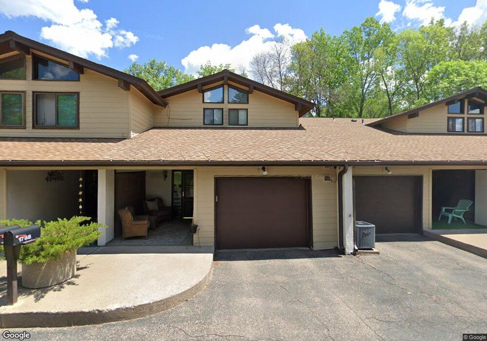
1768 Mcknight Rd N Unit 14 Saint Paul, MN 55109
Hillside NeighborhoodEstimated Value: $217,000 - $239,000
3
Beds
2
Baths
1,495
Sq Ft
$149/Sq Ft
Est. Value
About This Home
This home is located at 1768 Mcknight Rd N Unit 14, Saint Paul, MN 55109 and is currently estimated at $222,630, approximately $148 per square foot. 1768 Mcknight Rd N Unit 14 is a home located in Ramsey County with nearby schools including Cowern Elementary School, Justice Alan Page Elementary, and Mounds Park Academy.
Ownership History
Date
Name
Owned For
Owner Type
Purchase Details
Closed on
Aug 12, 2020
Sold by
Walker Jo
Bought by
Lindberg Renee and Lindberg Steve
Current Estimated Value
Home Financials for this Owner
Home Financials are based on the most recent Mortgage that was taken out on this home.
Original Mortgage
$116,250
Interest Rate
2.3%
Mortgage Type
New Conventional
Purchase Details
Closed on
May 12, 2000
Sold by
Wilson Beth R and Wilson Robert L
Bought by
Haugen Betty
Create a Home Valuation Report for This Property
The Home Valuation Report is an in-depth analysis detailing your home's value as well as a comparison with similar homes in the area
Home Values in the Area
Average Home Value in this Area
Purchase History
| Date | Buyer | Sale Price | Title Company |
|---|---|---|---|
| Lindberg Renee | $155,000 | Burnet Title | |
| Haugen Betty | $97,900 | -- |
Source: Public Records
Mortgage History
| Date | Status | Borrower | Loan Amount |
|---|---|---|---|
| Previous Owner | Lindberg Renee | $116,250 |
Source: Public Records
Tax History Compared to Growth
Tax History
| Year | Tax Paid | Tax Assessment Tax Assessment Total Assessment is a certain percentage of the fair market value that is determined by local assessors to be the total taxable value of land and additions on the property. | Land | Improvement |
|---|---|---|---|---|
| 2025 | $2,838 | $211,700 | $30,000 | $181,700 |
| 2023 | $2,838 | $198,800 | $30,000 | $168,800 |
| 2022 | $2,314 | $184,300 | $30,000 | $154,300 |
| 2021 | $1,862 | $153,700 | $30,000 | $123,700 |
| 2020 | $1,684 | $147,700 | $30,000 | $117,700 |
| 2019 | $1,466 | $129,000 | $24,200 | $104,800 |
| 2018 | $1,260 | $117,500 | $24,200 | $93,300 |
| 2017 | $1,228 | $103,000 | $24,200 | $78,800 |
| 2016 | $1,200 | $0 | $0 | $0 |
| 2015 | $1,194 | $97,200 | $14,600 | $82,600 |
| 2014 | $1,090 | $0 | $0 | $0 |
Source: Public Records
Map
Nearby Homes
- 1742 Howard St N
- 2225 Larpenteur Ave E
- 2165 Holloway Ave E
- 2076 Larpenteur Ave E
- 2007 6th St N
- 1279 Ripley Ave
- 2092 Shryer Ave E
- 1700 Stanich Place
- 2054 Shryer Ct E
- 2075 Cardinal Glen
- 2317 Arlington Ave E
- 2543 Montana Ave E
- 2226 South Ave E
- 2342 South Ave E
- 2507 Belmont Ln E
- 2191 Gateway Hill Rd
- 2189 Gateway Hill Rd N
- 2102 Sherwood Ave
- 2315 Mckenney Way N
- 2112 Cottage Ave E
- 1770 Mcknight Rd N Unit 13
- 1772 Mcknight Rd N Unit 12
- 1766 Mcknight Rd N Unit 15
- 1774 Mcknight Rd N Unit 11
- 1764 Mcknight Rd N Unit 16
- 1776 Mcknight Rd N Unit 10
- 1778 Mcknight Rd N Unit 9
- 1762 1762 McKnight Rd N
- 1762 Mcknight Rd N Unit 17
- 1760 Mcknight Rd N
- 1760 Mcknight Rd N Unit 18
- 1782 Mcknight Rd N Unit 8
- 1758 Mcknight Rd N Unit 19
- 1784 Mcknight Rd N Unit 7
- 1784 1784 McKnight Rd N
- 2290 Kingston Ave E
- 1756 Mcknight Rd N Unit 20
- 1786 Mcknight Rd N Unit 6
- 1754 1754 McKnight Rd N
- 1754 Mcknight Rd N Unit 21