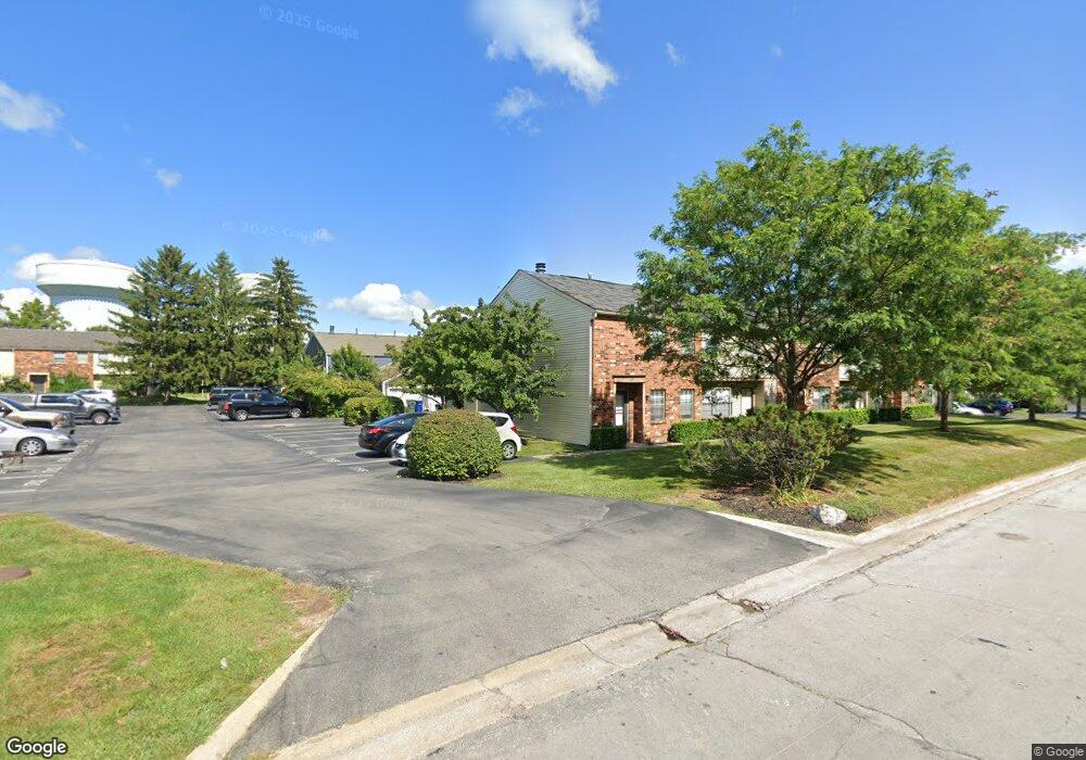
1768 Queensbridge Dr Columbus, OH 43235
Brookside Village NeighborhoodEstimated Value: $180,000 - $223,087
2
Beds
3
Baths
1,232
Sq Ft
$163/Sq Ft
Est. Value
About This Home
This home is located at 1768 Queensbridge Dr, Columbus, OH 43235 and is currently estimated at $200,272, approximately $162 per square foot. 1768 Queensbridge Dr is a home located in Franklin County with nearby schools including Brookside Elementary School, McCord Middle School, and Worthington Kilbourne High School.
Ownership History
Date
Name
Owned For
Owner Type
Purchase Details
Closed on
Apr 18, 2024
Sold by
Hmh Associates Of Columbus Llc
Bought by
Team Hellas Llc
Current Estimated Value
Purchase Details
Closed on
Apr 5, 2024
Sold by
Hmh Associates Of Columbus Llc
Bought by
Team Hellas Llc
Purchase Details
Closed on
Dec 30, 2011
Sold by
Hoerath James M and Hoerath Lynda A
Bought by
Hmh Associates Of Columbus Llc
Purchase Details
Closed on
Nov 1, 1995
Sold by
James Mildred C
Bought by
Hoerath James M and Hoerath Lynda
Home Financials for this Owner
Home Financials are based on the most recent Mortgage that was taken out on this home.
Original Mortgage
$252,000
Interest Rate
7.61%
Mortgage Type
New Conventional
Purchase Details
Closed on
Jan 1, 1986
Purchase Details
Closed on
Jul 1, 1983
Create a Home Valuation Report for This Property
The Home Valuation Report is an in-depth analysis detailing your home's value as well as a comparison with similar homes in the area
Home Values in the Area
Average Home Value in this Area
Purchase History
| Date | Buyer | Sale Price | Title Company |
|---|---|---|---|
| Team Hellas Llc | $182,500 | None Listed On Document | |
| Team Hellas Llc | $182,500 | None Listed On Document | |
| Hmh Associates Of Columbus Llc | -- | None Available | |
| Hoerath James M | $270,000 | -- | |
| -- | -- | -- | |
| -- | -- | -- |
Source: Public Records
Mortgage History
| Date | Status | Borrower | Loan Amount |
|---|---|---|---|
| Previous Owner | Hoerath James M | $252,000 |
Source: Public Records
Tax History Compared to Growth
Tax History
| Year | Tax Paid | Tax Assessment Tax Assessment Total Assessment is a certain percentage of the fair market value that is determined by local assessors to be the total taxable value of land and additions on the property. | Land | Improvement |
|---|---|---|---|---|
| 2024 | $3,133 | $50,050 | $10,500 | $39,550 |
| 2023 | $2,999 | $50,050 | $10,500 | $39,550 |
| 2022 | $2,287 | $30,280 | $5,010 | $25,270 |
| 2021 | $2,114 | $30,280 | $5,010 | $25,270 |
| 2020 | $2,038 | $30,280 | $5,010 | $25,270 |
| 2019 | $1,738 | $23,280 | $3,850 | $19,430 |
| 2018 | $1,635 | $23,280 | $3,850 | $19,430 |
| 2017 | $1,562 | $23,280 | $3,850 | $19,430 |
| 2016 | $1,584 | $21,710 | $3,610 | $18,100 |
| 2015 | $1,584 | $21,710 | $3,610 | $18,100 |
| 2014 | $1,584 | $21,710 | $3,610 | $18,100 |
| 2013 | $789 | $21,700 | $3,605 | $18,095 |
Source: Public Records
Map
Nearby Homes
- 1721 Worthington Run Dr Unit 1721-1731
- 1637 Park Row Dr Unit F
- 1620 Park Row Dr Unit A
- 1930 Shallowford Ave
- 1889 Slaton Ct Unit 1889
- 6921 Spruce Pine Dr
- 1828 Gardenstone Dr
- 2056 Fincastle Ct
- 2001 Sawbury Blvd Unit 2001
- 2687 Snouffer Rd
- 1380 Tiehack Ct
- 2161 Heatherfield Ave
- 7164 Durness Place
- 2074 Hard Rd
- 2220 Surreygate Dr
- 1986 Sutter Pkwy
- 7373 Palmleaf Ln
- 7680 Foxboro Ln
- 7734 Henry David Ct
- 2392 Dunsworth Dr
- 1768 Queensbridge Dr Unit F
- 1766 Queensbridge Dr Unit E
- 1764 Queensbridge Dr
- 1762 Queensbridge Dr
- 1760 Queensbridge Dr
- 1760 Queensbridge Dr Unit B
- 1758 Queensbridge Dr
- 1790 Queensbridge Dr Unit AC
- 1792 Queensbridge Dr
- 1773 Worthington Run Dr
- 1773 Worthington Run Dr Unit F
- 1769 Worthington Run Dr Unit D
- 1769 Worthington Run Dr
- 1757 Queensbridge Dr
- 1794 Queensbridge Dr
- 1771 Worthington Run Dr Unit E
- 1754 Queensbridge Dr Unit F
- 1767 Worthington Run Dr
- 1796 Queensbridge Dr Unit DF
- 1763 Worthington Run Dr Unit A