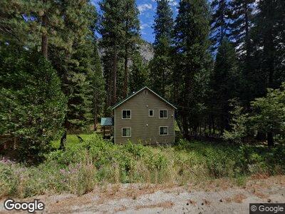
17682 Us Highway 50 Twin Bridges, CA 95735
Estimated Value: $502,000 - $708,000
3
Beds
2
Baths
1,495
Sq Ft
$417/Sq Ft
Est. Value
About This Home
This home is located at 17682 Us Highway 50, Twin Bridges, CA 95735 and is currently estimated at $624,160, approximately $417 per square foot. 17682 Us Highway 50 is a home with nearby schools including El Dorado High School.
Ownership History
Date
Name
Owned For
Owner Type
Purchase Details
Closed on
Jun 25, 2024
Sold by
Jessup Pamela L and Runner George C
Bought by
George And Pamela Runner Trust and Runner
Current Estimated Value
Purchase Details
Closed on
Jul 28, 2020
Sold by
Runner Micah S and Runner Sandra L
Bought by
Runner George C and Runner Pamela L
Home Financials for this Owner
Home Financials are based on the most recent Mortgage that was taken out on this home.
Original Mortgage
$300,600
Interest Rate
3%
Mortgage Type
New Conventional
Purchase Details
Closed on
Aug 14, 2015
Sold by
Jung Melinda and Hamrah Livia
Bought by
Runner George C and Runner Sharon Y
Home Financials for this Owner
Home Financials are based on the most recent Mortgage that was taken out on this home.
Original Mortgage
$310,400
Interest Rate
3.97%
Mortgage Type
New Conventional
Purchase Details
Closed on
Jan 2, 2014
Sold by
King Diane
Bought by
Jung Melinda and Hamrah Livia
Create a Home Valuation Report for This Property
The Home Valuation Report is an in-depth analysis detailing your home's value as well as a comparison with similar homes in the area
Home Values in the Area
Average Home Value in this Area
Purchase History
| Date | Buyer | Sale Price | Title Company |
|---|---|---|---|
| George And Pamela Runner Trust | -- | None Listed On Document | |
| Runner George C | -- | Fidelity National Title | |
| Runner George C | $388,000 | Old Republic Title Company | |
| Jung Melinda | -- | None Available |
Source: Public Records
Mortgage History
| Date | Status | Borrower | Loan Amount |
|---|---|---|---|
| Previous Owner | Runner George C | $300,600 | |
| Previous Owner | Runner George C | $310,400 |
Source: Public Records
Tax History Compared to Growth
Tax History
| Year | Tax Paid | Tax Assessment Tax Assessment Total Assessment is a certain percentage of the fair market value that is determined by local assessors to be the total taxable value of land and additions on the property. | Land | Improvement |
|---|---|---|---|---|
| 2024 | $4,730 | $450,301 | $87,041 | $363,260 |
| 2023 | $4,635 | $441,473 | $85,335 | $356,138 |
| 2022 | $4,563 | $432,817 | $83,662 | $349,155 |
| 2021 | $4,497 | $424,331 | $82,022 | $342,309 |
| 2020 | $4,438 | $419,981 | $81,181 | $338,800 |
| 2019 | $4,368 | $411,747 | $79,590 | $332,157 |
| 2018 | $4,242 | $403,675 | $78,030 | $325,645 |
| 2017 | $4,167 | $395,760 | $76,500 | $319,260 |
| 2016 | $4,102 | $388,000 | $75,000 | $313,000 |
| 2015 | $537 | $44,152 | $8,433 | $35,719 |
| 2014 | $537 | $43,289 | $8,269 | $35,020 |
Source: Public Records
Map
Nearby Homes
- 191 Margaret Dr
- 164 Margaret Dr
- 7150 Sayles Canyon Rd Unit 13
- 7176 Sayles Canyon Trail Unit 6
- 7046 Sierra Pines Rd
- 39 Milestone Unit 20
- 7834 Phillips Heights Ave
- 7845 Hemlock Ave
- 7864 Tamarack Ave
- 2051 Huckleberry Rd
- 20625 Us Highway 50
- 2051 Nez Perce Dr
- 2045 Nez Perce Dr
- 3446 E River Park Dr
- 816 Kekin St
- 1909 Mewuk Dr
- 2004 Kickapoo St
- 1966 Nez Perce Dr
- 36 Milestone Rd Unit 12
- 2677 S Upper Truckee Rd
- 17682 Us Highway 50
- 17676 Us Highway 50
- 17660 Us Highway 50
- 281 Margaret Dr
- 17673 Us Highway 50
- 17673 Highway 50
- 273 Margaret Dr
- 7700 Strawberry Ln
- 506 Cedar St
- 17644 Us Highway 50
- 270 Margaret Dr
- 288 Margaret Dr
- 311 Margaret Dr
- 280 Margaret Dr
- 296 Margaret Dr
- 17620 Strawberry Ln
- 262 Margaret Dr
- 302 Margaret Dr
- 507 Cedar St
- 254 Margaret Dr