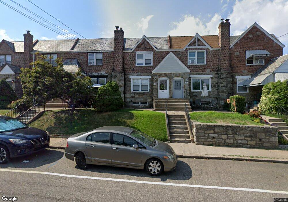
177 E Plumstead Ave Lansdowne, PA 19050
Estimated Value: $206,741 - $254,000
3
Beds
1
Bath
1,314
Sq Ft
$172/Sq Ft
Est. Value
About This Home
This home is located at 177 E Plumstead Ave, Lansdowne, PA 19050 and is currently estimated at $225,435, approximately $171 per square foot. 177 E Plumstead Ave is a home located in Delaware County with nearby schools including East Lansdowne Elementary School, Penn Wood Middle School, and Penn Wood High School - Cypress Street Campus.
Ownership History
Date
Name
Owned For
Owner Type
Purchase Details
Closed on
Feb 10, 2025
Sold by
Famous Donald P and Binder Patricia Giannini
Bought by
Binder Patricia Giannini
Current Estimated Value
Purchase Details
Closed on
Jun 19, 1975
Bought by
Donald P Famous
Create a Home Valuation Report for This Property
The Home Valuation Report is an in-depth analysis detailing your home's value as well as a comparison with similar homes in the area
Home Values in the Area
Average Home Value in this Area
Purchase History
| Date | Buyer | Sale Price | Title Company |
|---|---|---|---|
| Binder Patricia Giannini | -- | None Listed On Document | |
| Binder Patricia Giannini | -- | None Listed On Document | |
| Donald P Famous | -- | -- |
Source: Public Records
Tax History Compared to Growth
Tax History
| Year | Tax Paid | Tax Assessment Tax Assessment Total Assessment is a certain percentage of the fair market value that is determined by local assessors to be the total taxable value of land and additions on the property. | Land | Improvement |
|---|---|---|---|---|
| 2025 | $3,782 | $91,850 | $27,170 | $64,680 |
| 2024 | $3,782 | $91,850 | $27,170 | $64,680 |
| 2023 | $3,605 | $91,850 | $27,170 | $64,680 |
| 2022 | $3,535 | $91,850 | $27,170 | $64,680 |
| 2021 | $6,163 | $106,650 | $27,170 | $79,480 |
| 2020 | $4,189 | $63,880 | $16,530 | $47,350 |
| 2019 | $4,119 | $63,880 | $16,530 | $47,350 |
| 2018 | $4,048 | $63,880 | $0 | $0 |
| 2017 | $3,959 | $63,880 | $0 | $0 |
| 2016 | $351 | $63,880 | $0 | $0 |
| 2015 | $358 | $63,880 | $0 | $0 |
| 2014 | $358 | $63,880 | $0 | $0 |
Source: Public Records
Map
Nearby Homes
- 291 N Wycombe Ave
- 360 Huntley Rd
- 149 Blackburn Ave
- 247 Coverly Rd
- 142 Springton Rd
- 243 Coverly Rd
- 149 Springton Rd
- 339 Huntley Rd
- 163 Springton Rd
- 143 Springton Rd
- 43 Springton Rd
- 7265 Calvin Rd
- 7261 Calvin Rd
- 209 Wabash Ave
- 7273 Guilford Rd
- 164 Woodland Ave
- 311 Margate Rd
- 318 Margate Rd
- 404 Croyden Rd
- 178 N Union Ave
- 179 E Plumstead Ave
- 175 E Plumstead Ave
- 181 E Plumstead Ave
- 173 E Plumstead Ave
- 308 N Maple Ave
- 171 E Plumstead Ave
- 310 N Maple Ave
- 169 E Plumstead Ave
- 167 E Plumstead Ave
- 312 N Maple Ave
- 165 E Plumstead Ave
- 303 Barker Ave
- 301 Barker Ave
- 305 Barker Ave
- 314 N Maple Ave
- 307 Barker Ave
- 161 E Plumstead Ave
- 309 Barker Ave
- 316 N Maple Ave
- 185 E Plumstead Ave