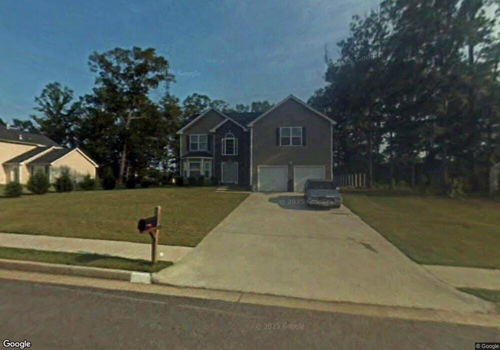
177 Edison Dr Stockbridge, GA 30281
Estimated Value: $298,264 - $318,000
4
Beds
3
Baths
2,427
Sq Ft
$127/Sq Ft
Est. Value
About This Home
This home is located at 177 Edison Dr, Stockbridge, GA 30281 and is currently estimated at $309,066, approximately $127 per square foot. 177 Edison Dr is a home located in Henry County with nearby schools including Cotton Indian Elementary School, Stockbridge Middle School, and Stockbridge High School.
Ownership History
Date
Name
Owned For
Owner Type
Purchase Details
Closed on
Feb 21, 2020
Sold by
Progress Atlanta Llc
Bought by
Progress Residential Borrower 13 Llc
Current Estimated Value
Purchase Details
Closed on
Dec 4, 2019
Sold by
Hallum Lashonda M
Bought by
Progress Atlanta Llc
Purchase Details
Closed on
May 27, 2004
Sold by
Homelife Communities Of Henry In
Bought by
Hallum Lashonda M
Home Financials for this Owner
Home Financials are based on the most recent Mortgage that was taken out on this home.
Original Mortgage
$158,700
Interest Rate
6.09%
Mortgage Type
VA
Create a Home Valuation Report for This Property
The Home Valuation Report is an in-depth analysis detailing your home's value as well as a comparison with similar homes in the area
Home Values in the Area
Average Home Value in this Area
Purchase History
| Date | Buyer | Sale Price | Title Company |
|---|---|---|---|
| Progress Residential Borrower 13 Llc | -- | -- | |
| Progress Atlanta Llc | $179,000 | -- | |
| Hallum Lashonda M | $160,100 | -- |
Source: Public Records
Mortgage History
| Date | Status | Borrower | Loan Amount |
|---|---|---|---|
| Previous Owner | Hallum Lashonda M | $158,700 |
Source: Public Records
Tax History
| Year | Tax Paid | Tax Assessment Tax Assessment Total Assessment is a certain percentage of the fair market value that is determined by local assessors to be the total taxable value of land and additions on the property. | Land | Improvement |
|---|---|---|---|---|
| 2025 | $5,252 | $130,600 | $14,000 | $116,600 |
| 2024 | $5,252 | $117,880 | $14,000 | $103,880 |
| 2023 | $3,178 | $80,520 | $10,000 | $70,520 |
| 2022 | $3,178 | $80,520 | $10,000 | $70,520 |
| 2021 | $2,714 | $80,520 | $10,000 | $70,520 |
| 2020 | $2,835 | $71,600 | $7,804 | $63,796 |
| 2019 | $2,315 | $66,800 | $8,000 | $58,800 |
| 2018 | $2,010 | $57,160 | $8,000 | $49,160 |
| 2016 | $1,869 | $53,480 | $8,000 | $45,480 |
| 2015 | $1,628 | $46,200 | $6,000 | $40,200 |
| 2014 | $1,558 | $44,080 | $4,800 | $39,280 |
Source: Public Records
Map
Nearby Homes
- 277 Edison Dr
- 109 Edison Dr
- 130 Chimney Ridge Trail
- 140 Springvalley Cir
- 0 Chimney Smoke Dr Unit 10640945
- 0 Chimney Smoke Dr Unit 182111
- 137 Springvalley Cir
- 135 Springvalley Way
- 0 Old Conyers Rd Unit 10684705
- 153 Springvalley Cir
- 0 Freeman Dr Unit 128 10480940
- 1527 Flat Rock Rd
- 0 Freeman #128 Dr
- 15 Chimney Smoke Dr
- 53 Springvalley Cir
- 52 Springvalley Cir
- 393 & 381 Old Conyers Rd
- 105 Longview Cir
- 126 Wildwood Rd
- 159 Brookwood Estates Trail
- 177 Edison Dr
- 177 Edison Dr Unit 40
- 181 Edison Dr
- 173 Edison Dr
- 185 Edison Dr
- 169 Edison Dr
- 176 Edison Dr
- 172 Edison Dr
- 180 Edison Dr
- 189 Edison Dr
- 165 Edison Dr
- 168 Edison Dr
- 184 Edison Dr
- 193 Edison Dr
- 161 Edison Dr
- 425 Peterson Dr
- 188 Edison Dr
- 421 Peterson Dr
- 429 Peterson Dr
- 429 Peterson Dr Unit 98/12
Your Personal Tour Guide
Ask me questions while you tour the home.