Estimated Value: $1,150,000 - $1,582,000
3
Beds
3
Baths
2,757
Sq Ft
$505/Sq Ft
Est. Value
About This Home
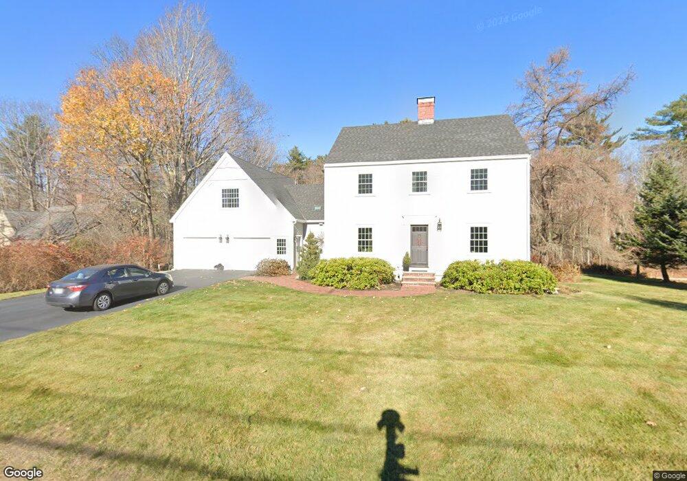
This home is located at 177 Wallis Rd, Rye, NH 03870 and is currently estimated at $1,393,456, approximately $505 per square foot. 177 Wallis Rd is a home located in Rockingham County with nearby schools including Rye Elementary School, Rye Junior High School, and Rye Country Day School.
Ownership History
Date
Name
Owned For
Owner Type
Purchase Details
Closed on
Apr 10, 2013
Sold by
Devine Robin J
Bought by
Pincomb John and Pincomb Lynn
Current Estimated Value
Purchase Details
Closed on
Mar 29, 1996
Sold by
Potvin Helen J
Bought by
Vrettos Theodore C and Vrettos Robin D
Home Financials for this Owner
Home Financials are based on the most recent Mortgage that was taken out on this home.
Original Mortgage
$190,800
Interest Rate
6.9%
Mortgage Type
Purchase Money Mortgage
Create a Home Valuation Report for This Property
The Home Valuation Report is an in-depth analysis detailing your home's value as well as a comparison with similar homes in the area
Home Values in the Area
Average Home Value in this Area
Purchase History
| Date | Buyer | Sale Price | Title Company |
|---|---|---|---|
| Pincomb John | $500,000 | -- | |
| Pincomb John | $500,000 | -- | |
| Vrettos Theodore C | $212,000 | -- | |
| Vrettos Theodore C | $212,000 | -- |
Source: Public Records
Mortgage History
| Date | Status | Borrower | Loan Amount |
|---|---|---|---|
| Previous Owner | Vrettos Theodore C | $360,000 | |
| Previous Owner | Vrettos Theodore C | $190,800 | |
| Closed | Vrettos Theodore C | $0 |
Source: Public Records
Tax History
| Year | Tax Paid | Tax Assessment Tax Assessment Total Assessment is a certain percentage of the fair market value that is determined by local assessors to be the total taxable value of land and additions on the property. | Land | Improvement |
|---|---|---|---|---|
| 2024 | $7,156 | $826,300 | $423,500 | $402,800 |
| 2023 | $6,635 | $826,300 | $423,500 | $402,800 |
| 2022 | $5,768 | $826,300 | $423,500 | $402,800 |
| 2021 | $5,895 | $576,800 | $295,200 | $281,600 |
| 2020 | $5,895 | $576,800 | $295,200 | $281,600 |
| 2019 | $3,657 | $576,800 | $295,200 | $281,600 |
| 2018 | $6,294 | $576,800 | $295,200 | $281,600 |
| 2017 | $1,953 | $576,800 | $295,200 | $281,600 |
| 2016 | $3,383 | $505,400 | $219,100 | $286,300 |
| 2013 | $5,578 | $508,500 | $219,100 | $289,400 |
Source: Public Records
Map
Nearby Homes
- 137 Clark Rd
- 389 Sagamore Rd
- 1193 Ocean Blvd
- 1215 Ocean Blvd Unit 5
- 236 Sagamore Rd
- 1191 - 1193 Ocean Blvd
- 1591 Ocean Blvd
- 1643 Ocean Blvd
- 665 Wallis Rd Unit 2
- 763 Ocean Blvd
- 14 Sagamore Rd Unit 3
- 267 Pioneer Rd
- 104 Odiorne Point Rd
- 4 Sagamore Rd
- 239 Gosport Rd
- 1 Pheasant Ln
- 397 Lang Rd
- 414 Springbrook Cir
- 46 Fowler Dr
- 2075 Lafayette Rd Unit A23
Your Personal Tour Guide
Ask me questions while you tour the home.