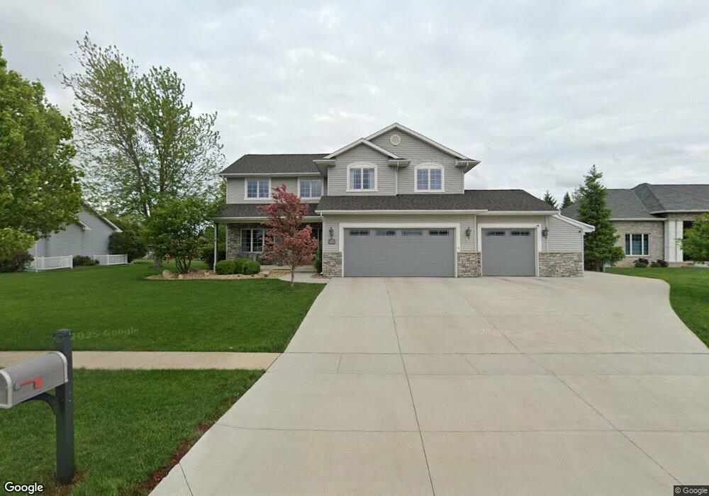
1770 Falcon Ridge Waterloo, IA 50701
Audubon NeighborhoodEstimated Value: $474,079 - $612,000
5
Beds
7
Baths
2,712
Sq Ft
$193/Sq Ft
Est. Value
About This Home
This home is located at 1770 Falcon Ridge, Waterloo, IA 50701 and is currently estimated at $523,270, approximately $192 per square foot. 1770 Falcon Ridge is a home located in Black Hawk County with nearby schools including Orange Elementary School, Hoover Middle School, and West High School.
Ownership History
Date
Name
Owned For
Owner Type
Purchase Details
Closed on
Jul 25, 2008
Sold by
Williams Richard B and Williams Kristin P
Bought by
Vanfleet Andrew J and Vanfleet Van Fleet
Current Estimated Value
Home Financials for this Owner
Home Financials are based on the most recent Mortgage that was taken out on this home.
Original Mortgage
$301,500
Outstanding Balance
$198,799
Interest Rate
6.51%
Mortgage Type
New Conventional
Estimated Equity
$324,471
Create a Home Valuation Report for This Property
The Home Valuation Report is an in-depth analysis detailing your home's value as well as a comparison with similar homes in the area
Home Values in the Area
Average Home Value in this Area
Purchase History
| Date | Buyer | Sale Price | Title Company |
|---|---|---|---|
| Vanfleet Andrew J | $335,000 | None Available |
Source: Public Records
Mortgage History
| Date | Status | Borrower | Loan Amount |
|---|---|---|---|
| Open | Vanfleet Andrew J | $301,500 |
Source: Public Records
Tax History Compared to Growth
Tax History
| Year | Tax Paid | Tax Assessment Tax Assessment Total Assessment is a certain percentage of the fair market value that is determined by local assessors to be the total taxable value of land and additions on the property. | Land | Improvement |
|---|---|---|---|---|
| 2025 | $6,906 | $356,500 | $64,060 | $292,440 |
| 2024 | $6,906 | $328,610 | $64,060 | $264,550 |
| 2023 | $6,456 | $314,690 | $64,060 | $250,630 |
| 2022 | $6,282 | $302,810 | $64,060 | $238,750 |
| 2021 | $6,510 | $302,810 | $64,060 | $238,750 |
| 2020 | $6,374 | $294,830 | $49,500 | $245,330 |
| 2019 | $6,374 | $294,830 | $49,500 | $245,330 |
| 2018 | $7,422 | $341,810 | $49,500 | $292,310 |
| 2017 | $7,650 | $341,600 | $49,500 | $292,100 |
| 2016 | $7,552 | $341,600 | $49,500 | $292,100 |
| 2015 | $7,552 | $341,600 | $49,500 | $292,100 |
| 2014 | $7,300 | $324,420 | $49,500 | $274,920 |
Source: Public Records
Map
Nearby Homes
- 125 Sunbird Ct
- 135 Sunbird Ct
- 1553 Audubon Dr
- 1944 Kitty Hawk Dr
- 1464 Audubon Dr
- 1416 Partridge Ln
- 122 Goldcrest Ct
- 128 Goldcrest Ct
- 1823 Partridge Ln
- 4755 Winghaven Dr
- 4750 Winghaven Dr
- 118 Aidin Way
- Lot 15 Red Tail Dr
- Lot 16 Red Tail Dr
- 122 Kestrel Cir
- 2107 Cassi Ridge Unit RG
- Lot 11 Red Tail Dr
- Lot 2 Red Tail Dr
- Lot 1 Red Tail Dr
- 2108 Josie Ridge Unit RG
- 1780 Falcon Ridge
- 1750 Falcon Ridge
- Lot 1 Falcon Ridge
- Lot 2 Falcon Ridge
- Lot 3 Falcon Ridge
- Lot 4 Falcon Ridge
- Lot 12 Falcon Ridge
- 1535 Audubon Dr
- 1545 Audubon Dr
- 1775 Falcon Ridge
- 1527 Audubon Dr
- 1908 Paloma Place
- 1810 Falcon Ridge
- 1736 Falcon Ridge
- 1515 Audubon Dr
- 1910 Kitty Hawk Dr
- 1503 Audubon Dr
- 1878 Falcon Ridge
- 1522 Audubon Dr
- 1916 Paloma Place