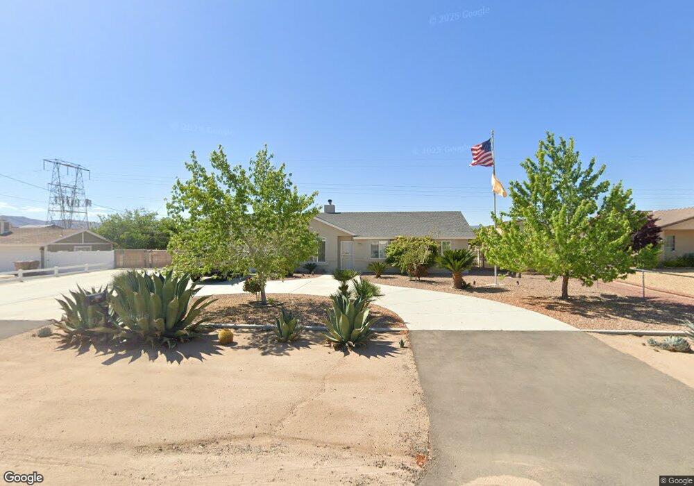
17715 Redding St Hesperia, CA 92345
The Mesa NeighborhoodEstimated Value: $420,000 - $435,000
3
Beds
2
Baths
1,368
Sq Ft
$312/Sq Ft
Est. Value
About This Home
This home is located at 17715 Redding St, Hesperia, CA 92345 and is currently estimated at $426,819, approximately $312 per square foot. 17715 Redding St is a home located in San Bernardino County with nearby schools including Kingston Elementary School, Ranchero Middle School, and Sultana High School.
Ownership History
Date
Name
Owned For
Owner Type
Purchase Details
Closed on
Dec 8, 2008
Sold by
Lasalle Bank National Association
Bought by
Davis Joshua
Current Estimated Value
Home Financials for this Owner
Home Financials are based on the most recent Mortgage that was taken out on this home.
Original Mortgage
$125,345
Outstanding Balance
$80,188
Interest Rate
5.49%
Mortgage Type
FHA
Estimated Equity
$346,631
Purchase Details
Closed on
Apr 29, 2008
Sold by
Velasquez Santos
Bought by
Lasalle Bank Na and First Franklin Mortgage Loan Trust 2006-
Purchase Details
Closed on
Oct 5, 2006
Sold by
17715 Redding St Hesperia Trust
Bought by
Velazquez Santos and Velazquez Dioselina
Home Financials for this Owner
Home Financials are based on the most recent Mortgage that was taken out on this home.
Original Mortgage
$216,800
Interest Rate
8.2%
Mortgage Type
Stand Alone First
Purchase Details
Closed on
Sep 26, 2006
Sold by
Mcgee Belinda K
Bought by
17715 Redding St Hesperia Trust and Kla Investment
Home Financials for this Owner
Home Financials are based on the most recent Mortgage that was taken out on this home.
Original Mortgage
$216,800
Interest Rate
8.2%
Mortgage Type
Stand Alone First
Purchase Details
Closed on
Aug 15, 2005
Sold by
Mcgee John J
Bought by
Mcgee Belinda K
Home Financials for this Owner
Home Financials are based on the most recent Mortgage that was taken out on this home.
Original Mortgage
$198,250
Interest Rate
8.85%
Mortgage Type
New Conventional
Purchase Details
Closed on
Jan 11, 2001
Sold by
Peterson Land & Development Inc
Bought by
Mcgee John J and Mcgee Belinda K
Home Financials for this Owner
Home Financials are based on the most recent Mortgage that was taken out on this home.
Original Mortgage
$104,069
Interest Rate
7.54%
Mortgage Type
FHA
Purchase Details
Closed on
Feb 11, 2000
Sold by
Reyes Raquel
Bought by
Peterson Land & Development Inc
Home Financials for this Owner
Home Financials are based on the most recent Mortgage that was taken out on this home.
Original Mortgage
$82,400
Interest Rate
8.3%
Mortgage Type
Construction
Create a Home Valuation Report for This Property
The Home Valuation Report is an in-depth analysis detailing your home's value as well as a comparison with similar homes in the area
Home Values in the Area
Average Home Value in this Area
Purchase History
| Date | Buyer | Sale Price | Title Company |
|---|---|---|---|
| Davis Joshua | $127,000 | First American Title Ins Co | |
| Lasalle Bank Na | $233,007 | Accommodation | |
| Velazquez Santos | $271,000 | Southland Title Corporation | |
| 17715 Redding St Hesperia Trust | $230,000 | None Available | |
| Mcgee Belinda K | -- | Commerce Title Company | |
| Mcgee John J | $105,000 | Lawyers Title Company | |
| Peterson Land & Development Inc | $8,000 | Lawyers Title Company |
Source: Public Records
Mortgage History
| Date | Status | Borrower | Loan Amount |
|---|---|---|---|
| Open | Davis Joshua | $125,345 | |
| Previous Owner | Velazquez Santos | $216,800 | |
| Previous Owner | Mcgee Belinda K | $198,250 | |
| Previous Owner | Mcgee John J | $104,069 | |
| Previous Owner | Peterson Land & Development Inc | $82,400 |
Source: Public Records
Tax History
| Year | Tax Paid | Tax Assessment Tax Assessment Total Assessment is a certain percentage of the fair market value that is determined by local assessors to be the total taxable value of land and additions on the property. | Land | Improvement |
|---|---|---|---|---|
| 2025 | $1,786 | $163,549 | $32,197 | $131,352 |
| 2024 | $1,745 | $160,342 | $31,566 | $128,776 |
| 2023 | $1,725 | $157,198 | $30,947 | $126,251 |
| 2022 | $1,685 | $154,115 | $30,340 | $123,775 |
| 2021 | $1,653 | $151,093 | $29,745 | $121,348 |
| 2020 | $1,633 | $149,544 | $29,440 | $120,104 |
| 2019 | $1,599 | $146,612 | $28,863 | $117,749 |
| 2018 | $1,567 | $143,737 | $28,297 | $115,440 |
| 2017 | $1,539 | $140,918 | $27,742 | $113,176 |
| 2016 | $1,505 | $138,155 | $27,198 | $110,957 |
| 2015 | $1,485 | $136,079 | $26,789 | $109,290 |
| 2014 | $1,464 | $133,413 | $26,264 | $107,149 |
Source: Public Records
Map
Nearby Homes
- 17995 Seaforth St
- 7864 Newhall Ave
- 8178 Kingston Ave
- 0 Oxford Ave Unit HD25072687
- 7653 Montrose Ave
- 7821 Lyons Ave
- 17375 Redding St
- 17412 Danbury Ave
- 18126 Fairburn St
- 7413 Montrose Ave
- 17594 Bangor Ave
- 17405 Adobe St
- 7331 I Ave
- 16 Bangor Ave
- 18132 Bangor Ave
- 7407 Kenyon Ave
- 7460 El Cerrito Ave
- 0000 Ranchero St
- 17111 Ranchero St
- 7601 Corona Ave
- 17699 Redding St
- 17731 Redding St
- 0 Redding St Unit I11081486
- 0 Redding St Unit EV14077694
- 0 Redding St Unit CV23030590
- 0 Redding St Unit IV22164596
- 0 Lot -293 Redding St
- 0 Redding St Unit DW20184389
- 0 Redding St Unit 369072
- 0 Redding St Unit 404506
- 0 Redding St Unit 404731
- 0 Redding St Unit 432670
- 0 Redding St Unit 441312
- 0 Redding St Unit 505695
- 0 Redding St Unit OC18242824
- 17745 Redding St
- 17685 Redding St
- 7924 Sherborn Ave
- 17671 Redding St
- 17761 Redding St
Your Personal Tour Guide
Ask me questions while you tour the home.